


ASTORIA / WARRENTON OREGON WEATHER | WEATHER CAMS | TIDES | ALERTS
Updated Constantly: Warrenton / Astoria Oregon Coast Weather | Cams | Tides | Alerts - Current conditions, forecasts, tides, weather, live radar weather cams, North Coast Range travel, storm alerts | Buoy reports and reports from passing ships | Live Radar
ASTORIA, OREGON 7-DAY FORECAST
7-Day Forecast
Detailed Forecast
WARRENTON WEATHER
7-Day Forecast
Detailed Forecast
WARRENTON-AREA WAVE FORECAST
Wave Forecast
Find Astoria / Warrenton Oregon Hotels, Lodging, Rentals

Watches, warnings, and advisories issued since Sat, Jun 21, 2025 2:30:00 PM +0000 for Clatsop County Coast (ORZ101) OR
The Heat Advisory has been cancelled.
14 Jun 2026 at 10:41pm
The Heat Advisory has been cancelled and is no longer in effect.
Heat Advisory issued June 14 at 10:50AM PDT until June 14 at 11:00PM PDT by NWS Portland OR
14 Jun 2026 at 11:50am
* WHAT...Temperatures 83 to 88 degrees F expected.
* WHERE...South Washington and North and Central Oregon Coast.
* WHEN...Until 11 PM PDT this evening.
* IMPACTS...Hot temperatures may cause heat illnesses.
* ADDITIONAL DETAILS...Easterly winds will bring in warmer air to
the coast today causing temperatures to rise. Moderate HeatRisk
expected.
Current watches, warnings, and advisories for Clatsop County Coast (ORZ101) OR
Current watches, warnings, and advisories for PZZ210
Astoria / Hammond Tide Tables - | - General Oregon Weather - | - Washington Coast Weather
Oregon Coast Highway, Coast Range Passes Traffic, Road Conditions - | - Portland, Oregon Highway Traffic, Road Conditions - Traffic Cams: I-5 - I-205 - I-405 - Hwy 217 - I-84 - | - List of Oregon Coast Webcams - Weather Cams
The Heat Advisory has been cancelled.
14 Jun 2026 at 10:41pm
The Heat Advisory has been cancelled and is no longer in effect.
Heat Advisory issued June 14 at 10:50AM PDT until June 14 at 11:00PM PDT by NWS Portland OR
14 Jun 2026 at 11:50am
* WHAT...Temperatures 83 to 88 degrees F expected. * WHERE...South Washington and North and Central Oregon Coast. * WHEN...Until 11 PM PDT this evening. * IMPACTS...Hot temperatures may cause heat illnesses. * ADDITIONAL DETAILS...Easterly winds will bring in warmer air to the coast today causing temperatures to rise. Moderate HeatRisk expected.
NORTH OREGON COAST RANGE - HWY 26 NEAR WARRENTON, ASTORIA - if empty then no alerts
Watches, warnings, and advisories issued since Fri, Jan 31, 2025 9:07:21 AM -0700 for North Oregon Coast Range (ORZ106) OR
The Heat Advisory has been cancelled.
15 Jun 2026 at 10:52pm
The Heat Advisory has been cancelled and is no longer in effect.
Heat Advisory issued June 15 at 7:40AM PDT until June 16 at 12:00AM PDT by NWS Portland OR
15 Jun 2026 at 8:40am
* WHAT...Temperatures of 93 to 98 degrees F expected.
* WHERE...Central and Southern Willamette Valley, Northern and
Central Coast Range Valleys and Mountains of Oregon, Foothills of
the Northern and Central Oregon Cascades, Central Columbia River
Gorge and the Hood River Valley, Willapa Hills and Adjacent River
Valleys of Pacific and Wahkiakum Counties, Lower Columbia River
and Cowlitz River Valleys, Outer Southeast Portland Metro, West
Columbia River Gorge of Oregon above 500 ft, North Clark County
Lowlands, and South Washington Cascade Foothills.
* WHEN...Until midnight PDT tonight.
* IMPACTS...Hot temperatures may cause heat illnesses.
* ADDITIONAL DETAILS...Today will be the hottest day of the week
with temperatures cooling down on Tuesday.
Heat Advisory issued June 14 at 9:41PM PDT until June 16 at 11:00PM PDT by NWS Portland OR
14 Jun 2026 at 10:41pm
* WHAT...Temperatures of 93 to 98 degrees F expected.
* WHERE...Central and Southern Willamette Valley, Northern and
Central Coast Range Valleys and Mountains of Oregon, Foothills of
the Northern and Central Oregon Cascades, Central Columbia River
Gorge and the Hood River Valley, Willapa Hills and Adjacent River
Valleys of Pacific and Wahkiakum Counties, Lower Columbia River
and Cowlitz River Valleys, Outer Southeast Portland Metro, West
Columbia River Gorge of Oregon above 500 ft, North Clark County
Lowlands, and South Washington Cascade Foothills.
* WHEN...Until 11 PM PDT Tuesday.
* IMPACTS...Hot temperatures may cause heat illnesses.
* ADDITIONAL DETAILS...Monday will be the hottest day of the week
with temperatures cooling down on Tuesday. Overnight temperatures
will remain elevated tonight into Monday morning, and Monday night
into Tuesday morning. Night time temperatures ranging from 60 to
65 degrees F will lead to limited overnight relief. There is
currently a 10-20% chance that night time temperatures remain
above 70 degrees F tonight into Monday morning across the Coast
Range and westernmost parts of the Central and Southern Willamette
Valley which would lead to poor overnight relief.
Watches, warnings, and advisories issued since Fri, Mar 21, 2025 2:30:00 PM +0000 for Oregon
Heat Advisory issued June 20 at 8:48PM PDT until June 23 at 11:00PM PDT by NWS Pendleton OR
20 Jun 2026 at 9:48pm
* WHAT...Dangerously hot conditions with temperatures up to 98
degrees possible. This will pose a major risk of heat-related
illness.
* WHERE...Eastern Columbia River Gorge of Oregon and Washington.
* WHEN...From 11 AM Monday to 11 PM PDT Tuesday.
* IMPACTS...Hot temperatures may cause heat illnesses.
Red Flag Warning issued June 20 at 8:51PM MDT until June 20 at 9:00PM MDT by NWS Boise ID
20 Jun 2026 at 8:51pm
The thunderstorm threat has ended.
Red Flag Warning issued June 20 at 5:57PM MDT until June 20 at 9:00PM MDT by NWS Boise ID
20 Jun 2026 at 5:57pm
...RED FLAG WARNING FOR LIGHTNING...
.Ongoing thunderstorms will continue through 9PM MDT/8PM PDT this
evening.
* AFFECTED AREA...In Oregon, Fire Weather Zones 670 Burns BLM
and 672 Southern Grasslands.
* TIMING...Until 8 PM PDT this evening.
* THUNDERSTORMS...Scattered coverage with abundant lightning.
* OUTFLOW WINDS...Gusty erratic winds up to 40 mph.
* IMPACTS...Any fire that develops will catch and spread
quickly. Outdoor burning is not recommended.

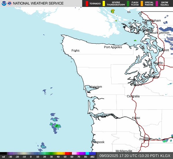
LIVE OREGON COAST / WASHINGTON COAST RADAR
_pid3322.JPG)
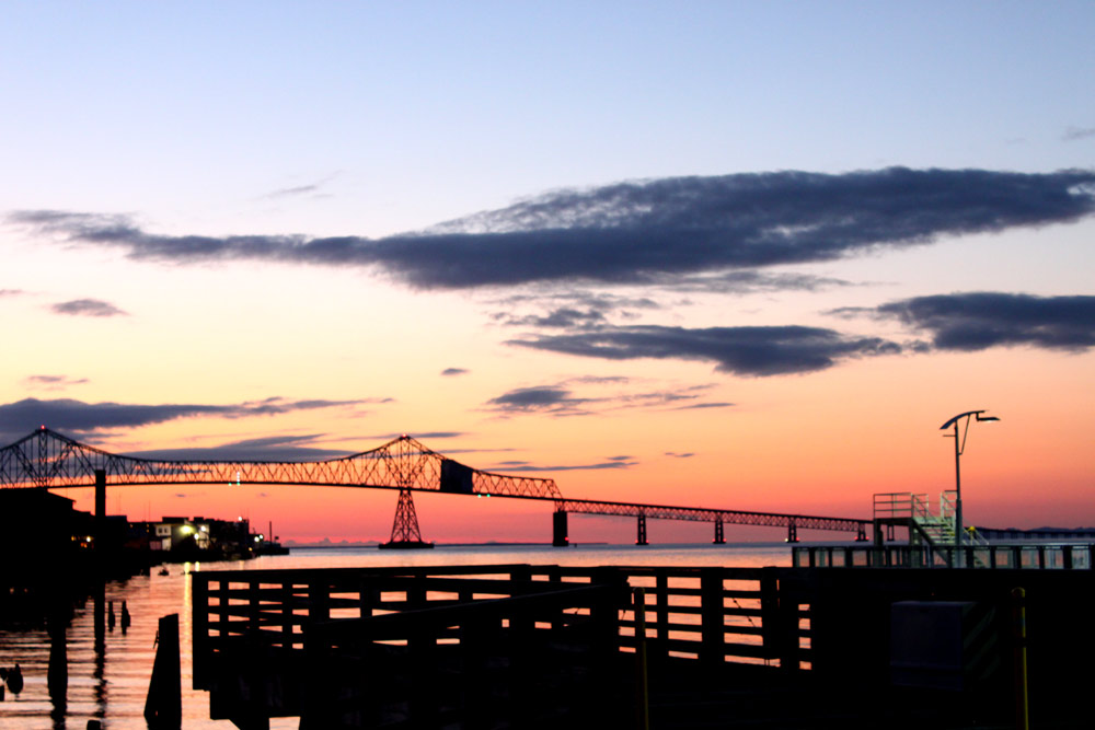
Astoria Traffic / Weather Cam
Astoria, Warrenton, Oregon Lodging, Hotels, Motels, Restaurants, Inns, Vacation Rentals
Seaside, Oregon Lodging, Hotels, Motels, Restaurants, Inns, Vacation Rentals
Find places to stay in Seaside; places to eat, dine in Seaside
Inn of the Four Winds, Seaside
Oceanfront, upscale feel while not as spendy
Seashore Inn, Seaside Hotel
Oceanfront, pet friendly, heated indoor pool, steps from beach attractions
Clementine's Bed and Breakfast - Astoria
Near Seaside: An engaging historic experience; vacation rental next door
Vacation Rentals in Astoria, Warrenton, Gearhart
Multi-bedroom houses, north Oregon coast luxury lodging to budget, including Seaside
Dining, Restaurants, Menus in Seaside, Oregon.
Find Restaurants, Dining in Seaside
Schooner's Cove Inn
Near Seaside: Oceanfront upscale w/ picnic lawn, decks, spa
Near Seaside: Tolovana Inn
Views of Haystack; classic luxury with saltwater pool, spa, spacious rooms
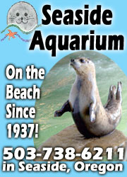
ATTRACTION: Seaside Aquarium
More than 70 years of letting you feed the seals
ATTRACTION: Seaside Virtual Tour, Map
100's of photos, details about Seaside, Oregon, including map
Oregon Coast and Seaside Lodging Fantastic Views on Video
From the balconies and patios of oceanfront hotels, motels and vacation rentals in Seaside and elsewhere
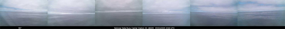
BUOY REPORTS NEAR ASTORIA, including passing ships
![]()
NDBC - Station 46029 - COLUMBIA RIVER BAR - 20NM West of Columbia River Mouth...
This feed shows recent marine weather observations from Station 46029.
Station 46029 - COLUMBIA RIVER BAR - 20NM West of Columbia River Mouth
20 Jun 2026 at 11:05pm
June 20, 2026 9:40 pm PDT
Location: 46.148N 124.508W
Wind Direction: NW (310°)
Wind Speed: 7.8 knots
Wind Gust: 9.7 knots
Atmospheric Pressure: 30.08 in (1018.6 mb)
Air Temperature: 57.4°F (14.1°C)
Dew Point: 55.4°F (13.0°C)
Water Temperature: 57.6°F (14.2°C)
![]()
NDBC - Station Observations near 46.15N 124.51W
This feed shows recent marine weather observations from NDBC and its partners within 100 nautical miles of 46.15N 124.51W.
Station 46029 - COLUMBIA RIVER BAR - 20NM WEST OF COLUMBIA RIVER MOUTH
20 Jun 2026 at 11:16pm
June 20, 2026 8:40 pm PST
Location: 46.148N 124.508W or 0 nautical miles SE of search location of 46.15N 124.51W.
Wind Direction: NW (310°)
Wind Speed: 8 knots
Wind Gust: 10 knots
Atmospheric Pressure: 30.08 in (1018.6 mb)
Air Temperature: 57°F (14.1°C)
Dew Point: 55°F (13.0°C)
Water Temperature: 58°F (14.2°C)
Station 46248 - ASTORIA CANYON, OR (179)
20 Jun 2026 at 11:16pm
June 20, 2026 8:26 pm PST
Location: 46.133N 124.64W or 6 nautical miles W of search location of 46.15N 124.51W.
Significant Wave Height: 8 ft
Dominant Wave Period: 9 sec
Water Temperature: 58°F (14.6°C)
Station 46243 - CLATSOP SPIT, OR (162)
20 Jun 2026 at 11:16pm
June 20, 2026 8:30 pm PST
Location: 46.215N 124.129W or 16 nautical miles ENE of search location of 46.15N 124.51W.
Significant Wave Height: 6 ft
Dominant Wave Period: 10 sec
Average Period: 7.3 sec
Mean Wave Direction: WNW (287°)
Air Temperature: 58°F (14.2°C)
Water Temperature: 58°F (14.3°C)
Station ASTO3 - 9439040 - ASTORIA, OR
20 Jun 2026 at 11:15pm
June 20, 2026 8:30 pm PST
Location: 46.207N 123.768W or 31 nautical miles E of search location of 46.15N 124.51W.
Wind Direction: NW (310°)
Wind Speed: 8 knots
Wind Gust: 10 knots
Air Temperature: 59°F (14.9°C)
Station TOKW1 - 9440910 - TOKE POINT, WA
20 Jun 2026 at 11:15pm
June 20, 2026 8:30 pm PST
Location: 46.707N 123.967W or 40 nautical miles NNE of search location of 46.15N 124.51W.
Wind Direction: W (280°)
Wind Speed: 5 knots
Wind Gust: 7 knots
Atmospheric Pressure: 30.08 in (1018.5 mb)
Air Temperature: 57°F (13.7°C)
Station 46278 - TILLAMOOK BAY SOUTH JETTY, OR (270)
20 Jun 2026 at 11:15pm
June 20, 2026 8:30 pm PST
Location: 45.559N 123.991W or 42 nautical miles SSE of search location of 46.15N 124.51W.
Significant Wave Height: 8 ft
Dominant Wave Period: 10 sec
Average Period: 7.4 sec
Mean Wave Direction: WNW (303°)
Air Temperature: 56°F (13.3°C)
Water Temperature: 52°F (11.2°C)
Station 46211 - GRAYS HARBOR, WA (036)
20 Jun 2026 at 11:15pm
June 20, 2026 8:26 pm PST
Location: 46.857N 124.243W or 44 nautical miles NNE of search location of 46.15N 124.51W.
Significant Wave Height: 6 ft
Dominant Wave Period: 9 sec
Water Temperature: 56°F (13.6°C)
Station WPTW1 - 9441102 - WESTPORT, WA
20 Jun 2026 at 11:15pm
June 20, 2026 8:36 pm PST
Location: 46.904N 124.105W or 48 nautical miles NNE of search location of 46.15N 124.51W.
Wind Direction: WNW (300°)
Wind Speed: 7 knots
Wind Gust: 7 knots
Atmospheric Pressure: 30.07 in (1018.4 mb)
Air Temperature: 55°F (12.9°C)
Water Temperature: 54°F (12.2°C)
Station 46089 - TILLAMOOK, OR - 85 NM WNW OF TILLAMOOK, OR
20 Jun 2026 at 11:15pm
June 20, 2026 8:40 pm PST
Location: 45.928N 125.815W or 56 nautical miles WSW of search location of 46.15N 124.51W.
Wind Direction: NW (320°)
Wind Speed: 14 knots
Wind Gust: 17 knots
Average Period: 6.8 sec
Mean Wave Direction: NNW (329°)
Atmospheric Pressure: 30.10 in (1019.2 mb)
Water Temperature: 60°F (15.5°C)
Station LOPW1 - 9440422 - LONGVIEW, WA
20 Jun 2026 at 11:15pm
June 20, 2026 8:30 pm PST
Location: 46.106N 122.954W or 65 nautical miles E of search location of 46.15N 124.51W.
Atmospheric Pressure: 30.06 in (1017.8 mb)
Water Temperature: 66°F (18.8°C)
SHIP
20 Jun 2026 at 11:15pm
June 21, 2026 04:00 UTC
Location: 46.1N 126.1W or 66 nautical miles W of search location of 46.15N 124.51W.
Atmospheric Pressure: 30.10 in (1019.4 mb)
Pressure Tendency: +0.00 in (+0.1 mb)
Air Temperature: 57°F (13.8°C)
Dew Point: 52°F (11.3°C)
Station KLMW1 - 9440357 - TEMCO KALAMA TERMINAL, WA
20 Jun 2026 at 11:15pm
June 20, 2026 8:30 pm PST
Location: 45.983N 122.835W or 70 nautical miles E of search location of 46.15N 124.51W.
Atmospheric Pressure: 30.04 in (1017.3 mb)
Station 46041 - CAPE ELIZABETH - 45NM NW OF ABERDEEN, WA
20 Jun 2026 at 11:15pm
June 20, 2026 8:40 pm PST
Location: 47.352N 124.739W or 73 nautical miles N of search location of 46.15N 124.51W.
Wind Direction: NW (310°)
Wind Speed: 8 knots
Wind Gust: 10 knots
Average Period: 6.9 sec
Mean Wave Direction: NW (305°)
Atmospheric Pressure: 30.08 in (1018.7 mb)
Air Temperature: 55°F (12.8°C)
Dew Point: 52°F (11.2°C)
Station 46453 - BACKYARD BUOYS - QUINAULT NORTH
20 Jun 2026 at 11:15pm
June 20, 2026 7:55 pm PST
Location: 47.45N 124.43W or 78 nautical miles N of search location of 46.15N 124.51W.
Significant Wave Height: 5 ft
Dominant Wave Period: 9 sec
Average Period: 6.7 sec
Mean Wave Direction: W (277°)
Station 46050 - STONEWALL BANK - 20NM WEST OF NEWPORT, OR
20 Jun 2026 at 11:15pm
June 20, 2026 8:40 pm PST
Location: 44.679N 124.535W or 88 nautical miles S of search location of 46.15N 124.51W.
Wind Direction: N (350°)
Wind Speed: 10 knots
Wind Gust: 14 knots
Atmospheric Pressure: 30.10 in (1019.2 mb)
Station DESW1 - DESTRUCTION ISLAND, WA
20 Jun 2026 at 11:15pm
June 20, 2026 11:00 pm CST
Location: 47.675N 124.485W or 92 nautical miles N of search location of 46.15N 124.51W.
Wind Speed: 2 knots
Wind Gust: 3 knots
Atmospheric Pressure: 30.09 in (1019.0 mb)
Pressure Tendency: +0.01 in (+0.5 mb)
Station NWPO3 - NEWPORT, OR
20 Jun 2026 at 11:15pm
June 20, 2026 9:00 pm PST
Location: 44.613N 124.067W or 94 nautical miles SSE of search location of 46.15N 124.51W.
Wind Direction: N (360°)
Wind Speed: 3 knots
Wind Gust: 4 knots
Air Temperature: 54°F (12.2°C)
Station SBEO3 - 9435380 - SOUTH BEACH, OR
20 Jun 2026 at 11:15pm
June 20, 2026 8:30 pm PST
Location: 44.625N 124.045W or 94 nautical miles SSE of search location of 46.15N 124.51W.
Atmospheric Pressure: 30.09 in (1019.1 mb)
Station 46123 - TWANOH - HOOD CANAL, WA (U OF WASH)
20 Jun 2026 at 11:15pm
June 20, 2026 7:30 pm PST
Location: 47.375N 123.008W or 96 nautical miles NE of search location of 46.15N 124.51W.
Air Temperature: 62°F (16.8°C)
Dew Point: 50°F (10.0°C)
Station 46283 - YAQUINA CHANNEL SW, OR (280)
20 Jun 2026 at 11:15pm
June 20, 2026 8:56 pm PST
Location: 44.567N 124.237W or 96 nautical miles S of search location of 46.15N 124.51W.
Significant Wave Height: 8 ft
Dominant Wave Period: 10 sec
Average Period: 7.8 sec
Mean Wave Direction: NNW (331°)
Latest Weather Articles from Astoria, Warrenton
100 Degrees Coming for Portland, Valley, Gorge, SW Washington
20 Jun 2026 at 4:06pm
Oregon coast may reach 80s; extreme heat watches for valley, Portland - Red Flag Warnings Until Tonight
Absolute Complete Guide to Oregon Coast Fourth of July, 2026: All Towns
19 Jun 2026 at 9:06am
Astoria events, Seaside events, Cannon Beach events, Manzanita events, Rockaway Beach events, Tillamook events, Oceanside events, Pacific City events, Lincoln City events, Depoe Bay events, Newport events, Waldport events, Yachats events, Florence events, Reedsport events, North Bend events, Coos Bay events, Charleston events, Bandon events, Port Orford events, Gold Beach events, Brookings events
Man Sought for Bias Crimes on Oregon Coast Is Shot After Pulling Gun on Officers
19 Jun 2026 at 9:06am
The man had damaged a fruit stand and threatened a woman. True crime
Science of Summer Solstice: How It Changes Around Oregon, Washington, the Coast
19 Jun 2026 at 9:06am
The 45th parallel can dictate a few things in this region. Sciences, weather, astronomy
Pacific Northwest Weather | Oregon, Washington, Coastlines - Live View from S...
19 Jun 2026 at 9:06am
See the region live from space. Gateway to Oregon coast, Washington coast, inland Oregon weather, warnings, alerts
Oregon State Police Seek Tips in Otter Poaching at Coastal Pond
19 Jun 2026 at 9:06am
Someone unlawfully killed a river otter near Fall Creek Road. True crime
Current Conditions in Oregon, Washington, Coastlines - Current Temps
19 Jun 2026 at 9:06am
Updated by Minute: Washington coast and all of Oregon current temperatures, conditions. Weather, sciences
Ontario Eastern Oregon Weather - Forecasts, Sky Cams, Alerts, Current Conditions
15 Jun 2026 at 8:54am
Weather forecasts, sky cams, alerts and current conditions for Ontario in eastern Oregon
Astoria / Warrenton Weather
Seaside Weather
Cannon Beach
Manzanita
Nehalem Bay / Wheeler
Rockaway
Oceanside/Tillamook
Pacific City
Lincoln City
Depoe Bay Weather
Newport
Yachats
Florence
Reedsport - Winchester Bay Weather
Coos Bay - North Bend - Charleston
Bandon Weather
Port Orford Weather
Gold Beach Weather
Brookings Weather

Astoria - Warrenton - Gearhart Virtual Tour
Where the Columbia meets the Pacific, Land of Lewis & Clark and loads of atmosphere & history
Washington Coast Weather
Oregon Inland Weather
- McMinnville, Oregon Weather
-- Salem Oregon Weather
-- Portland / Beaverton Oregon Weather
-- Eugene / Springfield Weather
-- Bend Central Oregon Weather
-- Medford Oregon Weather
-- Government Camp / Mt Hood Weather
-- West Columbia River Gorge / Cascade Locks, Oregon Weather
-- Pendleton / Eastern Gorge Weather
-- Corvallis / Albany Oregon Weather
-- Ontario Oregon Weather


Search over 7,500 Pages for Oregon coast subjects, articles or lodging...
Back to Oregon Coast
Contact Advertise on BeachConnection.net
All Content, unless otherwise attributed, copyright BeachConnection.net Unauthorized use or publication is not permitted
Follow us on


South Coast Hotels
Oregon Coast Hotels
Astoria/Warrenton Hotels
Seaside
Cannon
Beach Lodging
Nehalem Bay Lodgings
Manzanita Hotels, Lodging
Rockaway Beach Hotels
Three Capes Lodging
Pacific City Hotels, Lodging
Lincoln
City Lodging
Depoe
Bay Lodging
Newport Lodging
Waldport Lodging
Yachats
Lodging
Florence Hotels
Reedsport Hotels
Coos Bay Hotels
Bandon Hotels
Port Orford Hotels
Gold Beach Hotels
Brookings Hotels
Oregon
Coast Vacation Rentals
Oregon
Coast Lodging Specials
Oregon Coast Luxury Hotels
Oregon Coast Pet Friendly Hotels/Rentals
Oregon
Coast Bed and Breakfasts / B&Bs
Cannon Beach Vacation Rentals
Pacific City Vacation Rentals
Newport, Depoe Bay Vacation Rentals
Oregon Coast Restaurant, Dining
Guide
Seaside
Cannon
Beach Dining
Manzanita,
Rockaway, Wheeler Dining
Pacific
City, Oceanside, Netarts, Tierra Del Mar Restaurants
Tillamook
Bay Restaurants, Dining
Lincoln
City Dining, Restaurants
Depoe
Bay Restaurants, Dining
Newport Restaurants, Dining
Waldport,
Yachats Restaurants, Dining
Florence Restaurants, Dining
Restaurant
Reviews
Coast
Events Calendar
Astoria
Seaside,
Cannon Beach Calendar
Manzanita,
Rockaway Events
Tillamook,
Pacific City Calendar
Lincoln
City Events Calendar
Newport,
Depoe Bay Events Calendar
Yachats Events Calendar
Oregon Coast Weather
Astoria, Warrenton Weather
Seaside Weather
Cannon Beach
Manzanita
Nehalem Bay / Wheeler
Rockaway
Oceanside/Tillamook
Pacific City
Lincoln City
Depoe Bay Weather
Newport
Yachats
Florence
Reedsport - Winchester Bay Weather
Coos Bay - North Bend - Charleston
Bandon Weather
Port Orford Weather
Gold Beach Weather
Brookings Weather
Search for Oregon Coast Subjects, Articles
Explore Every Beach Spot
Astoria
Where the Columbia meets the Pacific, Land of Lewis & Clark and loads of atmosphere & history

Seaside
The Promenade, Tillamook Head, family fun & broad, sandy beaches

Cannon Beach
A mysterious lighthouse, upscale yet earthy, a huge monolith, fine eateries & an art mecca

Nehalem Bay - Manzanita, Rockaway, Wheeler
Manzanita's beaches, Nehalem and Wheeler's quirky beauty; laid back Rockaway

Tillamook Bay
Garibaldi, Barview, Bay City, Tillamook & an oceanfront ghost town

Three Cape Loop - Oceanside, Netarts, Pacific City
The hidden secret of the coast: Cape Meares, a lighthouse, Oceanside, Netarts and Pacific City

Lincoln City & the Corridor of Mystery
Miles & miles of unbroken beaches, Cascade Head, Neskowin and manmade attractions

Depoe Bay
A spouting horn downtown, freaky hidden cliffs and whales, whales, whales

Newport
Two lighthouses, timeless Nye Beach, bustling bayfront, regal bridge

Waldport, Seal Rock
Sands and dunes, craggy Seal Rock, semi-secret beaches

Yachats
Constantly dramatic wave action, a mix of the rugged & upscale

Upper Lane County
25 miles of deserted beaches & oodles of wonders

Florence
A lighthouse, ancient bayfront and miles and miles of fluffy dunes
South Oregon Coast Travel
News Headlines from All Over Oregon Need to scan Oregon headlines? Constantly updated news from all over Oregon: a comprehensive, up-to-the-minute display of news headlines from a variety of media
Oregon Coast Oceanfront Lodging, Hotels, Rentals