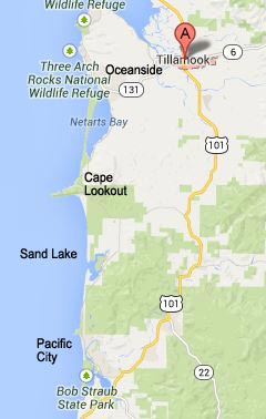
THREE CAPES LOOP FROM NORTH TO SOUTH
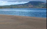
Bay Ocean and Cape Meares Village: Beach access #29 and access #30 are found here.
- BACK TO TOP
Meares Loop Road: Three Capes Loop
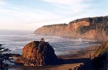
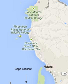
From Bayocean Road and the little village nestled against Cape Meares (with the same name), take Meares Loop Road to head south to Cape Meares and to Oceanside. This tight, winding and often precarious little drag twists upward and downward, a little like a roller coaster, and brings you to some beautiful viewpoints. Viewpoints abound. It was until 2024 closed due to damage but is now open. -- Cape Meares Loop Rd. Reopens, N. Oregon Coast's Three Capes is 'Loop' Again After 10 Years -- Video, Photos Dig Into Story Behind N. Oregon Coast's Reopened, Captivating Three Capes Loop
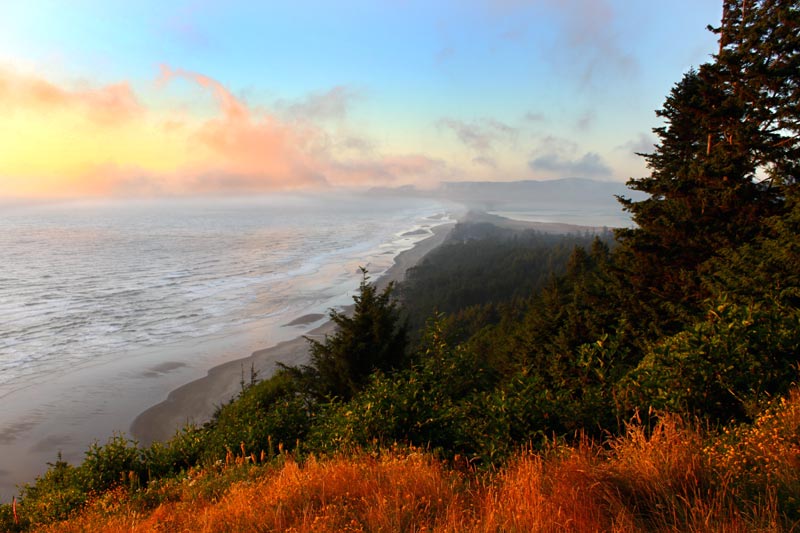
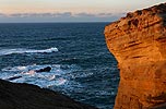
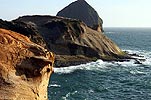
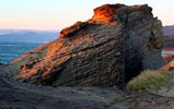
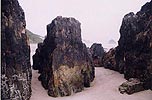
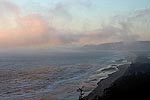
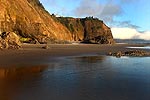
Cape Meares
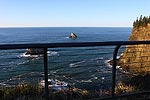
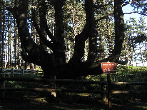
A lighthouse, a weird tree anomaly and a few hidden trails all create a whole new world to explore in this relatively small State Park – all a trifle north of MP 4.
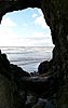
From the Octopus Tree, more trails await. A trail to the highway darts off toward the road, going for about a half mile and passing several viewpoints. There are also long, meandering trails snaking down to the beach and a hidden cove at Cape Meares (village), as well as one which ends up at Meares itself. -- Views from Cape Meares -- Cape Meares Scary Geology --
- Cape Meares Lighthouse History and Its Future -
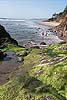
Short Beach - Beach Access #30A
Lurking on the side of Meares Loop Rd. near Radar Rd., just a tiny bit north of MP 4, sits this stunning hidden spot. Old radar station kitty corner from the Short Beach Trailhead.
Access to the beach is a long stairway but worth it. -- Short Beach, Near Oceanside
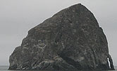
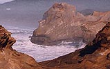
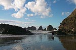
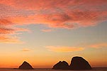
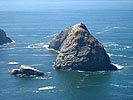
Three Arch Rocks, from Above, National Refuge
Oceanside - Beach Access #31
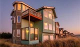
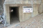
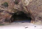
At first glance, Oceanside appears to be not much but a collection of homes clustered around it. There is so much here, including Maxwell Point, the top of the mountain, an amazing neighborhood tour, the tunnel and Tunnel Beach (sometimes called Star Trek Beach) and other surrounding trails.
Note: the road name changes to Netarts Hwy here, eventually become Netarts Bay Dr as Netarts Hwy veers inland. MP numbers also start over when these road changes happen. -- Unusual Tide Conditions, Easy Access -- A Cluster of Caves at Oceanside -- Oceanside, Oregon - Other Side of Maxwell Point, Hidden Area -- Visions of a Tunnel and Secret Cave: Oceanside - Star Trek Beach -- Oceanside, Oregon - Beach, Attractions -- Maxwell Point and Tunnel Beach, Oceanside Complete Guide
Symons Viewpoint
No actual beach access - next access a couple miles south at Netarts' Happy Camp. Symons State Scenic Viewpoint, Oceanside
Happy Camp - Beach Access #32 (Happy Camp Beach as it's sometimes called)
At about MP 2, the tiny community of Happy Camp pops up, looking more like a driveway than an actual beach access. Northern edges of Netarts, Netarts Bay. Netarts, Happy Camp Surprises -- Ghost Forest Found at N. Oregon Coast's Happy Camp a Chilling Reminder
Netarts - Crab Ave Beach Access
The comfy, tiny burgh of Netarts doesn't look like much, but there's more than meets the eye. Lovely view of Netarts Bay and Happy Camp as well as a beach access at the end of Crab Ave. About a half mile down the road are more Netarts Bay and the docks. No known beach access #'s.
Various pullouts along the bay for parking / recreation. Netarts Bay Above and Below: Recreational Crabbing, Oysters
Former Wee Willies
The famed burger joint many Oregonians grew up with is long gone, but the building remains. About one quarter mile north of Hatchery.
Whiskey Creek Fish Hatchery (About MP 3)
Watch the little baby fishies swim around their spawning tank. Appears just as Netarts Bay is out of view. Almost a mile south of Netarts.
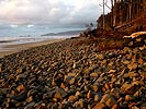
Cape Lookout State Park (MP 0) - Beach Accesses #33, #33A, #33B, #33C
At Cape Lookout State Park, the road changes from Whiskey Creek Road to Cape Lookout Road - hence the designation of MP 0. All beach accesses with numbers are within the park.
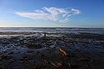
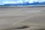
The beach at this popular park is mostly one immense, sandy stretch, going on for nearly five miles to the north into Netarts Spit. Parts of the beach dip steeply into the tide line, causing the waves to crash loudly and abruptly, then quickly running out of steam and altogether creating an intense natural spectacle. Lots of camping here.
The North Trail leads you up about 2 miles to Cape Lookout - an uphill journey that's rigorous. -- Cape Lookout Wild Skies, Trees -- Strange Beauty Cape Lookout -- Cape Lookout Beaches
Anderson's Viewpoint
At approximately MP 1, look for this favorite spot for hang gliders to launch themselves off of. Vast views of the ocean spread out here, and ample parking is provided by surrounding gravel areas. -- Anderson's Viewpoint, Ocean Vistas, Hang Gliding
Cape Lookout Upper Trailhead & Trails
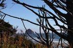
The Cape Trail makes a five-mile loop around the entire cape, winding up at the tip of this majestic outcropping where, if the weather permits, you can catch sight of Cascade Head and Cape Foulweather - some 40 miles to the south. To the north, you can even see Tillamook Head - about 42 miles to the north. It's primarily an easy trek with very little elevation gain. But there are enough uphill stretches to induce heavy breathing in even the most hardy.
About a half mile down the Cape Trail - at one of the first railed lookout spots - there's the Crash Sight Memorial, where a World War II B-17 bomber slammed into the headland in 1942.
The South Trail veers off to the left of the Cape Trail, taking you down to a hidden cove and a secluded, very sandy beach - eventually connecting to the Sand Beach campground area about four miles to the south. This is no easy trek, however. It's a zigzagging plod downward through two miles of trail before you hit the beach, so you can assume the hike back up will be a hellish one. This is the only beach access for about two miles until Sand Lake. -- Hiking Cape Lookout Trail on N. Oregon Coast Yields Soaring Views -- Misty Moments Above the Oregon Coast: Cape Lookout Trailhead -- What Really Happened with the Crashed B-17 Bomber on N. Oregon Coast's Cape Lookout
Shortcuts at Lookout and Sand Lake Junction
The Three Capes Tour is twisted and winding north of this point. But if you go east on Sand Lake Rd., you hit a much straighter northbound stretch of the inland part of Highway 101.
So, if you want to make better time and don't mind missing some of the details of the Three Capes Loop, take 101 to Sand Lake Road, then crossover to this junction (about a ten-minute drive through beautiful back country) and take the fairly straight stretch past Pacific City to 101 again.
If you're going north, do it in reverse: take the Three Capes Tour off 101, go past Pacific City and Tierra Del Mar, then head over Sand Lake Road to this straight section of 101 going to Tillamook. Sand Lake Rec Area Video Experiment, GPS -- Beaches of Sand Lake - loose sands
Cape Lookout Rd Becomes Sand Lake Rd.
This is a tad confusing as the road becomes Sand Lake Rd in two directions: southward and east.
Sand Lake Recreation Area and Sandbeach Campground & Dunes
Several beach accesses are here, including beach access #34 at the end of Galloway Road.
Take Galloway Road (at approximately MP 5) and you’ll find a place where ATV enthusiasts abound because of the sprawling dunes - so expansive they are known as the ``Other Dunes on the Oregon Coast.''
Sandbeach is divided into the East Dunes, the West Winds campground area and the Fisherman Day-Use area. In between these sections, there are numerous sandy trails meandering throughout the small, brownish pines.
From the main entrance northward, it's a sandy, grassy, dune-covered stretch of about 4 miles until the secretive cove at the bottom of Cape Lookout - and not much else. But after the first mile it's usually pure solitude as you leave the roaring ATV's far behind.
Derrick Road & ATV Access
Off Galloway Road, you'll find the densely forested, winding Derrick Road, twisting past tiny country homes. At its end, about a mile up the hill, there's yet another ATV access and parking lot. This fairly unknown access leads to the dunes just off Cape Lookout Road. There's also camping here.
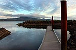
Whalen Island County Park – Clay Meyers State Natural Area
A small clump of forest lies at the center of this tiny park, lined by picnic tables, campsites and a lovely view of the marshy, mushy Sand Lake. There's no beach access here, but it's a swell spot for boating, fishing, bird watching or just taking in the sights.
The park is located on a slightly steep drop just off the side of the road and you might miss it if you blink. It features a reservable group area and RV hookups as well.
Sitka Sedge State Natural Area
Sitka Sedge Parking and Trailhead are here – in one of the newest of state parks. Includes Beach Access #34A and #34B.Less Obvious Pacific City: Sandy Wonders of the N Oregon Coast Town, Unique Hikes
Tierra Del Mar – Beach Access #35
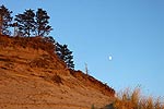
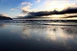
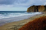
If you're southbound, near MP 10 you'll wander into a few tight curves and eventually wind up in a small collection of homes known as Tierra Del Mar. Here, the beach abruptly pops into view: a long, nearly endless expanse of sand with golden, sandstone cliffs above it in a few places.
This area allows you some beach access with your car. The road morphs into McPhillips Dr here. -- Near Pacific City, Tierra Del Mar Travel Tips, Hiking -- Tierra Del Mar at Night - Tierra Del Mar Jump Off Point, Scenic Bluffs -- Tierra Del Mar
McPhillips Beach - Beach Access #36
Hidden spot just south of the road change. McPhillips Beach - hidden spot -- McPhillps Beach next to Cape Kiwanda
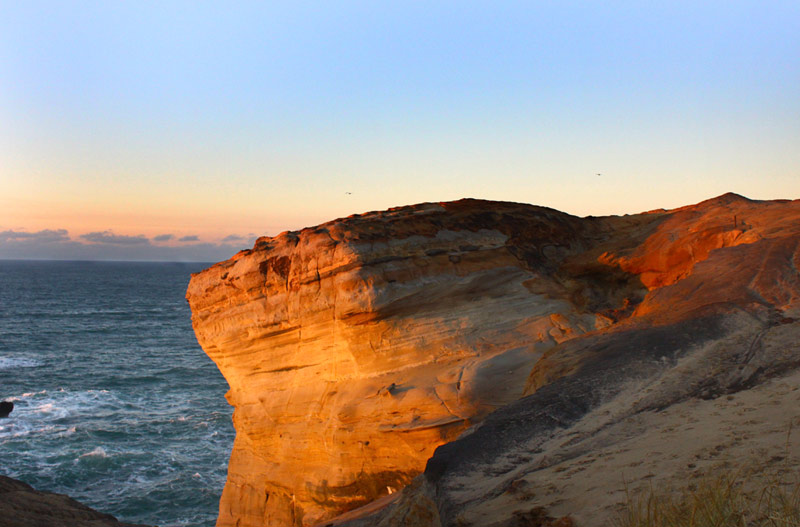
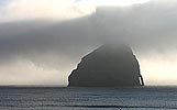
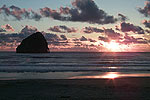
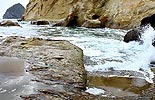
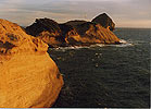
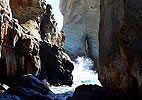
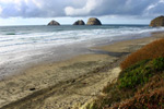
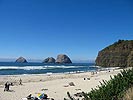
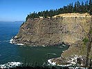
Cape Kiwanda State Natural Area
Encompasses Cape Kiwanda all the way to Tierra Del Mar. The sweeping, golden and wind and sea ravaged cliffs of Cape Kiwanda are known as the most photographed chunk of the Oregon Coast - and you need only see them from a distance to understand why. Cape Kiwanda, Oregon Coast: Complete Travel Guide / Hiking -- Geology of an Oregon Coast Icon: Sweeping Cape Kiwanda -- Secret View, Cliffs of Kiwanda. Pacific City photos --
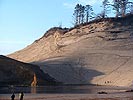
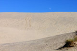
Top of Cape Kiwanda / Kiwanda Dune
Nearly 300 feet high, the dune atop Cape Kiwanda is a favorite, especially for those who want slide down it in innovative ways. Sandboarding is one way.
Kiwanda Dune: How High Is It? -- Guide to Top of Cape Kiwanda -- Cape Kiwanda, Oregon Coast: Complete Travel Guide / Hiking
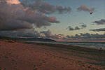
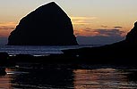
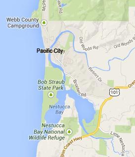
Pacific City
This cute hamlet is a tiny charmer, mixing rustic with the upscale. There are enough natural and manmade nooks and crannies to make it a captivating bit of rural exploration. Numerous restaurants, a famous brew pub, a few choice lodgings, more beach than you might know what to do with and even a small airport inhabit this rugged country town with an occasional upscale touch. Weird History: Cape Kiwanda Almost Had Nuclear Power Plant -- Pacific City's Haystack Rock Up Close --
Cape Kiwanda is Access #37. Access #37A is at Pacific Ave.
The sweeping, golden and wind and sea ravaged cliffs of Cape Kiwanda are known as the most photographed chunk of the Oregon Coast - and you need only see them from a distance to understand why. Bob Straub Red Sands
Bob Straub State Park - Access #37B.
The spit goes on for over three miles until it dead ends at the Nestucca River banks, across from Porter Point and the surreal, clandestine fun of Winema Beach (see Lincoln City Virtual Tour). Bob Straub State Park
Brooten Rd.
The main drag through Pacific City cuts through what could be considered its downtown, starting at the Highway 101 junction, past some interesting nautical items on the roadside and the muddy, sandy banks of the Little Nestucca. This, too, is a favorite fishing spot, and there are many places to pull over and park.
The road then takes you back onto Highway 101, going towards Neskowin.
- BACK TO TOP