Geology of an Oregon Coast Icon: Sweeping Cape Kiwanda
Three Capes Loop Virtual Tour, Oregon Coast: Oceanside, Netarts, Tierra Del Mar, Pacific City
(Pacific City, Oregon) - Sometime around 18 million years ago or so, a massive area along what would eventually become the northwest United States had already been carved out by various erosional processes. About then, it started filling back up with other rock debris, primarily sandstone and similar materials. Primarily underwater or around the tide line, it formed a layer of sandstone and mudstone that was eventually named the Astoria Formation, running from the central Oregon coast up to the north coast.
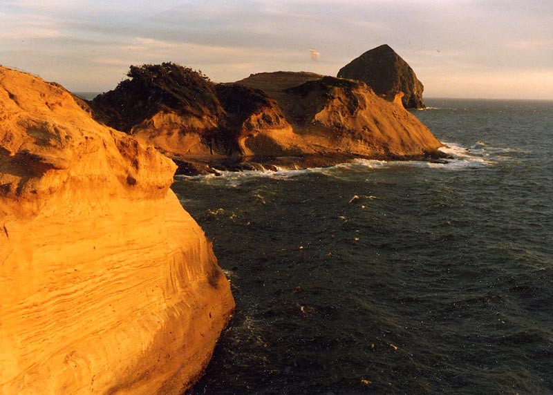
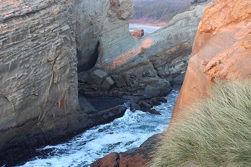
This was the very beginning of the headland now known as Cape Kiwanda – the iconic headland at Pacific City that's been known for decades as one “of the most photogenic places in North America.”
Cape Kiwanda is actually a bit of an oddity along the northern half of the Oregon coast: it's about the only major headland that is not made of basalt – the black rock that is created by ancient lava flows (south coast is completely different). In fact the area around Kiwanda is considered unusual in that there is relatively little presence of the massive lava flows that covered and smothered much of the area from 18 million years ago onward, and created most of the major landmarks we see.
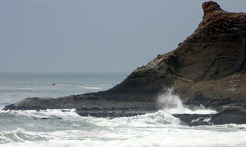
Sometime after the initial formation of the sandstone of the Astoria Formation, big lava flows came scorching through the region from what would eventually be Idaho, down the Columbia Gorge, and then forming nearby headlands like Cape Lookout and Cape Meares. But these mostly missed the Kiwanda area. However, the presence of the iconic Haystack Rock just offshore shows some “intrusive” basalts – meaning the lava flows were so powerful they plunged down into softer sediment and ground, then coming up again a ways away to re-erupt in the forms of smaller headlands.
It's theorized Haystack Rock is one of these intrusive eruptions – just like the other Haystack Rock up at Cannon Beach. It's also theorized it was originally large enough to be another headland, but was whittled away into its present form.
Later, time and changing sea levels covered all this up, including the layers that comprised Cape Kiwanda, and then uncovered them again. Consequently, like much of the Astoria Formation throughout the central Oregon coast, fossils can be found embedded in the cape (although not as many as around Newport and Depoe Bay). Some larger creatures were found in Kiwanda, including sea lions and even a fossilized whale.
In a geology paper written by Ernest H. Lund for the State of Oregon in 1974, Lund – a professor of geology at the University of Oregon at the time – noted how Haystack Rock has been key to Cape Kiwanda's survival over the millennia, especially considering such sandstone erodes relatively quickly.
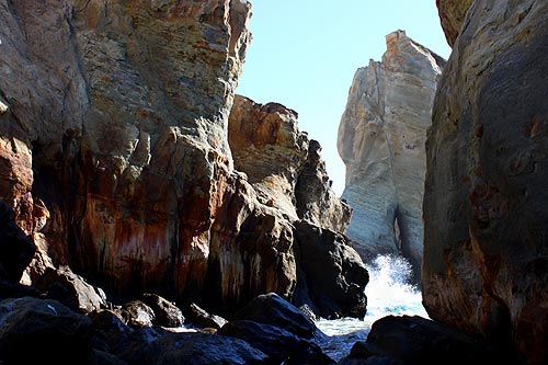
“This point of sandstone owes its survival in small part to the basalt dike on its south side but more importantly to Haystack Rock. a basalt sea stack four-tenths of a mile to the southwest,” Lund wrote in his paper. “At one time, the promontory extended to Haystack Rock, which defended the sandstone from severe winter wave attacks from the southwest. Erosion on the flanks of the promontory finally separated the basalt from the sandstone, isolating it as a sea stack.”
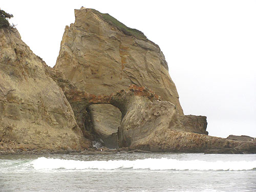
Eventually, without direct protection from Haystack, the cape was eroded to its current position. But the rock still plays an interesting part in what happens on the rubbly cape.
“Haystack Rock still gives some protection to the cape by receiving part of the assault of the storms from the southwest, but the Cape is being visibly eroded, principally by undercutting along the sea cliffs and by rock fall.”
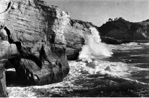
You can see some striking differences between now and past photos of the Oregon coast icon. Below is a photo in the geology document by Lund from what was then called the Oregon Highway Department (later ODOT). It's unclear how much earlier than than 1974 this photo was taken, but it shows the beginning of an arch and what was still a large, towering chunk of sandstone. Compare this photo with those above, and you see that not only is a massive portion now gone of the structure at the top from the B/W photo, (the one that keeps ascending at a diagonal) but many other structures as well.
Also, another arch in the photo above stood until February of 2010, after which it too crumbled away.You can see more here Just What is Cape Kiwanda on Oregon's Coast? And Why It's Falling Apart