


Port Orford SOUTHERN OREGON COAST WEATHER | SKY CAMS | TIDES | ALERTS | LIVE RADAR
Updated Constantly: Port Orford, Cape Blanco Oregon Coast Weather | Cams | Tides | Alerts - Current conditions, forecasts, tides, weather, live radar weather cams, South Coast Range travel, storm alerts
PORT ORFORD OREGON COAST 7-DAY FORECAST - Cape Blanco, more
7-Day Forecast
Detailed Forecast
CAPE BLANCO WEATHER
7-Day Forecast
Detailed Forecast
Wave Forecast

Heat Advisory issued June 15 at 11:13PM PDT until June 15 at 11:00PM PDT by N...
16 Jun 2026 at 12:13am
The heat advisory has expired. Highs on Tuesday will be a few to
several degrees lower than they were on Monday.
Heat Advisory issued June 15 at 1:53PM PDT until June 15 at 11:00PM PDT by NW...
15 Jun 2026 at 2:53pm
* WHAT...High temperatures of 85 to 95 degrees expected, except 75
to 85 at the beaches. Low temperatures of 55 to 65 degrees.
* WHERE...South Central Oregon Coast, including all locations from
Port Orford to Florence, and inland to Coquille and Myrtle Point.
* WHEN...Until 11 PM PDT this evening.
* IMPACTS...Hot temperatures may cause heat illnesses.
* ADDITIONAL DETAILS...Strongest offshore flow will be Sunday, so
beaches could get quite warm to hot then. Inland areas will be hot
both days.
Heat Advisory issued June 15 at 3:57AM PDT until June 15 at 11:00PM PDT by NW...
15 Jun 2026 at 4:57am
* WHAT...High temperatures of 85 to 95 degrees expected, except 75
to 85 at the beaches. Low temperatures of 55 to 65 degrees.
* WHERE...South Central Oregon Coast, including all locations from
Port Orford to Florence, and inland to Coquille and Myrtle Point.
* WHEN...Until 11 PM PDT this evening.
* IMPACTS...Hot temperatures may cause heat illnesses.
Small Craft Advisory issued June 20 at 12:43PM PDT until June 23 at 5:00AM PD...
20 Jun 2026 at 1:43pm
* WHAT...North winds 10 to 20 kt with gusts up to 30 kt and seas
6 to 9 ft at 10 seconds.
* WHERE...For the outer waters.
* WHEN...Until 5 AM PDT Tuesday.
* IMPACTS...Gusty winds and/or steep seas could capsize or
damage smaller vessels.
* View the hazard area in detail at https://go.usa.gov/x6hks
![]()
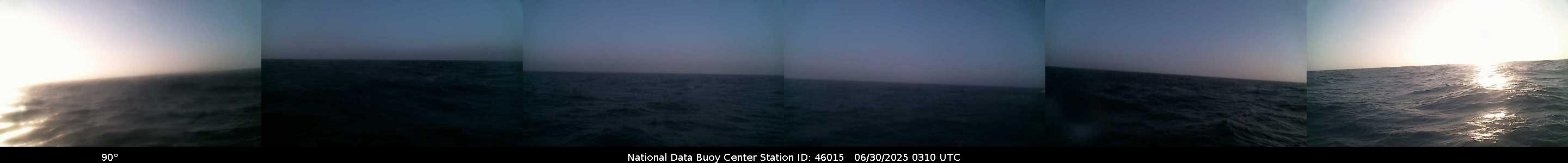
NDBC - Station 46015 - PORT ORFORD - 15 NM West of Port Orford, OR Observations
This feed shows recent marine weather observations from Station 46015.
Station 46015 - PORT ORFORD - 15 NM West of Port Orford, OR
21 Jun 2026 at 12:15am
June 20, 2026 10:50 pm PDT
Location: 42.754N 124.839W
Wind Direction: N (360°)
Wind Speed: 15.6 knots
Wind Gust: 17.5 knots
Significant Wave Height: 6.6 ft
Dominant Wave Period: 10 sec
Average Period: 6.8 sec
Mean Wave Direction: NNW (335°)
Atmospheric Pressure: 30.08 in (1018.7 mb)
Air Temperature: 53.6°F (12.0°C)
Water Temperature: 49.3°F (9.6°C)
![]()
NDBC - Station PORO3 - 9431647 - Port Orford, OR Observations
This feed shows recent marine weather observations from Station PORO3.
Station PORO3 - 9431647 - Port Orford, OR
21 Jun 2026 at 12:45am
June 20, 2026 11:18 pm PDT
Location: 42.739N 124.498W
Wind Direction: NNE (20°)
Wind Speed: 11.1 knots
Wind Gust: 13.0 knots
Atmospheric Pressure: 30.04 in (1017.4 mb)
See the Cape Blanco Lighthouse / Historical Society Weather Station (Likely more accurate because station is on Cape Blanco)
Port Orford Tide Tables | General Oregon Weather | Ocean Temperatures
Oregon Coast Highway 101 / Coast Range Traffic | Portland, Oregon Traffic, Road Conditions - Traffic Cams: I-5 - I-205 - I-405 - Hwy 217 - I-84 - Highway 26 Beaverton | Portland Street Traffic (Northwest, Southeast, Southwest, Northeast Traffic) | Willamette Valley / Salem, Oregon Traffic | Eugene / Albany / Corvallis Traffic | Columbia Gorge Traffic | More Oregon Traffic Soon
SOUTH OREGON COAST RANGE ALERTS DOUGLAS COUNTY - if empty then no alerts
Heat Advisory issued June 20 at 12:43PM PDT until June 23 at 11:00PM PDT by N...
20 Jun 2026 at 1:43pm
* WHAT...Daytime highs of 95 to 103 are possible, with reduced
overnight cooling.
* WHERE...Valleys and low-lying areas west of the Cascades. This
includes communities in the Umpqua, Illinois, Rogue, Shasta,
Scott, and Klamath River valleys as well as exposed areas in the
western Cascades foothills, in eastern Curry County, and south of
Mount Shasta.
* WHEN...From 11 AM Monday to 11 PM PDT Tuesday.
* IMPACTS...Hot temperatures may cause heat illnesses.
* ADDITIONAL DETAILS...Drink plenty of fluids, stay in an
air-conditioned room, stay out of
the sun, and check up on relatives and neighbors.
Heat Advisory issued June 15 at 11:13PM PDT until June 15 at 11:00PM PDT by N...
16 Jun 2026 at 12:13am
The heat advisory has expired. Highs on Tuesday will be a few to
several degrees lower than they were on Monday.
Heat Advisory issued June 15 at 1:53PM PDT until June 15 at 11:00PM PDT by NW...
15 Jun 2026 at 2:53pm
* WHAT...High temperatures of 90 to 104 degrees expected with low
temperatures of 55 to 65 degrees.
* WHERE...Central Douglas County and Eastern Douglas County
Foothills, including Roseburg, Sutherlin, Elkton, Camas Valley,
Glendale, Canyonville, Tiller and Toketee Falls.
* WHEN...Until 11 PM PDT this evening.
* IMPACTS...Hot temperatures may cause heat illnesses.

PORT ORFORD WEB-WEATHER CAMS, RADAR
Coos Bay / Coos River Bar Cam click to view latest
More Port Orford Webcams at Oregon Coast Webcams and at Oregon Coast Road Conditions

Live South Coast Radar
Port Orford Oregon Coast Lodging, Hotels, Motels, Restaurants, Inns, Vacation Rentals
BUOY REPORTS - including passing ship reports
![]()
NDBC - Station Observations near 42.75N 124.84W
This feed shows recent marine weather observations from NDBC and its partners within 100 nautical miles of 42.75N 124.84W.
Station 46015 - PORT ORFORD - 15 NM WEST OF PORT ORFORD, OR
21 Jun 2026 at 12:58am
June 20, 2026 10:30 pm PST
Location: 42.754N 124.839W or 0 nautical miles N of search location of 42.75N 124.84W.
Wind Direction: N (10°)
Wind Speed: 16 knots
Wind Gust: 17 knots
Atmospheric Pressure: 30.08 in (1018.6 mb)
Air Temperature: 53°F (11.9°C)
Water Temperature: 50°F (9.8°C)
Station PORO3 - 9431647 - PORT ORFORD, OR
21 Jun 2026 at 12:58am
June 20, 2026 10:18 pm PST
Location: 42.739N 124.498W or 15 nautical miles E of search location of 42.75N 124.84W.
Wind Direction: NNE (20°)
Wind Speed: 11 knots
Wind Gust: 13 knots
Atmospheric Pressure: 30.04 in (1017.4 mb)
Station SNTO3 - TOM'S CREEK, SOUTH SLOUGH RESERVE, OR
21 Jun 2026 at 12:58am
June 20, 2026 10:30 pm PST
Location: 43.279N 124.318W or 39 nautical miles NE of search location of 42.75N 124.84W.
Wind Direction: E (90°)
Wind Speed: 2 knots
Atmospheric Pressure: 30.12 in (1020.0 mb)
Air Temperature: 52°F (11.0°C)
Dew Point: 51°F (10.4°C)
Station CHAO3 - 9432780 - CHARLESTON, OR
21 Jun 2026 at 12:58am
June 20, 2026 9:36 pm PST
Location: 43.351N 124.337W or 42 nautical miles NNE of search location of 42.75N 124.84W.
Wind Direction: NNE (20°)
Wind Speed: 3 knots
Wind Gust: 4 knots
Atmospheric Pressure: 30.09 in (1018.9 mb)
Station 46027 - ST GEORGES - 8 NM NW OF CRESCENT CITY, CA
21 Jun 2026 at 12:58am
June 20, 2026 10:30 pm PST
Location: 41.84N 124.382W or 58 nautical miles SSE of search location of 42.75N 124.84W.
Wind Direction: NNW (340°)
Wind Speed: 16 knots
Wind Gust: 17 knots
Atmospheric Pressure: 30.00 in (1016.0 mb)
Air Temperature: 54°F (12.3°C)
Dew Point: 51°F (10.5°C)
Station CECC1 - 9419750 - CRESCENT CITY, CA
21 Jun 2026 at 12:58am
June 20, 2026 10:18 pm PST
Location: 41.746N 124.184W or 67 nautical miles SSE of search location of 42.75N 124.84W.
Wind Direction: SE (130°)
Wind Speed: 7 knots
Wind Gust: 8 knots
Atmospheric Pressure: 30.02 in (1016.7 mb)
Latest Weather Articles from Port Orford
Absolute Complete Guide to Oregon Coast Fourth of July, 2026: All Towns
19 Jun 2026 at 9:06am
Astoria events, Seaside events, Cannon Beach events, Manzanita events, Rockaway Beach events, Tillamook events, Oceanside events, Pacific City events, Lincoln City events, Depoe Bay events, Newport events, Waldport events, Yachats events, Florence events, Reedsport events, North Bend events, Coos Bay events, Charleston events, Bandon events, Port Orford events, Gold Beach events, Brookings events. Weather
Pacific Northwest Weather | Oregon, Washington, Coastlines - Live View from S...
19 Jun 2026 at 9:06am
See the region live from space. Gateway to Oregon coast, Washington coast, inland Oregon weather, warnings, alerts
Ontario Eastern Oregon Weather - Forecasts, Sky Cams, Alerts, Current Conditions
15 Jun 2026 at 8:54am
Weather forecasts, sky cams, alerts and current conditions for Ontario in eastern Oregon
Video: Oregon / Washington Heatwave Warnings Abound, Around 100
12 Jun 2026 at 7:01pm
Heat warnings lighting up weather pages from mid Washington to southern Oregon.
Tillamook, Oregon Weather - Tillamook Bay 7-Day Forecast, Current Conditions,...
4 Jun 2026 at 8:29am
Tillamook, Oregon weather conditions and forecasts
Free Fishing Weekend All Over Oregon, Coastline
1 Jun 2026 at 10:05pm
Oregon's Free Fishing Weekend returns June 6 - 7, 2026. Brookings events, Gold Beach events, Port Orford events, Coos Bay events, Bandon events, Florence events, Yachats events, Newport events, Lincoln City events, Rockaway Beach events, Manzanita events, Cannon Beach events, Seaside events, Astoria events
State Parks Day Means One Big Freebie for Oregonians - including the coastline
30 May 2026 at 7:01am
June 6 brings free parking to all Oregon state parks for residents. Brookings events, Gold Beach events, Port Orford events, Coos Bay events, Bandon events, Florence events, Yachats events, Newport events, Lincoln City events, Rockaway Beach events, Manzanita events, Cannon Beach events, Seaside events, Astoria events
Shop at the Dock and Discover Oregon Seafood Return to the Coast for Summer
27 May 2026 at 9:15pm
Back to Newport, Garibaldi events, Port Orford events, Winchester Bay events, Brookings events, Newport events, Pacific City events
Port Orford + Cape Blanco Oregon Coast Updates
Absolute Complete Guide to Oregon Coast Fourth of July, 2026: All Towns
19 Jun 2026 at 9:06am
Astoria events, Seaside events, Cannon Beach events, Manzanita events, Rockaway Beach events, Tillamook events, Oceanside events, Pacific City ...
Free Fishing Weekend All Over Oregon, Coastline
1 Jun 2026 at 10:05pm
Oregon's Free Fishing Weekend returns June 6 - 7, 2026. Brookings events, Gold Beach events, Port Orford events, Coos Bay events, Bandon events, Fl...
State Parks Day Means One Big Freebie for Oregonians - including the coastline
30 May 2026 at 7:01am
June 6 brings free parking to all Oregon state parks for residents. Brookings events, Gold Beach events, Port Orford events, Coos Bay events, Bando...
Shop at the Dock and Discover Oregon Seafood Return to the Coast for Summer
27 May 2026 at 9:15pm
Back to Newport, Garibaldi events, Port Orford events, Winchester Bay events, Brookings events, Newport events, Pacific City events
Astoria / Warrenton Weather
Seaside Weather
Cannon Beach
Manzanita
Nehalem Bay / Wheeler
Rockaway
Oceanside/Tillamook
Pacific City
Lincoln City
Depoe Bay Weather
Newport
Yachats
Florence
Reedsport - Winchester Bay Weather
Coos Bay - North Bend - Charleston
Bandon Weather
Port Orford Weather
Gold Beach Weather
Brookings Weather
Oregon Inland Weather
- McMinnville, Oregon Weather
-- Salem Oregon Weather
-- Portland / Beaverton Oregon Weather
-- Eugene / Springfield Weather
-- Bend Central Oregon Weather
-- Medford Oregon Weather
-- Government Camp / Mt Hood Weather
-- West Columbia River Gorge / Cascade Locks, Oregon Weather
-- Pendleton / Eastern Gorge Weather
-- Corvallis / Albany Oregon Weather
-- Ontario Oregon Weather
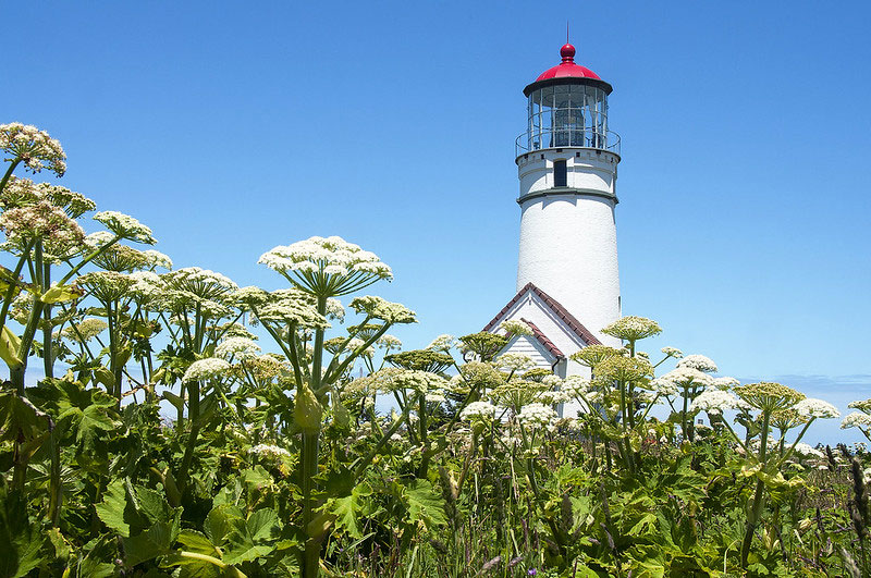
How Cape Blanco is a Dividing Line in South Oregon Coast Weather It has an impact but not in ways you'd expect
1919 Wreck of J.A. Chanslor on South Oregon Coast Left 36 Dead Near Cape Blanco Conditions were shifting on the morning of December 18, 1919


Photo Manuela Durson - Manuela Durson Fine Arts
Search
over 8,500 Pages for Oregon coast subjects, articles or lodging...
Back to Oregon Coast
Contact Advertise on BeachConnection.net
All Content, unless otherwise attributed, copyright BeachConnection.net Unauthorized use or publication is not permitted
Follow us on


South Coast Hotels
Oregon
Coast Hotels Astoria/Warrenton Hotels
Seaside
Cannon
Beach Lodging
Nehalem Bay Lodgings
Manzanita Hotels, Lodging
Rockaway Beach Hotels
Three Capes Lodging
Pacific City Hotels, Lodging
Lincoln
City Lodging
Depoe
Bay Lodging
Newport Lodging
Waldport Lodging
Yachats
Lodging
Oregon
Coast Vacation Rentals
Oregon
Coast Lodging Specials
Oregon Coast Luxury Hotels
Oregon Coast Pet Friendly Hotels/Rentals
Oregon
Coast Bed and Breakfasts / B&Bs
Cannon Beach Vacation Rentals
Pacific City Vacation Rentals
Newport, Depoe Bay Vacation Rentals
Oregon Coast Restaurant, Dining
Guide
Seaside
Cannon
Beach Dining
Manzanita,
Rockaway, Wheeler Dining
Pacific
City, Oceanside, Netarts, Tierra Del Mar Restaurants
Tillamook
Bay Restaurants, Dining
Lincoln
City Dining, Restaurants
Depoe
Bay Restaurants, Dining
Newport Restaurants, Dining
Waldport,
Yachats Restaurants, Dining
Florence Restaurants, Dining
Restaurant
Reviews
Coast
Events Calendar
Astoria
Seaside,
Cannon Beach Calendar
Manzanita,
Rockaway Events
Tillamook,
Pacific City Calendar
Lincoln
City Events Calendar
Newport,
Depoe Bay Events Calendar
Yachats Events Calendar
Oregon Coast Weather
Astoria, Warrenton Weather
Seaside Weather
Cannon Beach
Manzanita
Nehalem Bay / Wheeler
Rockaway
Oceanside/Tillamook
Pacific City
Lincoln City
Depoe Bay Weather
Newport
Yachats
Florence
Reedsport - Winchester Bay Weather
Coos Bay - North Bend - Charleston
Bandon Weather
Port Orford Weather
Gold Beach Weather
Brookings Weather
Search for Oregon Coast Subjects, Articles
Explore Every Beach Spot

Astoria
Where the Columbia meets the Pacific, Land of Lewis & Clark and loads of atmosphere & history

Seaside
The Promenade, Tillamook Head, family fun & broad, sandy beaches

Cannon Beach
A mysterious lighthouse, upscale yet earthy, a huge monolith, fine eateries & an art mecca

Nehalem Bay - Manzanita, Rockaway, Wheeler
Manzanita's beaches, Nehalem and Wheeler's quirky beauty; laid back Rockaway

Tillamook Bay
Garibaldi, Barview, Bay City, Tillamook & an oceanfront ghost town

Three Cape Loop - Oceanside, Netarts, Pacific City
The hidden secret of the coast: Cape Meares, a lighthouse, Oceanside, Netarts and Pacific City

Lincoln City & the Corridor of Mystery
Miles & miles of unbroken beaches, Cascade Head, Neskowin and manmade attractions

Depoe Bay
A spouting horn downtown, freaky hidden cliffs and whales, whales, whales

Newport
Two lighthouses, timeless Nye Beach, bustling bayfront, regal bridge

Waldport, Seal Rock
Sands and dunes, craggy Seal Rock, semi-secret beaches

Yachats
Constantly dramatic wave action, a mix of the rugged & upscale

Upper Lane County
25 miles of deserted beaches & oodles of wonders

Florence
A lighthouse, ancient bayfront and miles and miles of fluffy dunes
South Oregon Coast Travel
News Headlines from All Over Oregon Need to scan Oregon headlines? Constantly updated news from all over Oregon: a comprehensive, up-to-the-minute display of news headlines from a variety of media
Oregon Coast Oceanfront Lodging, Hotels, Rentals