


SEASIDE OREGON WEATHER | 7-DAY FORECAST | SKY CAMS | WAVE FORECASTS | TIDES | ALERTS
Updated Constantly: Seaside Oregon Coast Weather | Cams | Tides | Alerts - Current conditions, forecasts, tides, weather, live radar weather cams, North Coast Range travel, storm alerts
SEASIDE - Updated 2026-05-18 20:42
SEASIDE, OREGON 7-DAY FORECAST
7-Day Forecast
Detailed Forecast
SEASIDE-AREA WAVE FORECAST
Wave Forecast
Watches, warnings, and advisories issued since Sat, Jun 21, 2025 2:30:00 PM +0000 for Clatsop County Coast (ORZ101) OR
Current watches, warnings, and advisories for PZZ251
| General Oregon Weather | Nearby Astoria, Warrenton Weather | Gearhart Weather | Cannon Beach
| Washington Coast Weather
Oregon Coast Highway, Coast Range Passes Traffic, Road Conditions
| Portland, Oregon Highway Traffic, Road Conditions - Traffic Cams: I-5 - I-205 - I-405 - Hwy 217 - I-84
| List of Oregon Coast Webcams - Weather Cams
NORTH OREGON COAST RANGE - HWY 26 NEAR SEASIDE - if empty then no alerts
Watches, warnings, and advisories issued since Fri, Jan 31, 2025 9:07:21 AM -0700 for North Oregon Coast Range Lowlands (ORZ104) OR
Watches, warnings, and advisories issued since Fri, Mar 21, 2025 2:30:00 PM +0000 for Oregon
Special Weather Statement issued July 7 at 10:16PM PDT by NWS Pendleton OR
7 Jul 2026 at 11:16pm
At 1015 PM PDT, Doppler radar was tracking a strong thunderstorm over
Lostine, or 9 miles northwest of Enterprise, moving northeast at 20
mph.
HAZARD...Wind gusts up to 40 mph.
SOURCE...Radar indicated.
IMPACT...Gusty winds could knock down tree limbs and blow around
unsecured objects.
Locations impacted include...
Enterprise and Lostine.
This includes the following highways...
Highway 3 between mile markers 23 and 43.
Highway 82 between mile markers 48 and 65.
Red Flag Warning issued July 7 at 9:57PM PDT until July 7 at 10:00PM PDT by NWS Pendleton OR
7 Jul 2026 at 10:57pm
Relative humidity has risen above Red Flag thresholds, so the
warning will be allowed to expire at 10 PM. Breezy winds will
continue through the night in wind-prone areas.
Special Weather Statement issued July 7 at 9:35PM PDT by NWS Pendleton OR
7 Jul 2026 at 10:35pm
At 935 PM PDT, Doppler radar was tracking a strong thunderstorm over
La Grande, moving east at 30 mph.
HAZARD...Wind gusts up to 50 mph and pea size hail.
SOURCE...Radar indicated.
IMPACT...Gusty winds could knock down tree limbs and blow around
unsecured objects. Minor hail damage to vegetation is
possible.
Locations impacted include...
La Grande, Island City, Cove, and Imbler.
This includes the following highways...
Highway 82 between mile markers 1 and 12.
Interstate 84 between mile markers 260 and 269.


 Control the Seaside Promenade Weather Cam - Take control
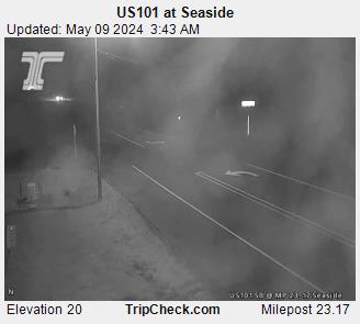
Seaside Traffic / Weather Cam
Seaside, Oregon Hotels, Lodging, Motels, Restaurants, Inns, Vacation Rentals
Seaside, Oregon Lodging, Hotels, Motels, Restaurants, Inns, Vacation Rentals
Find places to stay in Seaside; places to eat, dine in Seaside
Inn of the Four Winds, Seaside
Oceanfront, upscale feel while not as spendy
Seashore Inn, Seaside Hotel
Oceanfront, pet friendly, heated indoor pool, steps from beach attractions
Clementine's Bed and Breakfast - Astoria
Near Seaside: An engaging historic experience; vacation rental next door
Vacation Rentals in Astoria, Warrenton, Gearhart
Multi-bedroom houses, north Oregon coast luxury lodging to budget, including Seaside
Dining, Restaurants, Menus in Seaside, Oregon.
Find Restaurants, Dining in Seaside
Schooner's Cove Inn
Near Seaside: Oceanfront upscale w/ picnic lawn, decks, spa
Near Seaside: Tolovana Inn
Views of Haystack; classic luxury with saltwater pool, spa, spacious rooms
ATTRACTION: Seaside Aquarium
More than 70 years of letting you feed the seals
ATTRACTION: Seaside Virtual Tour, Map
100's of photos, details about Seaside, Oregon, including map
Oregon Coast and Seaside Lodging Fantastic Views on Video
From the balconies and patios of oceanfront hotels, motels and vacation rentals in Seaside and elsewhere
BUOY REPORTS NEAR SEASIDE (+ observations from passing ships)
![]()
NDBC - Station 46243 - Clatsop Spit, OR (162) Observations
This feed shows recent marine weather observations from Station 46243.
Station 46243 - Clatsop Spit, OR (162)
7 Jul 2026 at 10:45pm
July 7, 2026 9:30 pm PDT
Location: 46.215N 124.129W
Significant Wave Height: 3.6 ft
Dominant Wave Period: 20 sec
Average Period: 5.6 sec
Mean Wave Direction: SW (224°)
Air Temperature: 56.3°F (13.5°C)
Water Temperature: 58.8°F (14.9°C)
![]()
NDBC - Station Observations near 45.93N 125.82W
This feed shows recent marine weather observations from NDBC and its partners within 100 nautical miles of 45.93N 125.82W.
Station 46248 - ASTORIA CANYON, OR (179)
7 Jul 2026 at 11:43pm
July 7, 2026 9:26 pm PST
Location: 46.133N 124.64W or 51 nautical miles ENE of search location of 45.93N 125.82W.
Significant Wave Height: 4 ft
Dominant Wave Period: 20 sec
Average Period: 6.5 sec
Mean Wave Direction: SSW (210°)
Water Temperature: 56°F (13.1°C)
Station 46029 - COLUMBIA RIVER BAR - 20NM WEST OF COLUMBIA RIVER MOUTH
7 Jul 2026 at 11:43pm
July 7, 2026 9:10 pm PST
Location: 46.148N 124.508W or 56 nautical miles ENE of search location of 45.93N 125.82W.
Wind Direction: NNW (340°)
Wind Speed: 8 knots
Wind Gust: 10 knots
Average Period: 5.8 sec
Mean Wave Direction: WNW (299°)
Atmospheric Pressure: 30.16 in (1021.4 mb)
Air Temperature: 56°F (13.5°C)
Water Temperature: 58°F (14.3°C)
Station 46243 - CLATSOP SPIT, OR (162)
7 Jul 2026 at 11:43pm
July 7, 2026 9:00 pm PST
Location: 46.215N 124.129W or 72 nautical miles ENE of search location of 45.93N 125.82W.
Significant Wave Height: 4 ft
Dominant Wave Period: 20 sec
Average Period: 5.8 sec
Mean Wave Direction: SW (227°)
Air Temperature: 56°F (13.3°C)
Water Temperature: 60°F (15.5°C)
Station 46211 - GRAYS HARBOR, WA (036)
7 Jul 2026 at 11:43pm
July 7, 2026 8:56 pm PST
Location: 46.857N 124.243W or 86 nautical miles NE of search location of 45.93N 125.82W.
Significant Wave Height: 4 ft
Dominant Wave Period: 9 sec
Water Temperature: 52°F (11.2°C)
Station ASTO3 - 9439040 - ASTORIA, OR
7 Jul 2026 at 11:43pm
July 7, 2026 9:00 pm PST
Location: 46.207N 123.768W or 87 nautical miles ENE of search location of 45.93N 125.82W.
Wind Direction: NNW (330°)
Wind Speed: 9 knots
Wind Gust: 10 knots
Air Temperature: 60°F (15.7°C)
Station TOKW1 - 9440910 - TOKE POINT, WA
7 Jul 2026 at 11:43pm
July 7, 2026 9:00 pm PST
Location: 46.707N 123.967W or 90 nautical miles ENE of search location of 45.93N 125.82W.
Wind Direction: W (270°)
Wind Speed: 5 knots
Wind Gust: 6 knots
Atmospheric Pressure: 30.15 in (1021.0 mb)
Pressure Tendency: +0.03 in (+0.9 mb)
Air Temperature: 57°F (13.7°C)
Station WPTW1 - 9441102 - WESTPORT, WA
7 Jul 2026 at 11:43pm
July 7, 2026 8:36 pm PST
Location: 46.904N 124.105W or 92 nautical miles NE of search location of 45.93N 125.82W.
Wind Direction: NW (310°)
Wind Speed: 11 knots
Wind Gust: 16 knots
Atmospheric Pressure: 30.14 in (1020.6 mb)
Air Temperature: 53°F (11.8°C)
Water Temperature: 51°F (10.8°C)
Station 46041 - CAPE ELIZABETH - 45NM NW OF ABERDEEN, WA
7 Jul 2026 at 11:42pm
July 7, 2026 9:10 pm PST
Location: 47.352N 124.739W or 96 nautical miles NNE of search location of 45.93N 125.82W.
Wind Direction: NW (320°)
Wind Speed: 12 knots
Wind Gust: 16 knots
Average Period: 6.0 sec
Mean Wave Direction: WNW (292°)
Atmospheric Pressure: 30.16 in (1021.4 mb)
Air Temperature: 56°F (13.1°C)
Seaside Hotel Reviews
The Seashore Inn, Seaside
14 Jun 2026 at 4:12am
Specials vary: click to see. Seaside, Oregon hotel reviews
Seaside Hotels, Oregon Coast
Seaside Hotel reviews, vacation rentals
Exquisite Spring Break Hangouts on Oregon Coast with New Discoveries
The wows of Lincoln City and Cannon Beach, including the beginning of a ghost forest. Lincoln City hotel reviews, Cannon Beach hotel reviews, specials, Seaside hotel reviews
Latest Weather Articles from Seaside, Gearhart
N. Oregon Coast Emergencies: Cannon Beach FD Deals with Injured Hiker, Missin...
7 Jul 2026 at 7:59pm
Crashes, missing child, hiker at Ecola, Life Flight and traffic hazard. Rescue, Seaside, Arch Cape, Silver Point
Lincoln City, Neskowin, Oregon Coast Virtual Tour - Maps, All Beaches, Trave...
5 Jul 2026 at 6:29am
Every beach access in Lincoln City and Neskowin, travel updates / news, mileposts, 100s of photos. Sciences, weather
Photos: Aurora Borealis Show Hits a High Note Above Oregon
5 Jul 2026 at 6:29am
Northern Lights documented even in southern Oregon, the coast. Weather, astronomy, sciences, Lincoln City, Florence, Salem, Bend
Cannon Beach, Oregon Coast Virtual Tour - Maps, All Beaches, Attractions, Tr...
3 Jul 2026 at 2:36am
Every beach access, travel updates, mileposts, 100s of photos. Sciences, weather
Fourth of July Weekend Around Oregon, Washington Warms Up and Summer's Back
3 Jul 2026 at 12:37am
Temps back to summer along the coastline, Portland, Eugene, Bend, Seattle. Weather
Pet Advice for Oregon Coast Travel: Keeping Doggo Safe During the Holiday
2 Jul 2026 at 6:44am
Tips on finding your pet if lost in another town. Safety, warning
Reedsport / Winchester Bay Oregon Coast Weather Forecasts and Alerts | Curren...
2 Jul 2026 at 6:48am
Weather forecasts, alerts, cams, ocean temperatures and tide information for Reedsport and Winchester Bay
Little N. Oregon Coast Theater Celebrates Five Years of Drama in Astoria
2 Jul 2026 at 6:50am
Ten Fifteen Productions: a daylong fundraiser set for July 18 beginning at 10:15 a.m. Astoria events
Astoria / Warrenton Weather
Seaside Weather
Cannon Beach
Manzanita
Nehalem Bay / Wheeler
Rockaway
Oceanside/Tillamook
Pacific City
Lincoln City
Depoe Bay Weather
Newport
Yachats
Florence
Reedsport - Winchester Bay Weather
Coos Bay - North Bend - Charleston
Bandon Weather
Port Orford Weather
Gold Beach Weather
Brookings Weather
Oregon Inland Weather
Oregon Inland Weather
-- Bend Central Oregon Weather
-- Burns Oregon Weather
-- Columbia River Gorge West / Cascade Locks, Oregon Weather
-- Corvallis / Albany Oregon Weather
-- Eugene / Springfield Weather
-- Government Camp / Mt Hood Weather
- McMinnville, Oregon Weather
-- Medford Oregon Weather
-- Salem Oregon Weather
-- Ontario Oregon Weather
-- Pendleton / Eastern Gorge Weather
-- Portland / Beaverton Oregon Weather

Seaside Virtual Tour
The Promenade, Tillamook Head, family fun & broad, sandy
beaches


Search over 7,500 Pages for Oregon coast subjects, articles or lodging...
Back to Oregon Coast
Contact Advertise on BeachConnection.net
All Content, unless otherwise attributed, copyright BeachConnection.net Unauthorized use or publication is not permitted
Follow us on


South Coast Hotels
Oregon Coast Hotels
Astoria/Warrenton Hotels
Seaside
Cannon
Beach Lodging
Nehalem Bay Lodgings
Manzanita Hotels, Lodging
Rockaway Beach Hotels
Three Capes Lodging
Pacific City Hotels, Lodging
Lincoln
City Lodging
Depoe
Bay Lodging
Newport Lodging
Waldport Lodging
Yachats
Lodging
Florence Hotels
Reedsport Hotels
Coos Bay Hotels
Bandon Hotels
Port Orford Hotels
Gold Beach Hotels
Brookings Hotels
Oregon
Coast Vacation Rentals
Oregon
Coast Lodging Specials
Oregon Coast Luxury Hotels
Oregon Coast Pet Friendly Hotels/Rentals
Oregon
Coast Bed and Breakfasts / B&Bs
Cannon Beach Vacation Rentals
Pacific City Vacation Rentals
Newport, Depoe Bay Vacation Rentals
Oregon Coast Restaurant, Dining
Guide
Seaside
Cannon
Beach Dining
Manzanita,
Rockaway, Wheeler Dining
Pacific
City, Oceanside, Netarts, Tierra Del Mar Restaurants
Tillamook
Bay Restaurants, Dining
Lincoln
City Dining, Restaurants
Depoe
Bay Restaurants, Dining
Newport Restaurants, Dining
Waldport,
Yachats Restaurants, Dining
Florence Restaurants, Dining
Restaurant
Reviews
Coast
Events Calendar
Astoria
Seaside,
Cannon Beach Calendar
Manzanita,
Rockaway Events
Tillamook,
Pacific City Calendar
Lincoln
City Events Calendar
Newport,
Depoe Bay Events Calendar
Yachats Events Calendar
South Coast Events
Oregon Coast Weather
Astoria, Warrenton Weather
Seaside Weather
Cannon Beach
Manzanita
Nehalem Bay / Wheeler
Rockaway
Oceanside/Tillamook
Pacific City
Lincoln City
Depoe Bay Weather
Newport
Yachats
Florence
Reedsport - Winchester Bay Weather
Coos Bay - North Bend - Charleston
Bandon Weather
Port Orford Weather
Gold Beach Weather
Brookings Weather
Search for Oregon Coast Subjects, Articles
Explore Every Beach Spot

Astoria
Where the Columbia meets the Pacific, Land of Lewis & Clark and loads of atmosphere & history
Seaside
The Promenade, Tillamook Head, family fun & broad, sandy beaches

Cannon Beach
A mysterious lighthouse, upscale yet earthy, a huge monolith, fine eateries & an art mecca

Nehalem Bay - Manzanita, Rockaway, Wheeler
Manzanita's beaches, Nehalem and Wheeler's quirky beauty; laid back Rockaway

Tillamook Bay
Garibaldi, Barview, Bay City, Tillamook & an oceanfront ghost town

Three Cape Loop - Oceanside, Netarts, Pacific City
The hidden secret of the coast: Cape Meares, a lighthouse, Oceanside, Netarts and Pacific City

Lincoln City & the Corridor of Mystery
Miles & miles of unbroken beaches, Cascade Head, Neskowin and manmade attractions

Depoe Bay
A spouting horn downtown, freaky hidden cliffs and whales, whales, whales

Newport
Two lighthouses, timeless Nye Beach, bustling bayfront, regal bridge

Waldport, Seal Rock
Sands and dunes, craggy Seal Rock, semi-secret beaches

Yachats
Constantly dramatic wave action, a mix of the rugged & upscale

Upper Lane County
25 miles of deserted beaches & oodles of wonders

Florence
A lighthouse, ancient bayfront and miles and miles of fluffy dunes
South Oregon Coast Travel
News Headlines from All Over Oregon Need to scan Oregon headlines? Constantly updated news from all over Oregon: a comprehensive, up-to-the-minute display of news headlines from a variety of media
Oregon Coast Oceanfront Lodging, Hotels, Rentals