


YACHATS, WALDPORT WEATHER | WEATHER CAMS | TIDES | ALERTS | OREGON COAST
Updated Constantly: Yachats, Waldport Oregon Coast Weather | Cams | Tides - Alsea Bay | Alerts - Current conditions, forecasts, tides, weather cams, Central Coast Range travel, storm alerts | Buoy reports and reports from passing ships | Live Radar
YACHATS / WALDPORT, OREGON 7-DAY FORECAST
7-Day Forecast
Detailed Forecast
WALDPORT WEATHER
7-Day Forecast
Detailed Forecast
YACHATS - WALDPORT WAVES FORECAST
Wave Forecast

The Heat Advisory has been cancelled.
14 Jun 2026 at 10:41pm
The Heat Advisory has been cancelled and is no longer in effect.
Heat Advisory issued June 14 at 10:50AM PDT until June 14 at 11:00PM PDT by N...
14 Jun 2026 at 11:50am
* WHAT...Temperatures 83 to 88 degrees F expected.
* WHERE...South Washington and North and Central Oregon Coast.
* WHEN...Until 11 PM PDT this evening.
* IMPACTS...Hot temperatures may cause heat illnesses.
* ADDITIONAL DETAILS...Easterly winds will bring in warmer air to
the coast today causing temperatures to rise. Moderate HeatRisk
expected.
Small Craft Advisory issued June 19 at 1:11AM PDT until June 19 at 5:00AM PDT...
19 Jun 2026 at 2:11am
* WHAT...Seas 6 to 9 ft at 9 seconds and north winds 5 to 15 kt.
* WHERE...Inner Coastal Waters from Cape Shoalwater to Florence
out 10 NM.
* WHEN...Until 5 AM PDT early this morning.
* IMPACTS...Conditions will be hazardous to small craft.
Small Craft Advisory issued June 18 at 1:16PM PDT until June 19 at 5:00AM PDT...
18 Jun 2026 at 2:16pm
* WHAT...Seas 6 to 9 ft at 9 seconds and north winds 10 to 20 kt
with gusts up to 25 kt.
* WHERE...Inner Coastal Waters from Cape Shoalwater to Florence
out 10 NM.
* WHEN...Until 5 AM PDT Friday.
* IMPACTS...Conditions will be hazardous to small craft.
Small Craft Advisory issued June 18 at 9:58AM PDT until June 19 at 5:00AM PDT...
18 Jun 2026 at 10:58am
* WHAT...Seas 6 to 9 ft at 9 seconds and north winds 10 to 20 kt
with gusts up to 25 kt.
* WHERE...Inner Coastal Waters from Cape Shoalwater to Florence
out 10 NM.
* WHEN...Until 5 AM PDT Friday.
* IMPACTS...Conditions will be hazardous to small craft.
Small Craft Advisory issued June 18 at 4:58AM PDT until June 19 at 5:00AM PDT...
18 Jun 2026 at 5:58am
* WHAT...Seas 6 to 9 ft at 9 seconds and north winds 10 to 20 kt
with gusts up to 25 kt.
* WHERE...Inner Coastal Waters from Cape Shoalwater to Florence
out 10 NM.
* WHEN...Until 5 AM PDT Friday.
* IMPACTS...Conditions will be hazardous to small craft.
Small Craft Advisory issued June 18 at 1:16AM PDT until June 19 at 5:00AM PDT...
18 Jun 2026 at 2:16am
* WHAT...Seas 6 to 9 ft at 9 seconds and north winds 10 to 20 kt
with gusts up to 25 kt.
* WHERE...Inner Coastal Waters from Cape Shoalwater to Florence
out 10 NM.
* WHEN...Until 5 AM PDT Friday.
* IMPACTS...Conditions will be hazardous to small craft.
![]()
NDBC - Station NWPO3 - Newport, OR Observations
This feed shows recent marine weather observations from Station NWPO3.
Station NWPO3 - Newport, OR
20 Jun 2026 at 10:10pm
June 20, 2026 9:00 pm PDT
Location: 44.613N 124.067W
Wind Direction: NNW (340°)
Wind Speed: 5.1 knots
Wind Gust: 5.1 knots
Air Temperature: 53.4°F (11.9°C)
Yachats, Waldport Tide Tables - | - General Oregon Weather - | - Washington Coast Weather
Oregon Coast Highway, Coast Range Passes Traffic, Road Conditions - | - Portland, Oregon Highway Traffic, Road Conditions - Traffic Cams: I-5 - I-205 - I-405 - Hwy 217 - I-84 - | - List of Oregon Coast Webcams - Weather Cams
CENTRAL OREGON COAST RANGE - if empty then no alerts
Heat Advisory issued June 20 at 11:25AM PDT until June 23 at 11:00PM PDT by N...
20 Jun 2026 at 12:25pm
* WHAT...Temperatures up to 93 to 98 expected.
* WHERE...Lower Columbia River and Cowlitz River Valleys, Portland
West Hills and Chehalem Mountain, North Clark County Lowlands, and
South Washington Cascade Foothills.
* WHEN...From 11 AM Monday to 11 PM PDT Tuesday.
* IMPACTS...Hot temperatures may cause heat illnesses.
The Heat Advisory has been cancelled.
15 Jun 2026 at 10:52pm
The Heat Advisory has been cancelled and is no longer in effect.
Heat Advisory issued June 15 at 7:40AM PDT until June 16 at 12:00AM PDT by NW...
15 Jun 2026 at 8:40am
* WHAT...Temperatures of 93 to 98 degrees F expected.
* WHERE...Central and Southern Willamette Valley, Northern and
Central Coast Range Valleys and Mountains of Oregon, Foothills of
the Northern and Central Oregon Cascades, Central Columbia River
Gorge and the Hood River Valley, Willapa Hills and Adjacent River
Valleys of Pacific and Wahkiakum Counties, Lower Columbia River
and Cowlitz River Valleys, Outer Southeast Portland Metro, West
Columbia River Gorge of Oregon above 500 ft, North Clark County
Lowlands, and South Washington Cascade Foothills.
* WHEN...Until midnight PDT tonight.
* IMPACTS...Hot temperatures may cause heat illnesses.
* ADDITIONAL DETAILS...Today will be the hottest day of the week
with temperatures cooling down on Tuesday.
Heat Advisory issued June 14 at 9:41PM PDT until June 16 at 11:00PM PDT by NW...
14 Jun 2026 at 10:41pm
* WHAT...Temperatures of 93 to 98 degrees F expected.
* WHERE...Central and Southern Willamette Valley, Northern and
Central Coast Range Valleys and Mountains of Oregon, Foothills of
the Northern and Central Oregon Cascades, Central Columbia River
Gorge and the Hood River Valley, Willapa Hills and Adjacent River
Valleys of Pacific and Wahkiakum Counties, Lower Columbia River
and Cowlitz River Valleys, Outer Southeast Portland Metro, West
Columbia River Gorge of Oregon above 500 ft, North Clark County
Lowlands, and South Washington Cascade Foothills.
* WHEN...Until 11 PM PDT Tuesday.
* IMPACTS...Hot temperatures may cause heat illnesses.
* ADDITIONAL DETAILS...Monday will be the hottest day of the week
with temperatures cooling down on Tuesday. Overnight temperatures
will remain elevated tonight into Monday morning, and Monday night
into Tuesday morning. Night time temperatures ranging from 60 to
65 degrees F will lead to limited overnight relief. There is
currently a 10-20% chance that night time temperatures remain
above 70 degrees F tonight into Monday morning across the Coast
Range and westernmost parts of the Central and Southern Willamette
Valley which would lead to poor overnight relief.

YACHATS - WALDPORT WEB-WEATHER CAMS

Yachats Web Cam (ODOT, Cape Cove) click to view latest
More Yachats Webcams at Oregon Coast Webcams

Bar Cam at Florence Siuslaw River
YachatS + Waldport Oregon Coast Lodging, Hotels, Motels, Restaurants, Inns, Vacation Rentals
Waldport and Yachats, Oregon, Lodging, Hotels, Motels, Restaurants, Inns, Vac...
Find places to stay in Yachats and Waldport, Oregon; places to eat, dine in Waldport, Yachats
Yachats Hotels, Lodgings, Inns
Hotels, lodings in and around Yachats, Waldport, Florence
Beachcombers NW Rentals in Yachats
Vacation Rentals in and around Yachats, Waldport, Florence
Near Yachats: Agate Beach Motel
Charmer nestled in the cove of Agate Beach
Inn at Nye Beach, Newport Hotel
The beauty on a bluff on the central Oregon coast. Upscale and pet friendly, wine, heaps of charm. Near Yachats.
Lodging Delights Near Yachats: Rentals
Lodgings near a lighthouse, on the bay, oceanfront
South Oregon Coast Hotels, Lodging, Motels
From Florence southward: Reedsport, Coos Bay, Gold Beach, Bandon
Attraction: Yachats Visitors Center
Local info for travelers
Best of Oregon Coast Lodging for Whale Watching, Yachats
Find places to stay while seeing the whales at Seaside, Cannon Beach, Manzanita, Oceanside, Netarts, Tierra Del Mar, Pacific City, Lincoln City, Depoe Bay, Newport, Yachats, Florence
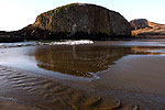
Florence Siuslaw River Bridge and Surrounding Area
Part of Florence, Oregon Coast Virtual Tour
BUOY REPORTS
[CaRP] Can't open remote newsfeed [404].
![]()
NDBC - Station 46281 - Newport PWS South, OR (278) Observations
This feed shows recent marine weather observations from Station 46281.
Station 46281 - Newport PWS South, OR (278)
12 May 2026 at 9:10am
May 12, 2026 7:56 am PDT
Location: 44.559N 124.233W
Significant Wave Height: 4.9 ft
Dominant Wave Period: 10 sec
Average Period: 6.9 sec
Mean Wave Direction: W (278°)
Water Temperature: 51.8°F (11.0°C)
![]()
NDBC - Station Observations near 44.38N 124.95W
This feed shows recent marine weather observations from NDBC and its partners within 100 nautical miles of 44.38N 124.95W.
Station 46050 - STONEWALL BANK - 20NM WEST OF NEWPORT, OR
20 Jun 2026 at 11:02pm
June 20, 2026 8:30 pm PST
Location: 44.679N 124.535W or 25 nautical miles NE of search location of 44.38N 124.95W.
Wind Direction: NNW (340°)
Wind Speed: 10 knots
Wind Gust: 12 knots
Atmospheric Pressure: 30.10 in (1019.2 mb)
Station 46283 - YAQUINA CHANNEL SW, OR (280)
20 Jun 2026 at 11:02pm
June 20, 2026 8:26 pm PST
Location: 44.567N 124.237W or 33 nautical miles ENE of search location of 44.38N 124.95W.
Significant Wave Height: 8 ft
Dominant Wave Period: 10 sec
Average Period: 7.8 sec
Mean Wave Direction: NNW (330°)
Station NWPO3 - NEWPORT, OR
20 Jun 2026 at 11:02pm
June 20, 2026 8:00 pm PST
Location: 44.613N 124.067W or 40 nautical miles ENE of search location of 44.38N 124.95W.
Wind Direction: NNW (340°)
Wind Speed: 5 knots
Wind Gust: 5 knots
Air Temperature: 53°F (11.9°C)
Station SBEO3 - 9435380 - SOUTH BEACH, OR
20 Jun 2026 at 11:02pm
June 20, 2026 8:18 pm PST
Location: 44.625N 124.045W or 41 nautical miles ENE of search location of 44.38N 124.95W.
Atmospheric Pressure: 30.09 in (1019.1 mb)
Station CHAO3 - 9432780 - CHARLESTON, OR
20 Jun 2026 at 11:02pm
June 20, 2026 7:36 pm PST
Location: 43.351N 124.337W or 67 nautical miles SSE of search location of 44.38N 124.95W.
Wind Direction: NNE (20°)
Wind Speed: 3 knots
Wind Gust: 5 knots
Atmospheric Pressure: 30.08 in (1018.5 mb)
Station SNTO3 - TOM'S CREEK, SOUTH SLOUGH RESERVE, OR
20 Jun 2026 at 11:02pm
June 20, 2026 8:30 pm PST
Location: 43.279N 124.318W or 72 nautical miles SSE of search location of 44.38N 124.95W.
Wind Direction: NNE (30°)
Wind Speed: 3 knots
Atmospheric Pressure: 30.12 in (1020.0 mb)
Air Temperature: 54°F (12.3°C)
Dew Point: 51°F (10.7°C)
Station 46278 - TILLAMOOK BAY SOUTH JETTY, OR (270)
20 Jun 2026 at 11:02pm
June 20, 2026 8:30 pm PST
Location: 45.559N 123.991W or 82 nautical miles NNE of search location of 44.38N 124.95W.
Significant Wave Height: 8 ft
Dominant Wave Period: 10 sec
Average Period: 7.4 sec
Mean Wave Direction: WNW (303°)
Air Temperature: 56°F (13.3°C)
Water Temperature: 52°F (11.2°C)
Station 46015 - PORT ORFORD - 15 NM WEST OF PORT ORFORD, OR
20 Jun 2026 at 11:02pm
June 20, 2026 8:30 pm PST
Location: 42.754N 124.839W or 98 nautical miles S of search location of 44.38N 124.95W.
Wind Direction: N (360°)
Wind Speed: 14 knots
Wind Gust: 17 knots
Atmospheric Pressure: 30.08 in (1018.5 mb)
Air Temperature: 54°F (12.2°C)
Water Temperature: 50°F (10.1°C)
Station 46089 - TILLAMOOK, OR - 85 NM WNW OF TILLAMOOK, OR
20 Jun 2026 at 11:02pm
June 20, 2026 8:30 pm PST
Location: 45.928N 125.815W or 100 nautical miles NNW of search location of 44.38N 124.95W.
Wind Direction: NW (320°)
Wind Speed: 14 knots
Wind Gust: 17 knots
Atmospheric Pressure: 30.10 in (1019.2 mb)
Water Temperature: 60°F (15.5°C)
Latest Weather Articles from Waldport, Yachats
100 Degrees Coming for Portland, Valley, Gorge, SW Washington
20 Jun 2026 at 4:06pm
Oregon coast may reach 80s; extreme heat watches for valley, Portland - Red Flag Warnings Until Tonight
Absolute Complete Guide to Oregon Coast Fourth of July, 2026: All Towns
19 Jun 2026 at 9:06am
Astoria events, Seaside events, Cannon Beach events, Manzanita events, Rockaway Beach events, Tillamook events, Oceanside events, Pacific City events, Lincoln City events, Depoe Bay events, Newport events, Waldport events, Yachats events, Florence events, Reedsport events, North Bend events, Coos Bay events, Charleston events, Bandon events, Port Orford events, Gold Beach events, Brookings events
Pacific Northwest Weather | Oregon, Washington, Coastlines - Live View from S...
19 Jun 2026 at 9:06am
See the region live from space. Gateway to Oregon coast, Washington coast, inland Oregon weather, warnings, alerts
Ontario Eastern Oregon Weather - Forecasts, Sky Cams, Alerts, Current Conditions
15 Jun 2026 at 8:54am
Weather forecasts, sky cams, alerts and current conditions for Ontario in eastern Oregon
Video: Oregon / Washington Heatwave Warnings Abound, Around 100
12 Jun 2026 at 7:01pm
Heat warnings lighting up weather pages from mid Washington to southern Oregon.
Tillamook, Oregon Weather - Tillamook Bay 7-Day Forecast, Current Conditions,...
4 Jun 2026 at 8:29am
Tillamook, Oregon weather conditions and forecasts
Free Fishing Weekend All Over Oregon, Coastline
1 Jun 2026 at 10:05pm
Oregon's Free Fishing Weekend returns June 6 - 7, 2026. Brookings events, Gold Beach events, Port Orford events, Coos Bay events, Bandon events, Florence events, Yachats events, Newport events, Lincoln City events, Rockaway Beach events, Manzanita events, Cannon Beach events, Seaside events, Astoria events
State Parks Day Means One Big Freebie for Oregonians - including the coastline
30 May 2026 at 7:01am
June 6 brings free parking to all Oregon state parks for residents. Brookings events, Gold Beach events, Port Orford events, Coos Bay events, Bandon events, Florence events, Yachats events, Newport events, Lincoln City events, Rockaway Beach events, Manzanita events, Cannon Beach events, Seaside events, Astoria events
Yachats + Waldport Oregon Coast Updates
Absolute Complete Guide to Oregon Coast Fourth of July, 2026: All Towns
19 Jun 2026 at 9:06am
Astoria events, Seaside events, Cannon Beach events, Manzanita events, Rockaway Beach events, Tillamook events, Oceanside events, Pacific City ...
Florence Fills Skies with Kites in June: Four Days of Oregon Coast Flying Colors
19 Jun 2026 at 9:06am
June 22 - 25 at Heceta Beach. Florence events
Free Fishing Weekend All Over Oregon, Coastline
1 Jun 2026 at 10:05pm
Oregon's Free Fishing Weekend returns June 6 - 7, 2026. Brookings events, Gold Beach events, Port Orford events, Coos Bay events, Bandon events, Fl...
State Parks Day Means One Big Freebie for Oregonians - including the coastline
30 May 2026 at 7:01am
June 6 brings free parking to all Oregon state parks for residents. Brookings events, Gold Beach events, Port Orford events, Coos Bay events, Bando...
Astoria / Warrenton Weather
Seaside Weather
Cannon Beach
Manzanita
Nehalem Bay / Wheeler
Rockaway
Oceanside/Tillamook
Pacific City
Lincoln City
Depoe Bay Weather
Newport
Yachats
Florence
Reedsport - Winchester Bay Weather
Coos Bay - North Bend - Charleston
Bandon Weather
Port Orford Weather
Gold Beach Weather
Brookings Weather
Oregon Inland Weather
-- Salem Oregon Weather
-- Portland / Beaverton Oregon Weather
-- Eugene, Oregon Weather
-- Bend, Oregon Weather
-- Medford Oregon Weather
-- Government Camp / Mt Hood Weather
-- West Columbia River Gorge / Cascade Locks, Oregon Weather
-- Corvallis / Albany Oregon Weather
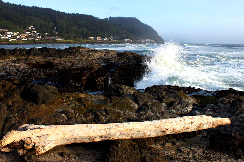
WALDPORT / SEAL ROCK
Pristine, even secretive sands and wild geologic landmarks

Yachats Virtual Tour
Dramatic rocky platforms, a famed trail and secret sands

Upper Lane County Virtual Tour: Between Yachats and Florence
15 miles of stunning, hidden beaches


Search
over 8,500 Pages for Oregon coast subjects, articles or lodging...
Back to Oregon Coast
Contact Advertise on BeachConnection.net
All Content, unless otherwise attributed, copyright BeachConnection.net Unauthorized use or publication is not permitted
Follow us on


South Coast Hotels
Oregon
Coast Hotels Astoria/Warrenton Hotels
Seaside
Cannon
Beach Lodging
Nehalem Bay Lodgings
Manzanita Hotels, Lodging
Rockaway Beach Hotels
Three Capes Lodging
Pacific City Hotels, Lodging
Lincoln
City Lodging
Depoe
Bay Lodging
Newport Lodging
Waldport Lodging
Yachats
Lodging
Oregon
Coast Vacation Rentals
Oregon
Coast Lodging Specials
Oregon Coast Luxury Hotels
Oregon Coast Pet Friendly Hotels/Rentals
Oregon
Coast Bed and Breakfasts / B&Bs
Cannon Beach Vacation Rentals
Pacific City Vacation Rentals
Newport, Depoe Bay Vacation Rentals
Oregon Coast Restaurant, Dining
Guide
Seaside
Cannon
Beach Dining
Manzanita,
Rockaway, Wheeler Dining
Pacific
City, Oceanside, Netarts, Tierra Del Mar Restaurants
Tillamook
Bay Restaurants, Dining
Lincoln
City Dining, Restaurants
Depoe
Bay Restaurants, Dining
Newport Restaurants, Dining
Waldport,
Yachats Restaurants, Dining
Florence Restaurants, Dining
Restaurant
Reviews
Coast
Events Calendar
Astoria
Seaside,
Cannon Beach Calendar
Manzanita,
Rockaway Events
Tillamook,
Pacific City Calendar
Lincoln
City Events Calendar
Newport,
Depoe Bay Events Calendar
Yachats Events Calendar
Oregon Coast Weather
Astoria, Warrenton Weather
Seaside Weather
Cannon Beach
Manzanita
Nehalem Bay / Wheeler
Rockaway
Oceanside/Tillamook
Pacific City
Lincoln City
Depoe Bay Weather
Newport
Yachats
Florence
Reedsport - Winchester Bay Weather
Coos Bay - North Bend - Charleston
Bandon Weather
Port Orford Weather
Gold Beach Weather
Brookings Weather
Search for Oregon Coast Subjects, Articles
Explore Every Beach Spot

Astoria
Where the Columbia meets the Pacific, Land of Lewis & Clark and loads of atmosphere & history

Seaside
The Promenade, Tillamook Head, family fun & broad, sandy beaches

Cannon Beach
A mysterious lighthouse, upscale yet earthy, a huge monolith, fine eateries & an art mecca

Nehalem Bay - Manzanita, Rockaway, Wheeler
Manzanita's beaches, Nehalem and Wheeler's quirky beauty; laid back Rockaway

Tillamook Bay
Garibaldi, Barview, Bay City, Tillamook & an oceanfront ghost town

Three Cape Loop - Oceanside, Netarts, Pacific City
The hidden secret of the coast: Cape Meares, a lighthouse, Oceanside, Netarts and Pacific City

Lincoln City & the Corridor of Mystery
Miles & miles of unbroken beaches, Cascade Head, Neskowin and manmade attractions

Depoe Bay
A spouting horn downtown, freaky hidden cliffs and whales, whales, whales

Newport
Two lighthouses, timeless Nye Beach, bustling bayfront, regal bridge

Waldport, Seal Rock
Sands and dunes, craggy Seal Rock, semi-secret beaches
Yachats
Constantly dramatic wave action, a mix of the rugged & upscale
Upper Lane County
25 miles of deserted beaches & oodles of wonders

Florence
A lighthouse, ancient bayfront and miles and miles of fluffy dunes
South Oregon Coast Travel
News Headlines from All Over Oregon Need to scan Oregon headlines? Constantly updated news from all over Oregon: a comprehensive, up-to-the-minute display of news headlines from a variety of media
Oregon Coast Oceanfront Lodging, Hotels, Rentals