



How Cape Blanco is a Dividing Line in South Oregon Coast Weather
Published 02/17/22 at 11:02 PM PST
By Oregon Coast Beach Connection staff
Includes exclusive listings; some specials in winter
In Cannon Beach:
Includes rentals not listed anywhere else
In Manzanita, Wheeler, Rockaway Beach:
Some specials for winter
In Pacific City, Oceanside:
Some specials for winter
In Lincoln City:
Some specials for winter
In Depoe Bay, Gleneden Beach:
Some specials for winter
In Newport:
Look for some specials
In Waldport
Some specials for winter
In Yachats, Florence
Some specials for winter
Southern Oregon Coast Hotels / Lodgings
Reedsport to Brookings, places to stay; winter deals
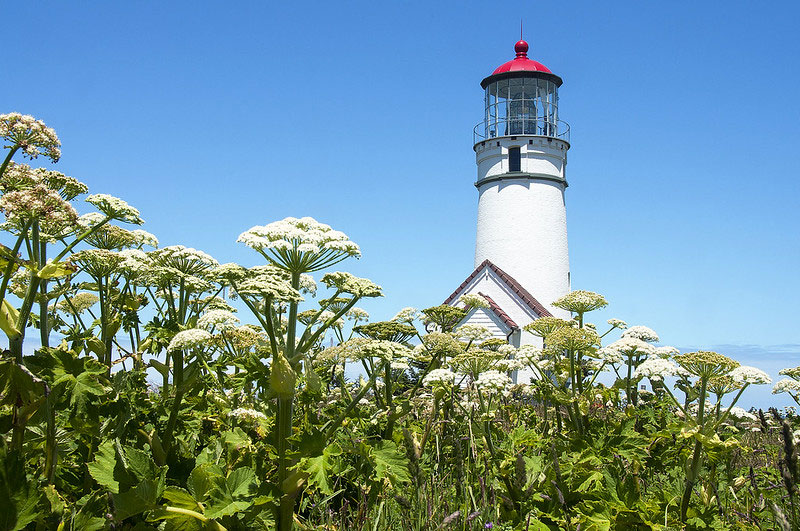
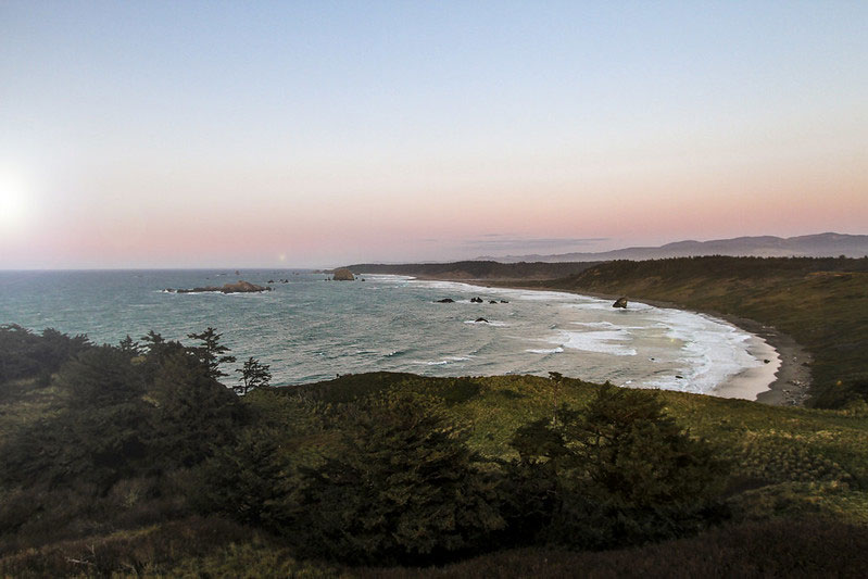
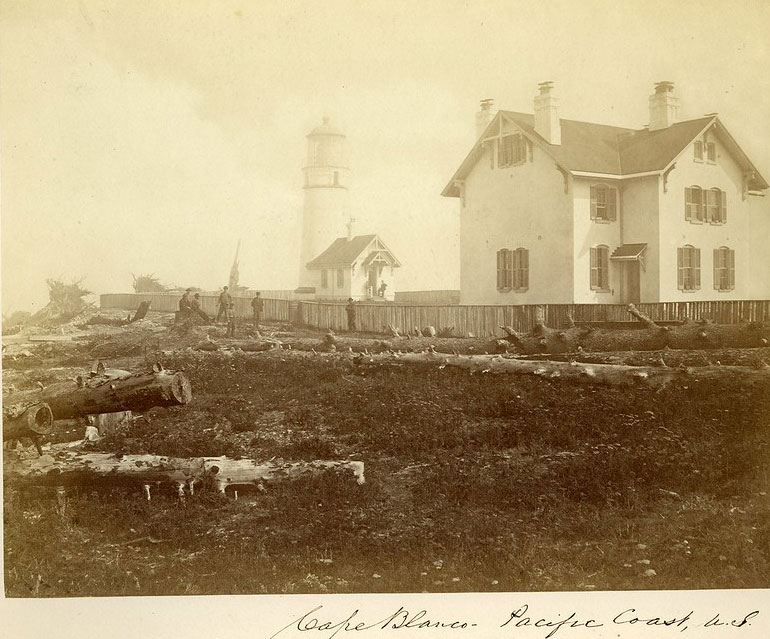
(Port Orford, Oregon) – At 245 feet high, and on a big bump where Oregon itself juts outward, the south Oregon coast's Cape Blanco winds up almost the westernmost point in the lower 48 states – aside from a spot on the Washington coast. In the scenic and geographic sense, it's a special place.
Yet it also has an impact on the weather patterns of the southern Oregon coast, but not in ways you'd expect. Right about here is the pinnacle of where the state slowly stretches westward, starting roughly about Coos Bay and then dipping back again around Gold Beach. So, things are going to shift to some degree. Indeed, if you look at weather reports of the south coast, especially those offshore, winds tend to be forecast differently north of Cape Blanco and south of it. But the fact the state bulges outward here is just part of the story of that meteorological dividing line.
Weather is truly different north of here and south of here. But why?
At the Medford office of the National Weather Service (NWS), this is what they deal with all the time. There, meteorologists Dan Weygand and Brian Nieuwenhuis explained the complex mechanisms involved, but there's a surprising bigger factor: the coast range south of Cape Blanco is simply higher. This changes things.
“There isn't as much of a variation in height of the terrain north of Cape Blanco,” Weygand said. “The peaks are higher when you get into Curry County.”
This cuts off the influence of east winds to some degree, and that can have various effects, depending on the kind of weather pattern this part of Oregon has.
When it comes to many runs of awesome weather on the south coast, it can be a thermal trough parked offshore – an area of cooler temps and lesser pressure – while there could be an area of higher pressure inland creating the heat. This kind of system creates winds from the north, while a cold front (or storm) will create winds coming from the south.
In the case of the northerly winds and a winter heatwave, the area south of Cape Blanco sees something a little different than up at Bandon or Coos Bay.
“Because of the height of the coastal range south of Cape Blanco that pattern gets enhanced, whereas usually it's a lot weaker north of Cape Blanco,” Weygand said.
No surprise, this can be part of the famed Chetco Effect, Nieuwenhuis said, but it's more complex than that.
Nieuwenhuis likened the Oregon coast to a curb that runs along the street from north to south, where rainwater can't get over it but is instead deflected along it. So if winds are coming from the north or south, they get deflected along the shore.
Courtesy Bureau of Land Management
“Now we throw in Cape Blanco (or any cape, as this same process occurs with Cape Mendocino in CA),” Nieuwenhuis said. “The Cape is like a rock we place against the curb. The water slows a bit ahead of the rock, but flows even faster once it gets around it and downstream due to the built up of momentum / pressure. This same process is why winds downwind of Blanco tend to be faster.”
This bulge in Oregon and the cape – along with the higher coast range - are why weather patterns get forecast differently there, so often mentioning “north of Cape Blanco” or south of it.
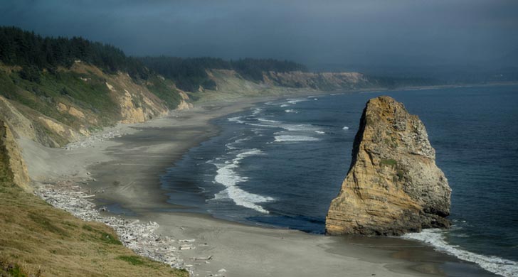
Courtesy Oregon State Parks
The biggest influence is often east winds coming over the Coast Range and getting warmed up as they do. If there's enough push to the east winds during a warm spell, and southern Oregon has it hotter than up north (which is often the case in summer), then those east winds come over the higher southern coast range and get warmed up even more.
“So this east wind tends to create warmer conditions along the coast, where the marine layer is pushed a bit offshore,” Nieuwenhuis said. “This warming is the 'Chetco Effect' in the Brookings area, and while it makes for warm temperatures there, it can also further enhance the thermal trough pattern overall.”
Then just a little ways northward, that pattern can make a difference and spoil it for everyone else.
“In places where the cooler marine air pushes onshore instead (where the east winds are weak or absent), temperatures will cool,” Nieuwenhuis said. “In other words, the cooling and warming temperatures can vary quite a bit depending on the pattern and location. So, Brookings may be warmer with winds out of the east/northeast, but to the north at Bandon, winds are onshore and cooler as the marine layer pushes inland due to the lack of an east wind.”
On a micro scale, the region around Cape Blanco can really have some interesting effects, Weygand said. Port Orford, just to the south, can be quite protected from winds at times because the cape is there.
- South Coast Hotels - Oregon Coast Vacation Rentals - Where to eat - Maps - Virtual Tours

















OREGON COAST HOTEL REVIEWS (hit refresh to see different reviews)
Yachats' Adobe Resort: Legacy Oregon Coast Biz, Once a Motel, Shifts Again wi...
Started in the 1950s, now a big name gets bigger. Yachats lodging reviews
Retro Beach Rental in Newport a Tiny, Cozy Oregon Coast Gem
A little vacation rental called View House Cottage. Hotel reviews, Newport lodging, Newport hotel reviews, Lincoln City hotel reviews, Newport vacation rentals
A Less Expensive May in Newport: Handful of Oregon Coast Inns Still Offering ...
Inn at Nye Beach, Nye Beach Cottages, Ocean House BnB: Newport hotel specials. Newport hotel reviews
Manzanita Hotel Review: Oregon Coast Inn A New Hotel
Nehalem River Inn is nearly 100 years old. Nehalem Hotel Review
More About Oregon Coast hotels, lodging.....
More About Oregon Coast Restaurants, Dining.....
 |
 |
 |
Washington Coast / Oregon Coast Articles (stories are random: hit reload to see different articles)
S. Oregon Coast's Cape Blanco and Hughes House Hold Holiday Teas, Open House, ConcertFrom now through December 29, with a concert on the 23rd. Port Orford events
Why Those Quake Swarms Off Oregon Coast? Geologists Provide Answers
Why some were so close to Bandon, how it's affecting Cape Blanco. Geology, sciences
Razor Clamming Shutters Again on South Oregon Coast Due to Biotoxin
Closed from Cape Blanco to the southern border
Shellfish Poisons Close Down More of Oregon Coast to Mussels, Razor Clams
Both paralytic shellfish poison (PSP) and domoic acid. Cape Blanco, Port Orford, Gold Beach, marine sciences
Mussel Harvesting Closed Part of South Oregon Coast, Reopens Central Coast
Mussels are closed from Cape Blanco south to the California border. Marine Sciences
Oregon Coast Roadwork, Traffic Delays Coming to Port Orford's Cape Blanco, Astoria, Highway 26
Blanco this week, Astoria-Megler Bridge, Humbug Creek in Coast Range. Seaside, Cannon Beach, Bandon
Three Curious Weather Phenomena of Oregon Coast: Manzanita, Cape Blanco, Headland 'Hats'
Some rather astounding atmospheric elements in the world of beach science
Recreational Crabbing Closed on Part of South Oregon Coast Due to Toxin
Winchester Bay down to Cape Blanco
Back to Oregon Coast
Contact Advertise on Oregon Coast Beach Connection
All Content, unless otherwise attributed, copyright © Oregon Coast Beach Connection. Unauthorized use or publication is not permitted


Oregon
Coast Hotels
S. Coast Hotels
Astoria/Warrenton Hotels
Seaside Hotels
Cannon
Beach Hotels
Nehalem Bay Lodgings
Manzanita Hotels, Lodging
Rockaway Beach Hotels
Three Capes Lodging
Pacific City Hotels, Lodging
Lincoln
City Lodging
Depoe
Bay Hotels
Newport Hotels
Waldport Lodging
Yachats
Lodging
Oregon
Coast Vacation Rentals
Oregon
Coast Lodging Specials
South Coast Hotels
Dining
Guide
Seaside
Cannon
Beach Dining
Manzanita,
Rockaway, Wheeler Dining
Pacific
City, Oceanside, Netarts, Tierra Del Mar Restaurants
Tillamook
Bay Restaurants, Dining
Lincoln
City Dining, Restaurants
Depoe
Bay Restaurants, Dining
Newport Restaurants, Dining
Waldport,
Yachats Restaurants, Dining
Florence Restaurants, Dining
Restaurant
Reviews
Coast
Events Calendar
Astoria
Seaside,
Cannon Beach Calendar
Manzanita,
Rockaway Events
Tillamook,
Pacific City Calendar
Lincoln
City Events Calendar
Newport,
Depoe Bay Events Calendar
Yachats Events Calendar
Oregon Coast Complete Guides every beach access, attraction
Search for Oregon Coast Subjects, Articles
Explore Every Beach Spot


News Headlines from All Over Oregon Need to scan Oregon headlines? Constantly updated news from all over Oregon: a comprehensive, up-to-the-minute display of news headlines from a variety of media
Oregon Coast Oceanfront Lodging, Hotels, Rentals
Book Coastal Lodging Now
Oregon
Coast Hotels