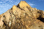
Tillamook Head
It’s the vast, rugged headland between Seaside from Cannon Beach, including a six-mile-long hike either way. Get ready for a few secrets like an old radar bunker. What is Tillamook Head Geologically? Deep Inside N. Oregon Coast Headland at Cannon Beach - Seaside Virtual Tour
For a shorter walk to the bunker, it’s only a 3.4-mile roundtrip from Indian Beach.
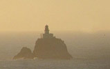
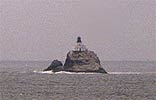
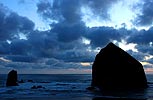
Tillamook Rock Lighthouse
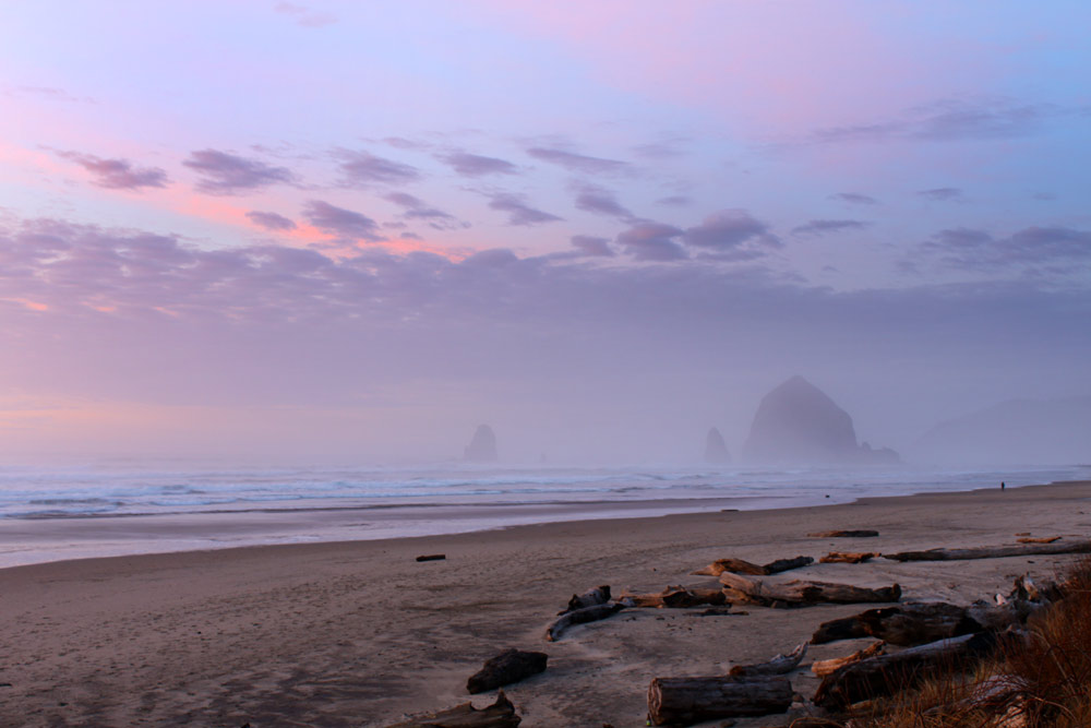
This baby has captured the imaginations of tourists for generations, starting back in 1880 when it was constructed. It's been nicknamed “Terrible Tilly.” The mysterious beauty lies about a mile and a half offshore and was decommissioned in the '50s. But during its lifetime it claimed at least one life during its construction. Tillamook Rock Lighthouse - Indian Beach & Lighthouse Views
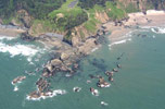
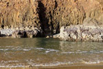
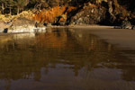
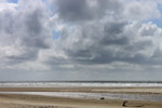
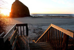
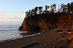
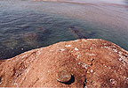
Indian Beach – at Ecola State Park, Access #12
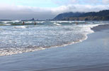
A crescent-shaped beach often filled with cobblestones, and where numerous rocky shapes stand and get slammed by large waves. Cannon Beach's Indian Beach Hiking, Surfing -
Famed Keyhole Rock
Indian Beach is famous for its Hollywood connection. Parts of the cult films Goonies and Twilight were filmed here. The offshore rock structure with the oval hole in it is called Keyhole (sometimes mixed up with Goonies but the rock wasn't the one featured at the end). Indian Beach, Ecola State Park + Goonies - Misnamed Goonies Rock, Cannon Beach, Movies
Ecola State Park, Cannon Beach - History of Ecola State Park - Intense History at Oregon Coast's Ecola State Park: Murder, Landslide, Explorers
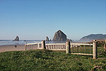
 Ecola Viewpoint Access #12A
The main section of the park is Ecola Point, where numerous viewpoints offer you glimpses of Cannon Beach, Haystack Rock and the lighthouse. A good spot for whale watching. Ecola Aerial Views, Indian Creek
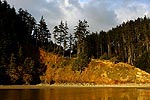
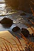
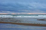
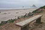
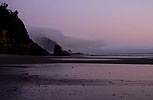
Crescent Beach
The only accessible way in is via a mile-long trail that begins along the road going into Ecola State Park. Crescent Beach, Coast Less Traveled in Cannon Beach
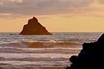
Chapman Point
The southern end of Crescent Beach – also the main rocky shapes you see looking north from the rest of town. Cannon Beach Northern Beaches - Cannon Beach Looking North
7th Street / Access #13
Closest to Chapman Point in a residential area – has restrooms.
Les Shirley Park
You’ll find this quaint park at the north of the bridge, next to Ecola Creek. Restrooms and picnic tables are just some of the amenities here. Lewis & Clark Landmark at Cannon Beach
Whale Park
This one too neighbors Ecola Creek, but is on the other side, part of downtown. It’s mostly a grassy spot with benches, but there’s access to the beach here, with Haystack Rock a few minutes walk away.
It’s also the locale where William Clark saw local tribes cutting up a whale for blubber.
Second St. Access / Ecola Creek
Beginnings of downtown Cannon Beach Downtown, Second Street View, Ecola Creek
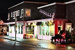
Downtown Cannon Beach
Numerous beach accesses dot the downtown and midtown area, as do shops and eateries. Cannon Beach Downtown Tour
Cannon Beach Midtown - Beginning of Cannon Beach Midtown Tour -
Gower St. Access / Ecola St. Ramp / Access #15
Main access to Haystack Rock with parking and restrooms. Cannon Beach's Access #15 / Midtown / Gower Access: Gateway to Oregon Coast's Famed Haystack Rock
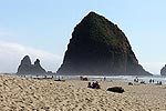
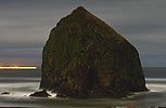
Haystack Rock - Midtown Haystack Rock Up Close
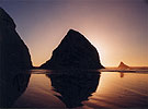
It’s the big recognizable landmark of Cannon Beach, and one of the most photographed beach spots in the world – certainly in the state of Oregon, anyway. Not to be confused with the Haystack Rock in Pacific City and the Haystack in Bandon. At low tide, Haystack is accessible and a lot of fun for tide pool viewing. It’s famous for its plentiful marine gardens. There’s even the Haystack Awareness Program, where naturalists hang out around the rock on summer weekend mornings, showing off the area’s points of interest to eager public eyes. How Cannon Beach's Haystack Rock Was Created / Formed: Fiery Oregon Coast Tale - Geology of Haystack Rock
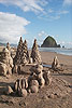
Cannon Beach Sandcastle Day
Sundry Side Street Accesses
More of these little charmers lurk within the neighborhoods.
Closest Access to Haystack
No real name given but it sits beneath Viewpoint Terrace, approximately where MP 30 is on Highway 101. Haystack Closest Access
Southern Beaches beginning at Tolovana Area
All of it just off of S. Hemlock
Tolovana District
Originally its own town separate from CBeach
 Tolovana Beach State Recreation Site / Access #16
The biggie everyone knows.
Hidden Accesses Southern Cannon Beach
More beach accesses south of the Tolovana area, but they lie at the end of neighborhood streets occupied by a myriad of private homes - so you'll want to be courteous and cautious when parking along here.
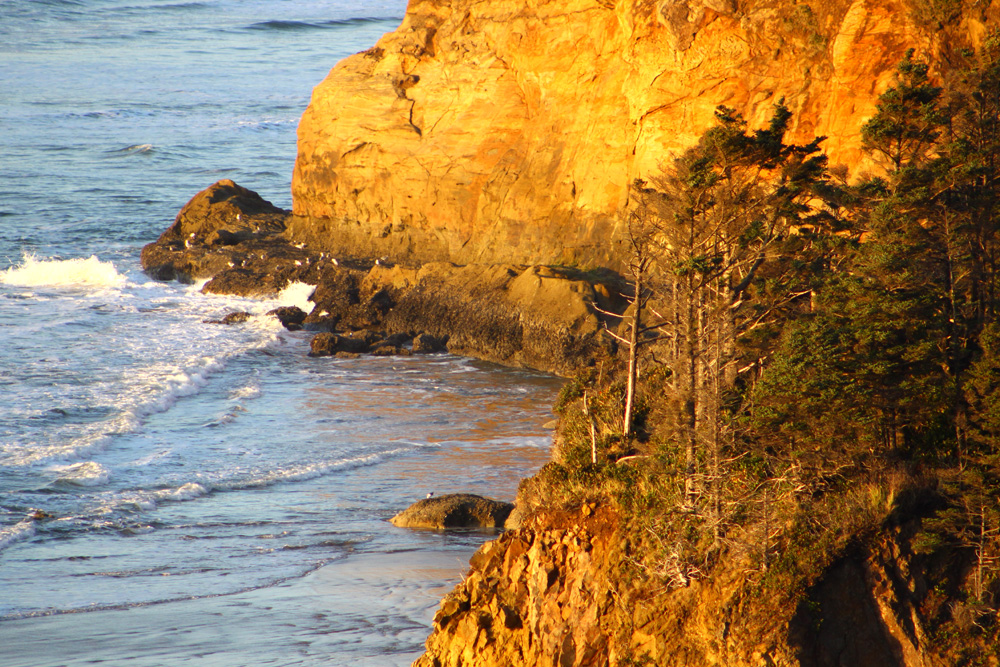
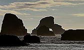
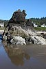
Silver Point - Above and Below
After a few winding turns in the road and some forestland that blocks the ocean view, you’ll come to a couple of pullouts featuring dramatic views. The northern part of Silver Point is huge and comes in three sections, allowing views north and south.
Jockey Cap Rock and other hidden wonders below can be found by walking the last of the neighborhood streets just south of Tolovana.
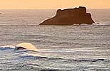
Unnamed Viewpoint / Pullout (400 ft from Silver Point)
The second viewpoint, only 3/10’s of a mile away, provides beautiful views of interesting sea stacks offshore and a sandy beach below.
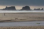
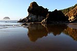
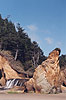
Arcadia Beach State Recreation Site / Access #17
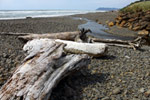
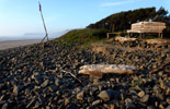
Not far south of MP 32 this tree-encompassed parking lot appears. Take the small path down and you’ll find a sandy beach covered in cobblestones near the tide line, as well as cliffs and rock structures that some have whimsically claimed look like a dragon and its young turned to stone. Lion Rock is here. Legends of “singing sands” here but that is likely gone now.
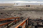
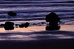
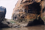
Hug Point State Park (Access #18)
A waterfall, several sea caves and that inimitable old road make one of the coast’s most fascinating spots. Most of the road is worn away and barnacle-covered now, but there are hints left with all the grooves worn into the surface. Other curiosities lurk such as ancient fossils, ghost forests, former hand-holds dug into the rock, a puzzling knob and more.
Southern Edges Hug Point
On the southern end of this beach there's a point that's normally not crossable unless the tide is sufficiently far enough. In such a case, you'll find another cove with more rock slabs to play around on, many of which are surrounded by rich tide pools.
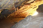
There's also another sea cave tucked away in here.
Hidden Beach View - Point Meriwether
Almost immediately after Hug Point you’ll start heading over a small bridge, and you’ll spot a blob of a hill on the westward side of the highway. Park nearby (either in front of an entrance or across the road), and as you walk up the path you’ll find a small, clandestine bluff.
Arch Cape + Castle
You've technically entered it just after Hug Point. There is what is called Castle Rock right out there (or Queen Vic).
North Arch Cape Accesses, Map
The beach at Arch Cape has a preponderance of large cobblestones. During some of the winter months, it’s almost entirely that, because stormy wave action tears away sand levels like crazy. Shark Lane is among the hidden accesses.
Leech Lane Access #19
Always your best bet – and the main access for Arch Cape. Sometimes incredible ghost forests show up here, but in summer – when sand levels are high – you often get access to the rock structures around this point and its arch.
Falcon Cove and the Manzanita / Rockaway Beach Virtual Tour are next.
Page Updated 2026-05-18 20:42

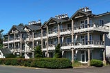


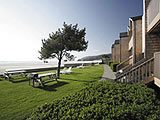 Schooner’s Cove Inn