Dusting of Snow for Much of NW Oregon Tonight a March Curiosity
Published 03/09/26 at 6:55 p.m.
By Oregon Coast Beach Connection Staff
(Portland, Oregon) – No crazy snow storms. No accumulation. It's really just a March, pre-spring oddity.
Includes exclusive listings; some specials in winter
In Cannon Beach:
Includes rentals not listed anywhere else
In Manzanita, Wheeler, Rockaway Beach:
Some specials for winter
In Pacific City, Oceanside:
Some specials for winter
In Lincoln City:
Some specials for winter
In Depoe Bay, Gleneden Beach:
Some specials for winter
In Newport:
Look for some specials
In Waldport
Some specials for winter
In Yachats, Florence
Some specials for winter
Southern Oregon Coast Hotels / Lodgings
Reedsport to Brookings, places to stay; winter deals
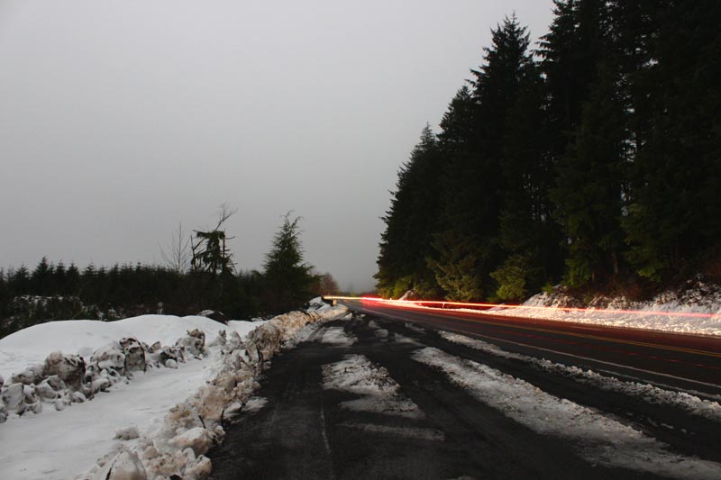
Snow either returns tonight or is about to hit for the first time to areas of northwest Oregon and southwest Washington. Showery conditions will persist through tonight as a cold air mass kicks in across the region, according to the National Weather Service (NWS).
“Snow returns today - Tuesday with snow levels falling to 1000-1500 ft tonight,” the NWS said. “Early tomorrow morning, light snow is possible down to 500 ft & a rain/snow mix with no accumulation expected to the valley floor north of Salem. Check road conditions in the Cascades before traveling.”
Snow levels are forecast to drop to roughly 500-1000 feet late tonight, mainly north of Salem, while the chance of any dusting south of Salem has largely faded – even for the higher elevations.
The Cascades in Oregon and especially Washington may be another matter, however. See full forecasts Oregon Inland Weather
The NWS said precipitation in the Cascades will remain mostly snow, with Winter Weather Advisories continuing through at least Tuesday afternoon. Advisories for the North Oregon Cascades and the Marion and Linn County Cascades will remain in effect until Wednesday afternoon.
NWS computations shows a 10-20% chance of accumulating snow below 500 feet in the Portland-Vancouver metro, increasing to 20-30% in higher terrain such as the West Hills. In the Cowlitz County lowlands, the chance of measurable snow is around 20-30%, with only a 5-10% chance of reaching one inch. The agency said travel impacts are unlikely in the lowlands and will be limited mainly to elevations above 1000 feet.
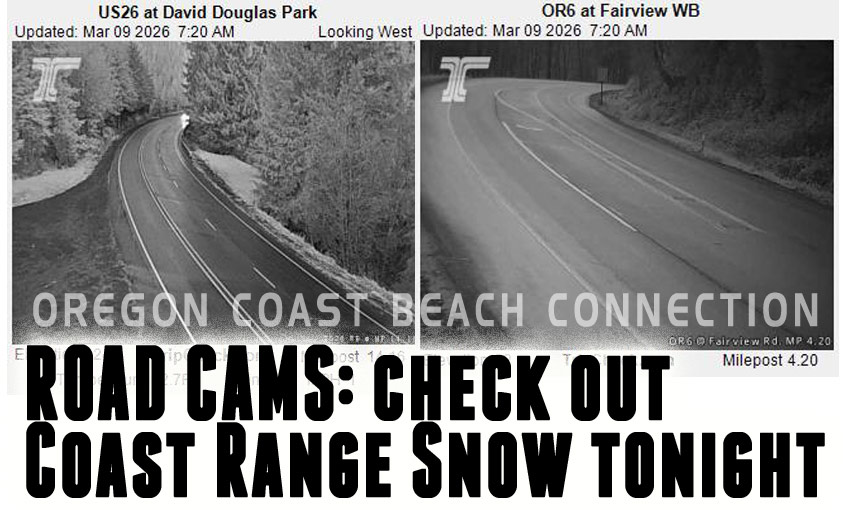
See Oregon Coast Highway 101 / Coast Range Traffic with all traffic cams
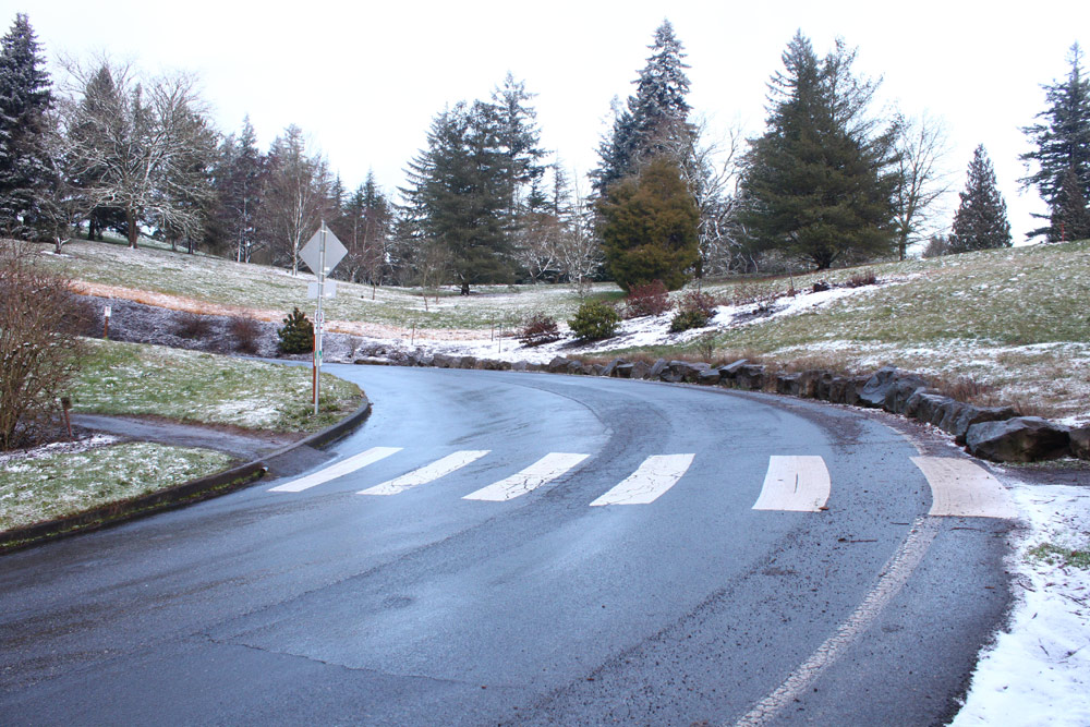
The Coast Range remains near the rain-snow line, with advisory-level snowfall of two inches or more most likely in the Willapa Hills and the north Oregon Coast Range. Probabilities vary widely by elevation, ranging from about 10% to 40%, and the NWS said major routes such as Highways 18 and 26 should remain in good shape.
Snow levels will rise quickly to 3500-4500 feet by Wednesday morning, ending concerns for the passes, though the south Washington Cascades may hold colder air slightly longer.
The Oregon coastline will see none of this, and if any snow falls in urban hills it's not going to be more than a dusting - and a March curiosity.
Along the Oregon coast, the agency said large waves will become the main hazard later in the week, especially north of Tillamook.
Also see
Oregon Inland Weather- McMinnville, Oregon Weather
-- Salem Oregon Weather
-- Portland / Beaverton Oregon Weather
-- Eugene / Springfield Weather
-- Bend Central Oregon Weather
-- Medford Oregon Weather
-- Government Camp / Mt Hood Weather
-- West Columbia River Gorge / Cascade Locks, Oregon Weather
-- Corvallis / Albany Oregon Weather
Oregon Coast Hotels or this event - South Coast Hotels - Oregon Coast Vacation Rentals - Where to eat - Maps - Virtual Tours


OREGON COAST HOTEL REVIEWS (hit refresh to see different reviews)
Manzanita's Ocean Inn Adds More Ways to Preserve, Give Back to Oregon Coast E...
About to become an Ocean Friendly Hotel through Surfrider. Manzanita hotel reviews, Manzanita hotel news
Nye Beach's Waves Hotel Keeps Making Waves: an Oregon Coast Classic
Less expensive than many, an innovative Newport boutique hotel. Newport lodging reviews
Waldport Hotels - Oregon Coast
Waldport lodging news, Waldport hotel news, Seal Rock hotel reviews, Waldport hotel reviews, vacation rentals
Summer's Surprise Rate Drops in July On Oregon Coast Include Lincoln City Bea...
20 percent some vacation rentals in the heat of July's highest rates. Lincoln City lodging specials, Lincoln City hotel reviews
More About Oregon Coast hotels, lodging.....
More About Oregon Coast Restaurants, Dining.....
 |
 |
 |
Washington Coast / Oregon Coast Articles (stories are random: hit reload to see different articles)
4.1 Quake Rattles Off South Oregon Coast Wednesday, A Few Days After 1.6 Quake16 May 2026 at 8:00am
Slightly larger than the usual shakers, it created no alerts. Sciences, geology
South Oregon Coast All Summer: Nature, History Events at Bandon's Bullards Beach State Park
8 Jun 2026 at 12:09am
From now through August there a ton of Bandon events. Literally
NASA Announces Crew, Mission of Next Artemis Launch in 2027
10 Jun 2026 at 7:01am
New details for Artemis III and the four astronauts named for the 2027 test mission. Sciences, astronomy
Manzanita in July: History of Oregon Coast's 101 and Pirate-Themed Scavenger Hunt
26 Jun 2026 at 6:51am
July 9: Scavenger Hunt. July 11: History of Highway. Manzanita events, Nehalem events, Cannon Beach events, Tillamook events
Rescue of Paraglider After She Was Caught on North Oregon Coast Cliff
8 Jun 2026 at 12:09am
The hang glider was stuck at Oceanside's Maxwell Point. Rescue, US Coast Guard
Famous Orcas from Alaskan Rescue Effort Pop Up on Oregon Coast, Blowing Up Social
26 Jun 2026 at 6:51am
The pair were stuck in a lake in 2023 and freed by elaborate means. Marine sciences, Newport
Oregon Tourism Faced Headwinds but Still Generated Billions into State's Economy
20 May 2026 at 12:34am
$14.6 billion in travel spending despite an unfriendly environment nationally. Traffic
I-5 Closures At Salem This Week. Oregon Coast Summer Road Work Roundup
23 Jun 2026 at 9:05pm
Work in Oregon Wine Country, OR 6, Nehalem, Depoe Bay, Newport, Tillamook. Traffic
Back to Oregon Coast
Contact Advertise on Oregon Coast Beach Connection
All Content, unless otherwise attributed, copyright © Oregon Coast Beach Connection. Unauthorized use or publication is not permitted

Oregon
Coast Hotels
S. Coast Hotels
Astoria/Warrenton Hotels
Seaside Hotels
Cannon
Beach Hotels
Nehalem Bay Lodgings
Manzanita Hotels, Lodging
Rockaway Beach Hotels
Three Capes Lodging
Pacific City Hotels, Lodging
Lincoln
City Lodging
Depoe
Bay Hotels
Newport Hotels
Waldport Lodging
Yachats
Hotels
Florence Hotels
Reedsport Hotels
Coos Bay Hotels
Bandon Hotels
Port Orford Hotels
Gold Beach Hotels
Brookings Hotels
Oregon
Coast Vacation Rentals
Oregon
Coast Lodging Specials
South Coast Hotels
Dining
Guide
Seaside
Cannon
Beach Dining
Manzanita,
Rockaway, Wheeler Dining
Pacific
City, Oceanside, Netarts, Tierra Del Mar Restaurants
Tillamook
Bay Restaurants, Dining
Lincoln
City Dining, Restaurants
Depoe
Bay Restaurants, Dining
Newport Restaurants, Dining
Waldport,
Yachats Restaurants, Dining
Florence Restaurants, Dining
Restaurant
Reviews
Coast
Events Calendar
Astoria
Seaside,
Cannon Beach Calendar
Manzanita,
Rockaway Events
Tillamook,
Pacific City Calendar
Lincoln
City Events Calendar
Newport,
Depoe Bay Events Calendar
Yachats Events Calendar
Oregon Coast Complete Guides every beach access, attraction
Search for Oregon Coast Subjects, Articles
Explore Every Beach Spot


News Headlines from All Over Oregon Need to scan Oregon headlines? Constantly updated news from all over Oregon: a comprehensive, up-to-the-minute display of news headlines from a variety of media
Oregon Coast Oceanfront Lodging, Hotels, Rentals