



Dangerous Surf on Oregon Coast Through Sunday - What Else It Affects
Published 11/19/2026 at 8:58 a.m.
By Oregon Coast Beach Connection Staff
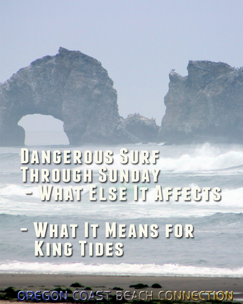
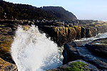
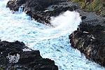
(Manzanita, Oregon) – It's the kind of wave alert we're all too used to now, but once again surf conditions on the Oregon coast are going to get unruly and dangerous.
Includes exclusive listings; some specials in winter
In Cannon Beach:
Includes rentals not listed anywhere else
In Manzanita, Wheeler, Rockaway Beach:
Some specials for winter
In Pacific City, Oceanside:
Some specials for winter
In Lincoln City:
Some specials for winter
In Depoe Bay, Gleneden Beach:
Some specials for winter
In Newport:
Look for some specials
In Waldport
Some specials for winter
In Yachats, Florence
Some specials for winter
Southern Oregon Coast Hotels / Lodgings
Reedsport to Brookings, places to stay; winter deals
It won't be as hazardous as recent events, and so far there are no outright surf advisories or warnings. There's just a brief statement from the National Weather Service (NWS) that things will get a bit dicey again through Sunday.
“Although high surf conditions have eased, a moderate to high threat of sneaker waves will persist through Sunday, 11/22,” the NWS said. “Keep off rocks, logs, and jetties near waterline on beaches. Use caution on beaches, never turn your back on the ocean.”
Then comes Monday and more large swells. That's just in time for king tides: November 23 - 27. While crazed waves are what everyone heads out for during king tides, it's not guaranteed, by far. It depends on if large swells are happening – and in this case that looks likely.
There are three interesting connected stories here:
1 – Long period timing between waves is going to be sizable, even more so south of Reedsport. This brings a higher risk for sneaker waves. Be extremely careful. These current forecasts mean serious dangers for king tides as well.
2 – Be on the lookout for sterner warnings for the Oregon and Washington coast, especially come king tides. You can see all Pacific Northwest weather alerts here:
Pacific Northwest Weather | Oregon, Washington, Coastline (see NW from space) |---| Washington Coast Weather |---| Oregon Coast Weather |---| Inland Oregon Weather
3 – The giant buoy at Depoe Bay that recently broke loose and eventually came ashore may become another problem. It may get washed back out to sea. These waves are also delaying the US Coast Guard from retrieving it. Central Oregon Coast Icon Gets Loose: Depoe Bay's Buoy Banging Against Rocks
North Oregon Coast Details
Here's what not to do: A Weekend of Near-Deadly Misses Along the Oregon Coast in Video
Wave heights remain relatively modest through Friday, with seas generally 5 to 7 feet. Conditions begin building Saturday, increasing from 6 to 8 feet in the morning to 8 to 9 feet by afternoon.
A more significant swell arrives Saturday night as seas build to 11 to 14 feet, driven largely by a long-period west swell around 14 feet at 13 seconds. Elevated surf continues Sunday with seas holding at 11 to 14 feet.
Conditions gradually ease Sunday night into Monday, dropping to 8 to 12 feet and then 8 to 9 feet. Another increase is possible Monday night as seas build back into the 9 to 13 foot range with strengthening southeast winds and a long-period west swell.
Behind the Forecast
A fading west swell allows seas to subside to 7 to 9 feet at 12 to 13 seconds by Thursday afternoon, according to the National Weather Service (NWS).
Seas are forecast to continue easing, falling to 6 to 7 feet by the end of the week.
A stronger system is expected to arrive late Friday night into Saturday.
“For the inner waters and Columbia River Bar, chances for isolated gale force wind gusts are lower around 20-30%,” the NWS said.
Seas are expected to build through the weekend as another west swell arrives, with forecasters expressing high confidence that wave heights will once again reach 10 feet or greater.
South Oregon Coast Details
Seas ease from 7 to 9 feet Thursday night down to 5 to 7 feet Friday, remaining relatively moderate through Saturday at 5 to 8 feet.
A stronger west swell arrives Saturday night, with seas building rapidly to 9 to 13 feet after midnight. Peak wave heights are expected Sunday when seas reach 12 to 14 feet, dominated by a 14-foot west swell with a 13-second period.
The swell gradually subsides Sunday night into Monday, lowering to 8 to 11 feet and then 8 to 9 feet. Another increase is forecast Monday night, with seas building to 11 to 15 feet after midnight as a new storm system approaches.
Behind the Forecast
Hazardous marine conditions continue along the south Oregon coast as a high and steep swell moves through the coastal waters, according to the NWS. Wave height is generally forecast as higher there than up north, but the south coast has no sneaker wave or other statement. Yet.
Seas are expected to remain dangerous for smaller vessels through Thursday evening, with wave heights near 15 feet and swell periods of 13 to 15 seconds. Conditions are forecast to gradually improve Thursday night into Friday as swell heights diminish.
That's not for long.
“Gales are possible with the next front on Saturday, and would produce high and very steep wind driven seas,” the NWS said. “High long period swells are expected around early next week.”
Oregon Coast Hotels for this event - South Coast Hotels - Oregon Coast Vacation Rentals - Where to eat - Maps - Virtual Tours

















OREGON COAST HOTEL REVIEWS (hit refresh to see different reviews)
Georgie R Reviewed Nehalem River Inn
7 Sep 2026 at 11:11pm
An exceptional atmosphere throughout! Love the backwoods feel of the area. Kind of isolated, serene. Great décor 'n comfy.
Lynn Sheneman Scrutton recommends A1 Beach Rentals, Lincoln City Reviews
3 Sep 2026 at 6:22pm
Family owned and operated, beautiful ocean front, clean and well cared for. Near Roads End, Cascade Head, NW 15th ramp. Best rooms for Roads End. Next to D River access, shopping, close to Siletz Bay
Depoe Bay / Lincoln City's Keystone Vacation Rentals
21 Oct 2026 at 10:32pm
Oregon Coast Reviews Does Keystone live up to its reputation? A few typical reviews of the agency and a larger review of the company. Near casino, D River, Roads End. Closest rooms to seawall and spouting horn. Fogarty Beach, Whale Watch Center, NW 15th ramp
More About Oregon Coast hotels, lodging.....
More About Oregon Coast Restaurants, Dining.....
 |
 |
 |
Washington Coast / Oregon Coast Articles (stories are random: hit reload to see different articles)
SOLVE's Inland Oregon River Cleanups Get the Wacky Finds As Well13 Oct 2026 at 11:31pm
Last of the waterways cleanups wrapped up in Sept: Medford, Clackamas, Portland, Ashland, Gladstone
Best Rooms with Ocean Views in Seaside
7 Oct 2026 at 9:15am
Rated tops in reviews for surf watching, storm watching, Seaside's Turnaround. Seaside reviews
Three Unique Holiday Happ's on Oregon Coast: Lighthouse to Local Shops
5 Nov 2026 at 7:30pm
Yummy treats, celebrating at a lighthouse and a three-month shopping fest. Florence events, Coos Bay events, Manzanita events, Wheeler events, Pacific City events, Tillamook events, Rockaway Beach events
Central Oregon Coast Icon Gets Loose: Depoe Bay's Buoy Banging Against Rocks
15 Nov 2026 at 8:15am
Buoy #2 has the bell and is used for navigation. US Coast Guard, weather
Body Recovered from Oregon Coast Beach After Being Spotted Off Newport This Weekend
19 Nov 2026 at 8:23am
Descedant was seen in waters of Yaquina Head but stormy waves prevented recovery. US Coast Guard, weather, safety
Lincoln City's NW 15th St. Ramp, Oregon Coast Access #44: To Drive or Not to Drive
29 Oct 2026 at 9:21pm
Rules about driving on the beach; odd science of the access. D River access, Roads End. Part of the Lincoln City, Oregon Coast Virtual Tour, Inland 101, Neskowin
Paid Parking Goes to Only Weekends at Central Oregon Coast's Newport
26 Oct 2026 at 9:49pm
Free parking at Nye Beach and Bayfront during weekdays
Festive and Family-Friendly on Oregon Coast: Florence Hotel Gets Lighthearted with Halloween
16 Oct 2026 at 9:21am
Haunted Hotel event on Saturday, Oct. 31 - with treats for adults too. Florence events
Back to Oregon Coast
Contact Advertise on Oregon Coast Beach Connection
All Content, unless otherwise attributed, copyright © Oregon Coast Beach Connection. Unauthorized use or publication is not permitted


Oregon
Coast Hotels
S. Coast Hotels
Astoria/Warrenton Hotels
Seaside Hotels
Cannon
Beach Hotels
Nehalem Bay Lodgings
Manzanita Hotels, Lodging
Rockaway Beach Hotels
Three Capes Lodging
Pacific City Hotels, Lodging
Lincoln
City Hotels
Depoe
Bay Hotels
Newport Hotels
Waldport Hotels
Yachats
Hotels
Florence Hotels
Reedsport Hotels
Coos Bay Hotels
Bandon Hotels
Port Orford Hotels
Gold Beach Hotels
Brookings Hotels
Oregon
Coast Vacation Rentals
Oregon
Coast Lodging Specials
South Coast Hotels
Dining
Guide
Seaside
Cannon
Beach Dining
Manzanita,
Rockaway, Wheeler Dining
Pacific
City, Oceanside, Netarts, Tierra Del Mar Restaurants
Tillamook
Bay Restaurants, Dining
Lincoln
City Dining, Restaurants
Depoe
Bay Restaurants, Dining
Newport Restaurants, Dining
Waldport,
Yachats Restaurants, Dining
Florence Restaurants, Dining
Restaurant
Reviews
Coast
Events Calendar
Astoria
Seaside,
Cannon Beach Calendar
Manzanita,
Rockaway Events
Tillamook,
Pacific City Calendar
Lincoln
City Events Calendar
Newport,
Depoe Bay Events Calendar
Yachats Events Calendar
Oregon Coast Complete Guides every beach access, attraction
Search for Oregon Coast Subjects, Articles
Explore Every Beach Spot


News Headlines from All Over Oregon Need to scan Oregon headlines? Constantly updated news from all over Oregon: a comprehensive, up-to-the-minute display of news headlines from a variety of media
Oregon Coast Oceanfront Lodging, Hotels, Rentals