Five South Oregon Coast Landmarks That Make You Think
Published 10/07/21 at 5:16 AM PDT
By Oregon Coast Beach Connection staff
Includes exclusive listings; some specials in winter
In Cannon Beach:
Includes rentals not listed anywhere else
In Manzanita, Wheeler, Rockaway Beach:
Some specials for winter
In Pacific City, Oceanside:
Some specials for winter
In Lincoln City:
Some specials for winter
In Depoe Bay, Gleneden Beach:
Some specials for winter
In Newport:
Look for some specials
In Waldport
Some specials for winter
In Yachats, Florence
Some specials for winter
Southern Oregon Coast Hotels / Lodgings
Reedsport to Brookings, places to stay; winter deals
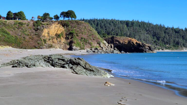
(Bandon, Oregon) – Scenic splendor is doled out in great abundance on the whole of the Oregon coast, but there is something special and even more curious about the southern half. It's where bizarre landforms reach gigantic proportions, creating new shapes that stretch the imagination, freaky textures that bend the mind and all the while telling tales that are simply astounding. (Photo courtesy Manuela Durson - see Manuela Durson Fine Arts for more)
Behind what you see on this more primitive, untouched half of the state's beaches is really an extraordinary story much of the time.
National Dunes Rec Area, Florence to Coos Bay
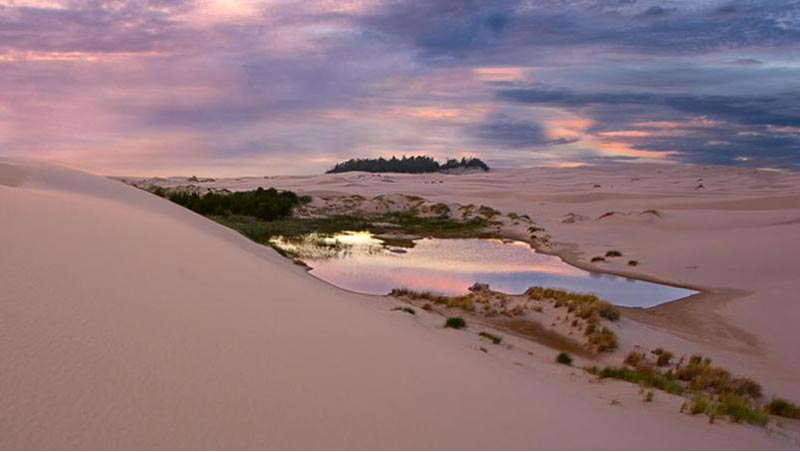
It's a hotspot for dune buggying, sandboarding and simply wandering on a near-ocean desert-like stretch, one with remarkable lines and patterns that appear out of nowhere to bring out the best in any would-be photog.
The National Dunes Recreation Area, starting at Florence, is also known for something much stranger and wilder on rare occasion: singing sands. This is when some very exacting conditions have to be met, causing a singing noise or sometimes what can sound like violins. It's rare here, but it's the only known spot on this coastline to actually make this noise.
Yet there's also something sad happening at the National Dunes Recreation Area: it's disappearing. Thousands of feet of dunes have been lost in the last 80 years because of different invasive plants, including Scotch Broom, Gorse and European Beachgrass. They don't allow the dune sands to move freely in the winds, which keeps them from replenishing. So, now you get more watery areas where trees and shrubs grow, nixing sand dunes around them.
There are groups working on this problem, but scientists estimate the dunes could be gone in 50 years. Oregon Coast Dunes National Rec Area in Trouble, Releases Video
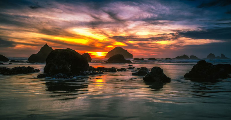
Shore Acres near Coos Bay
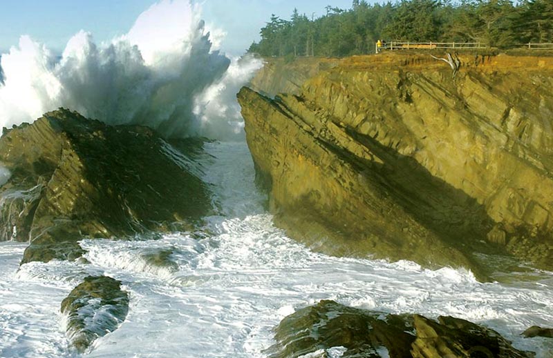
Photo courtesy Oregon's Adventure Coast
This iconic magnet for manic wave action is a wonderland of geologic fun that simply can't be beat. There's so much going on here it's impossible to cover it in one article, and much of it is out in the open.
Why the waves here go so bonkers has much to do with the tilted angle of the rocks and reef below, which you can plainly see from the large structure directly in front of the cliffs. But there's even more going on than that, which you can see at Why Shore Acres Waves Are So Big: Height Measurement.
The strangely-tilted rock formations here are directly related to the continental shelves that are pushing into each other offshore, echoing the crushing action down below.
Then there are all those myriad of pockmarked holes, weird blobs and other surreal shapes, with each having their own geologic explanation.
Shore Acres is a wild ride, not to mention its nearby curious ghost forest action at Sunset Bay.
Battle Rock, Port Orford
Battle Rock is right behind the outcropping: photo courtesy CoastWatch / Skip Jane Legacy
A beautiful and engaging landform to go bouncing around on, this south Oregon coast stalwart tells a rather sad tale with its moniker.
A group of nine men arrived here by steamship in 1851, with guns and cannon in tow to force themselves on the tribal village that sat here. This, of course, did not go over well, and the next few days saw the men (minus their Captain William Tichenor, who snaked off to San Francisco) fighting off an angry mob of locals.
Sadly, they wound up doing all the killing, with the Qua-to-mah sustaining the casualties. The eight invaders managed to slip away in the dead of night. Tichenor returned months later with a whole army and slaughtered most of the tribe.
Face Rock
Bandon's most ancient resident is somewhere beyond 50 million years old, but local tribal tales talk of her being a young Indian princess who strayed too far into the waters with her dog and a group of kittens, with a vengeful being turning them all to stone.
In truth, the rock itself is of a very complex origin – a melange of different rock types that were compressed into this object starting 200 million years and going through to about 50 million years ago. It was likely part of a larger chunk of rock that was then whittled away by time and tide over the millennia. Geologists say it's even possible the 1700 tsunami and quake could've had something to do with carving it out into its current shape. How Bandon's Face Rock Was Created A Wild S. Oregon Coast Geologic Tale
Natural Bridges of Boardman Corridor
Just north of Brookings, one of the most striking and yet fairly cloistered sections of Oregon coast is the Samuel H. Boardman State Scenic Corridor, filled with visual treats such as China Beach, Secret Beach, Arch Rock and the jaw-dropping Natural Bridges. These rocky arches perform a variety of photographic feats for people, creating some of the most iconic imagery online. They even allow you to walk on them at times.
But what are they? There is some geologic explanation of the Natural Bridges on the south Oregon coast.
According to Ernest Lund, a famed geologist from the ‘60s through the ‘80s, they were part of a sea cave.
“The ‘bowl' behind the natural bridges probably was formed by collapse of roof rock of intersecting sea caves,” Lund wrote in the ‘70s. “The bridges are what is left of the roofs of the caves.”
So how old are they?
It appears as if they are a part of the Otter Point complex, which has been designated as about 145 to 152 years old – basically what is known as the Tithonian age. However, this analysis based on Oregon Coast Beach Connection research has not yet been verified. It's not yet 100% if they're part of that formation, but is quite likely.
South Coast Hotels - Where to eat - Maps - Virtual Tours


Cannon Beach Lodging
Nehalem Bay Lodgings
Manzanita Hotels, Lodging
Three Capes Lodging
Pacific City Hotels, Lodging
Lincoln City Lodging
Depoe Bay Lodging
Newport Lodging
Waldport Lodging
Yachats Lodging
Oregon Coast Vacation Rentals
Oregon Coast Lodging Specials


More About Oregon Coast hotels, lodging.....
More About Oregon Coast Restaurants, Dining.....
LATEST Related Oregon Coast Articles
27 Jun 2026 at 11:23pm
The man was taken to a burn center in Portland. Video of lightning by satellite. Molalla, Clackamas County, Marion County, Wilsonville
Oregon Coast Jazz Party Announces Lineup in Newport - October
27 Jun 2026 at 11:23pm
October 2 - 4 in Nye Beach, Newport. Newport events
Oregon Officials Advice on Fireworks, Leave Them At Home If Heading to State ...
27 Jun 2026 at 11:23pm
Fireworks are banned in all state parks; Sheriffs urge caution. Safety. Astoria events, Seaside events, Cannon Beach events, Manzanita events, Rockaway Beach events, Tillamook events, Oceanside events, Pacific City events, Lincoln City events, Depoe Bay events, Newport events, Waldport events, Yachats events, Florence events, Reedsport events, North Bend events, Coos Bay events, Charleston events, Bandon events, Port Orford events, Gold Beach events, Brookings events. Weather
Absolute Complete Guide to Oregon Coast Fourth of July, 2026: All Towns
26 Jun 2026 at 6:51am
Astoria events, Seaside events, Cannon Beach events, Manzanita events, Rockaway Beach events, Tillamook events, Oceanside events, Pacific City events, Lincoln City events, Depoe Bay events, Newport events, Waldport events, Yachats events, Florence events, Reedsport events, North Bend events, Coos Bay events, Charleston events, Bandon events, Port Orford events, Gold Beach events, Brookings events. Weather
Pirate Invasion, Curry County Fair and Wild Mushrooms Dot S. Oregon Coast Lan...
26 Jun 2026 at 6:51am
Fair in Gold Beach July 23 - 26; Pirates of Pacific Fest Aug 7 - 9; Wild Rivers Mushroom Fest Nov 7 - 8. Brookings events, Gold Beach events
Manzanita in July: History of Oregon Coast's 101 and Pirate-Themed Scavenger ...
26 Jun 2026 at 6:51am
July 9: Scavenger Hunt. July 11: History of Highway. Manzanita events, Nehalem events, Cannon Beach events, Tillamook events
Oregon Coast News Roundup: Dead Whale, Fatal Vehicle Wreck, Arrests
26 Jun 2026 at 6:51am
19th deceased whale this year; fatal collision Yamhill County. Seaside, marine sciences, Gearhart, Newberg, traffic, true crime
Famous Orcas from Alaskan Rescue Effort Pop Up on Oregon Coast, Blowing Up So...
26 Jun 2026 at 6:51am
The pair were stuck in a lake in 2023 and freed by elaborate means. Marine sciences, Newport
Back to Oregon Coast
Contact Advertise on BeachConnection.net
All Content, unless otherwise attributed, copyright BeachConnection.net Unauthorized use or publication is not permitted

Oregon
Coast Hotels
S. Coast Hotels
Seaside Hotels
Cannon
Beach Hotels
Nehalem Bay Lodgings
Manzanita Hotels, Lodging
Rockaway Beach Hotels
Three Capes Lodging
Pacific City Hotels, Lodging
Lincoln
City Lodging
Depoe
Bay Hotels
Newport Hotels
Waldport Lodging
Yachats
Lodging
Oregon
Coast Vacation Rentals
Oregon
Coast Lodging Specials
South Coast Hotels
Dining
Guide
Seaside
Cannon
Beach Dining
Manzanita,
Rockaway, Wheeler Dining
Pacific
City, Oceanside, Netarts, Tierra Del Mar Restaurants
Tillamook
Bay Restaurants, Dining
Lincoln
City Dining, Restaurants
Depoe
Bay Restaurants, Dining
Newport Restaurants, Dining
Waldport,
Yachats Restaurants, Dining
Florence Restaurants, Dining
Restaurant
Reviews
Coast
Events Calendar
Astoria
Seaside,
Cannon Beach Calendar
Manzanita,
Rockaway Events
Tillamook,
Pacific City Calendar
Lincoln
City Events Calendar
Newport,
Depoe Bay Events Calendar
Yachats Events Calendar
Oregon Coast Complete Guides every beach access, attraction
Search for Oregon Coast Subjects, Articles
Explore Every Beach Spot


News Headlines from All Over Oregon Need to scan Oregon headlines? Constantly updated news from all over Oregon: a comprehensive, up-to-the-minute display of news headlines from a variety of media
Oregon Coast Oceanfront Lodging, Hotels, Rentals
Book Coastal Lodging Now
Booking.com