Three Wild, Even Mysterious Spots Near Yachats, Central Oregon Coast
Published 12/02/20 at 2:55 AM PDT
By Oregon Coast Beach Connection staff
Includes exclusive listings; some specials in winter
In Cannon Beach:
Includes rentals not listed anywhere else
In Manzanita, Wheeler, Rockaway Beach:
Some specials for winter
In Pacific City, Oceanside:
Some specials for winter
In Lincoln City:
Some specials for winter
In Depoe Bay, Gleneden Beach:
Some specials for winter
In Newport:
Look for some specials
In Waldport
Some specials for winter
In Yachats, Florence
Some specials for winter
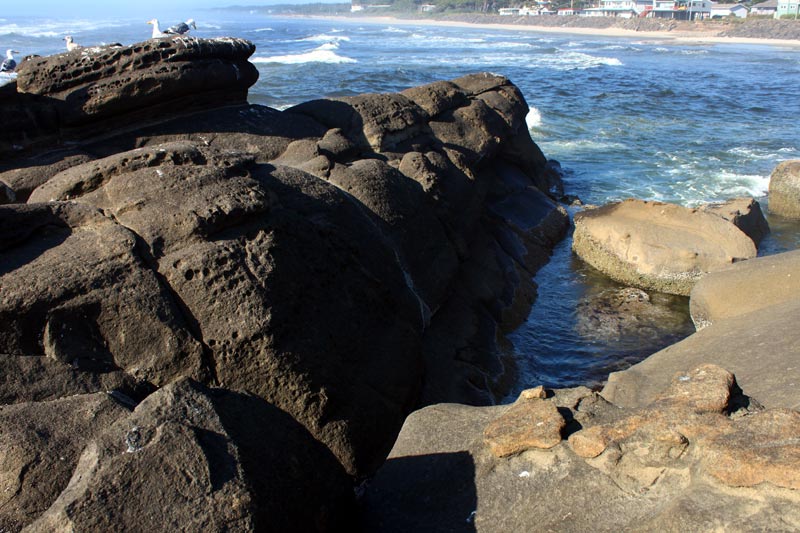
(Yachats, Oregon) – There’s so much going on in and around Yachats on the central Oregon coast you actually couldn’t explore it all in one day, especially if you add that intricate stretch of Lane County that’s just south of town. Insane wave action, a blowhole, a beach that does not always exist and surreal but astounding sights that defy categorization – it’s just a sampling of what to find. (Above: the boundary between beach and basalt rocks.)
Here are three spots in the area that never cease to surprise.
Beginning or End of the Yachats’ Trail?
Just outside the limits of this gem of a central Oregon coast town, there’s a tiny gravel road that darts off to the west and leads to a stretch of beach – and the massive basalt structures that dominate most of Yachats. It’s the gateway to what everyone knows as Yachats’ general look.
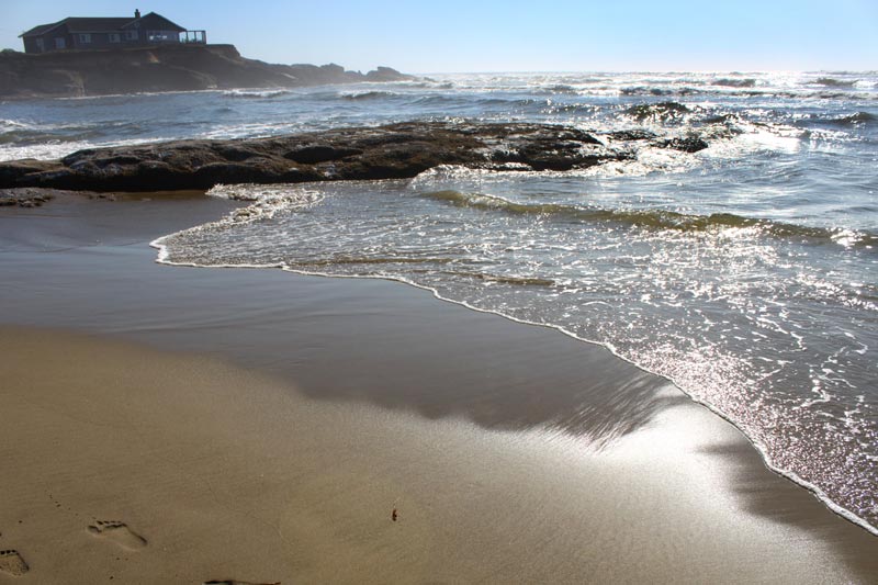
It's also here where the 804 Trail ends, having begun a little less than a mile away at Smelt Sands State Park. At this spot, it's the dividing line between the two different types of beaches, with crusty boulders and odd basalt shapes meandering in dozens of different directions at once. The area literally creates a maze of an alien landscape, with one startling, fascinating find after another.
Clamber up these wild forms and encounter more oddities in the rocks. In fact, right here at the gateway there’s a puzzling section of this 40-million-years-old lava field that looks as if it were cut into a zigzag, as if two square sections were sawed from the rock by human hands. Around it, green pools of sea goo are left high and dry by the tides, while gargantuan crevices and dramatic waves as far as you can see occupy this unusual and unforgettable place.
A Tale of Two Chasms
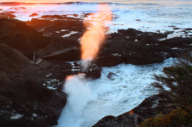
Cook's Chasm lies just immediately north of the Lane County/Lincoln County line, with its enormous crack in the rock stretching back underneath the bridge, and creating a spectacle of wave action during stormier moments. The spouting horn here even makes wild hissing noises.
A scenic bridge and stone viewpoints at either end let you glimpse all the action from above - or take a small trail down to the rocky slabs.
Thor’s Well lies here as well, but stay far from it. Too many people are careless here with that feature and think they’re safe.
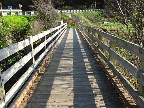
Just a stone's throw north of Cook's Chasm lies another state access and viewpoint to yet another large crevice - this one is handicapped accessible and requires a state pass for parking. It’s called Cape Cove. Take the quarter-mile wooden path and it'll lead you over another chasm and down some brushy areas, ending up at a viewpoint full of dramatic waves and green. Sometimes it’s grass, sometimes it’s an array of green sea goo covering a stark, striking landscape of rocky basalt and waves that shoot up in the air. These marine garden areas are also accessible by foot, but the taking of sea creatures is not allowed here.
The Cape Cove parking lot also leads to an unusual beach by the same name, which technically doesn’t always exist. In winter and higher tides, it’s a swirling cauldron of deadly sea. On calmer, summer days – when sand levels are raised – you can explore this intriguing area.
Strawberry Hill Wayside, Between Florence and Yachats
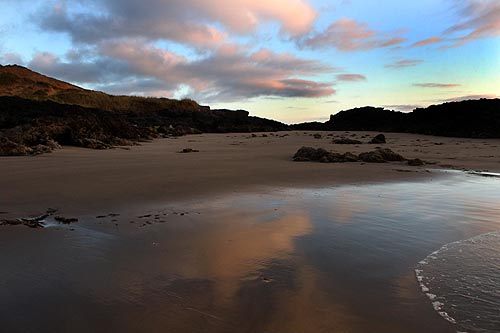
Really, this entire stretch of northern Lane County is one massive bright spot full of little amazing locales - a little less than 20 miles from Heceta Head Lighthouse up to Cape Perpetua, One full of intrigue stands out: Strawberry Hill Wayside. It sits about ten miles south of Yachats.
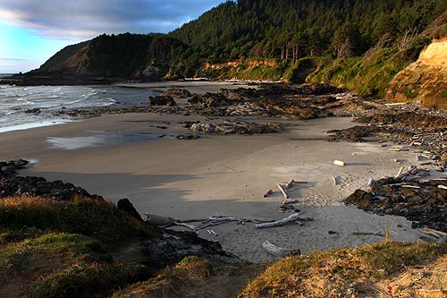
The tiny, semi-circular parking lot belies the expansive size of this incredibly varied beach. There’s something for everyone here: craggy rock formations to climb on, a decent section of soft sands, a sloped, a gravelly beach that promises agates quite often, and another chunk that simply defies definition.
First, you walk down semi-sandy slope along a stairway the forks off different directions. From here, watch the tides smack the rocks in front and imitate storm action even in calmer days. To the south lies the section with agates. To the north, you step on the beachy labyrinth that leads you to tons of tidepool life.
Then there’s truly strange chunk of cliff geologically separated from the rest, coming complete a giant log piercing it. See the Upper Lane County Virtual Tour for full info.
Hotels in Yachats - Where to eat - Yachats Maps and Virtual Tours
Cannon Beach Lodging
Nehalem Bay Lodgings
Manzanita Hotels, Lodging
Three Capes Lodging
Pacific City Hotels, Lodging
Lincoln City Lodging
Depoe Bay Lodging
Newport Lodging
Waldport Lodging
Yachats Lodging
Oregon Coast Vacation Rentals
Oregon Coast Lodging Specials
More About Oregon Coast hotels, lodging.....
More About Oregon Coast Restaurants, Dining.....
LATEST Related Oregon Coast Articles
State park at Port Orford was closed for more than a week
2026 Beachcombers 'n Glass Float Expo Brings Real Glass Floats to Washington ...
Feb 14 through March 8 they're dropped; Expo at Ocean Shores March 7?8. Washington events
Wildlife Officials Offer Rewards for Info in Multiple Oregon Gray Wolf Poachings
The latest in southern Oregon, preceded by others in the east
Some Minor Traffic Issues / Construction for Lincoln City, OR 18B to Oregon C...
Work begins next week in Lincoln City and Willamina / Sheridan
Train Derailment Shuts Down Some Central Oregon Coast Roads Briefly
It appears as if part of a train trestle gave way. Newport, Toledo, Depoe Bay. Traffic
Seaside Event Brings Sea Rescue History of Oregon / Washington Coast To Life
January 29 at 6 p.m. at Seaside Brewing: the precursor to the US Coast Guard. Seaside events
Last Night's Aurora Shots from Oregon Coast
A strong storm seen from Newport, Bandon, Port Angeles, Florence, Pacific City, Cannon Beach and more. Astronomy. Sciences
South Oregon Coast Gets Yummy: Charleston Crab Feed, Robert Burns Celebration
22nd Annual Burns event Feb 7; 41st Charleston Crab Feed Feb 14. Coos Bay events
Back to Oregon Coast
Contact Advertise on BeachConnection.net
All Content, unless otherwise attributed, copyright BeachConnection.net Unauthorized use or publication is not permitted


