Still Some Big Wave Action Along Oregon Coast But Gone by Weekend
Published 12/28/22 at 5:45 AM
By Oregon Coast Beach Connection staff
Includes exclusive listings; some specials in winter
In Cannon Beach:
Includes rentals not listed anywhere else
In Manzanita, Wheeler, Rockaway Beach:
Some specials for winter
In Pacific City, Oceanside:
Some specials for winter
In Lincoln City:
Some specials for winter
In Depoe Bay, Gleneden Beach:
Some specials for winter
In Newport:
Look for some specials
In Waldport
Some specials for winter
In Yachats, Florence
Some specials for winter
Southern Oregon Coast Hotels / Lodgings
Reedsport to Brookings, places to stay; winter deals
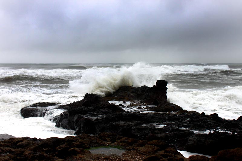
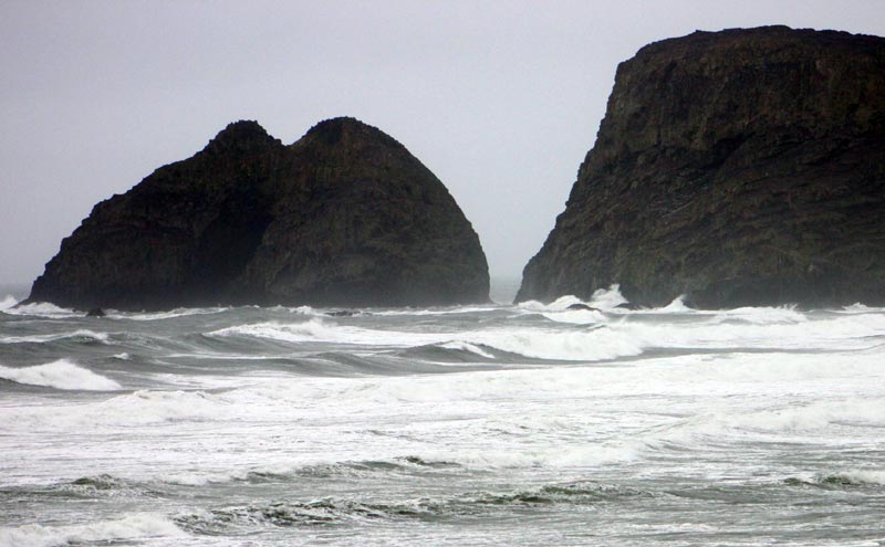
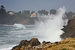
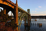
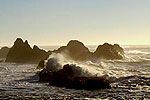
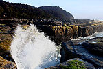
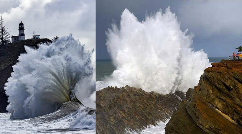
(Oregon Coast) – After some mammoth waves and winds along the Oregon coast and Washington coast, the region is shaking loose those over-25-foot waves. Not all the crazed action is completely over, however, with wave height returning to the 17-foot range briefly on Wednesday and Thursday on the southern Oregon coast. On the north Oregon coast and southern Washington coast, waves will around 13 feet over those two days, with a possible brief spike above that. (Graphic above: Oregon Coast Beach Connection. Cape Disappointment shot courtesy Kris Hurrle; Shore Acres courtesy Oregon's Adventure Coast)
The National Weather Service (NWS) is forecasting wave height to still be quite active at sea and on the shorelines, and more so down south – from Reedsport southward.
13-foot waves won't cause any hazards on the beaches, but it will still make for great storm action along rocky areas like Cape Disappointment in Washington or the ledges of Depoe Bay and Yachats. These are expected to stick around until later on Thursday night when they subside, leaving Friday maybe up around 15 feet high but then dropping to below ten feet over the weekend.
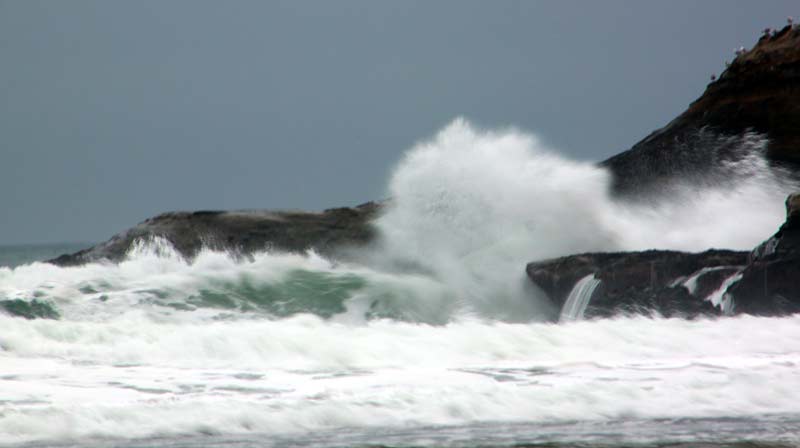
Cape Kiwanda, Oregon Coast Beach Connection
For the southern coast, it may still be an adventure. With wave height coming onshore at around 15 to 18 feet at times over Wednesday and Thursday, the dangerous part will come with the dominant period between swells, which will be about 13 seconds. A longer timing between waves means the energy can pile up offshore and you get more sneaker waves.
None of this will be like the chaos of 25- to 35-foot waves seen earlier this week, but sneaker wave advisories may be issued for the southern coast. This, plus high winds offshore, are cause for small craft advisories, however, and other dangers relevant to mariners.
Still, even for areas north of Florence and into Washington, early Thursday could well see a bit of a resurgence.
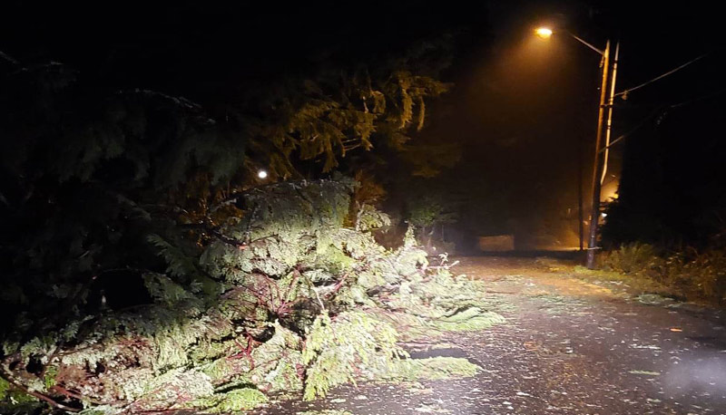
Storm damage in Seaside this week, courtesy Angi D Wildt Gallery
“Seas will also rebuild during this time an are expected to build toward 14 to 17 ft,” the NWS said. “Conditions are expected to subside rapidly behind the front with calmer winds and seas expected by Thursday afternoon.”
See Oregon Coast Weather - Washington Coast Weather
Watch the action from the Oregon Coast Sky Cams - Web Cams, Weather Cams
For the southern Oregon coast, NWS is hinting at more tidal craziness offshore for that area beyond Friday.
“Although there will be a relative break Wednesday, seas will remain steep until the next front arrives Wednesday night into Thursday, with another round of gales and very steep seas possible,” the NWS said. “Active weather will continue with additional weaker fronts expected through this weekend.”
Places to be on the southern coast between now and Thursday include Shore Acres near Coos Bay, Bandon's viewpoints, and any other area with many sea stacks close to shore – such as Arizona Beach. Remain up on high viewpoints, however, to watch the waves. Do not enter the beaches during these conditions.
When all is calm after the weekend, some areas of Oregon and Washington's coastline should have good gravel bed exposure, which means many agates.
Oregon Coast Hotels for this event - South Coast Hotels - Where to eat - Maps - Virtual Tours
Cannon Beach Lodging
Nehalem Bay Lodgings
Manzanita Hotels, Lodging
Three Capes Lodging
Pacific City Hotels, Lodging
Lincoln City Lodging
Depoe Bay Lodging
Newport Lodging
Waldport Lodging
Yachats Lodging
Oregon Coast Vacation Rentals
Oregon Coast Lodging Specials
More About Oregon Coast hotels, lodging.....
More About Oregon Coast Restaurants, Dining.....
 Andre' GW Hagestedt is editor, owner and primary photographer / videographer of Oregon Coast Beach Connection, an online publication that sees over 1 million pageviews per month. He is also author of several books about the coast.
LATEST Related Oregon Coast Articles
A look at rule details, how it affects creators. Weather
More Central Oregon Coast Glass Float Big Drops: Lincoln City This Week and June
Adding 50 limited-edition glass floats for Earth Week then 130 in June. Lincoln City events
Reggae Musician Mike Love Hits Oregon Coast for Seriously Irie Lincoln City Show
The Beach Club in Lincoln City hosts the show on Saturday, June 28. Lincoln City events
Harrowing Accident Scene on S. Oregon Coast Turns Into Search for Driver and ...
Sheriffs found an empty vehicle and searched nearly 24 hours before locating the driver. Traffic
Camping and Parking Rate Hikes Kick In Around Oregon, Coastline - More Possible
This season means higher rates and more could be coming. Sciences, travel tips
Six Orcas Dazzle Oregon Coast - Pacific Northwest Sees 2st Gray Whale Wash Up
Oregon had its fifth dead gray whale; orcas heading south. See video. Marine sciences, whales
Ontario Eastern Oregon Weather - Forecasts, Sky Cams, Alerts, Current Conditions
Weather forecasts, sky cams, alerts and current conditions for Ontario in eastern Oregon
Pictures of a Reconstruction: N. Oregon Coast's Ecola State Park Damage and R...
Photos show repairs underway at the Cannon Beach?area landmark. Traffic
Back to Oregon Coast
Contact Advertise on Oregon Coast Beach Connection
All Content, unless otherwise attributed, copyright Oregon Coast Beach Connection. Unauthorized use or publication is not permitted


