Sunny Skies Return to Washington / Oregon Coast, More 'Glowing' Possible
Published 08/23//20 at 6:11 PM PDT
By Oregon Coast Beach Connection staff
Includes exclusive listings; some specials in winter
In Cannon Beach:
Includes rentals not listed anywhere else
In Manzanita, Wheeler, Rockaway Beach:
Some specials for winter
In Pacific City, Oceanside:
Some specials for winter
In Lincoln City:
Some specials for winter
In Depoe Bay, Gleneden Beach:
Some specials for winter
In Newport:
Look for some specials
In Waldport
Some specials for winter
In Yachats, Florence
Some specials for winter
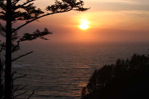
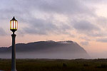
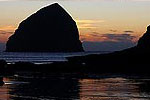
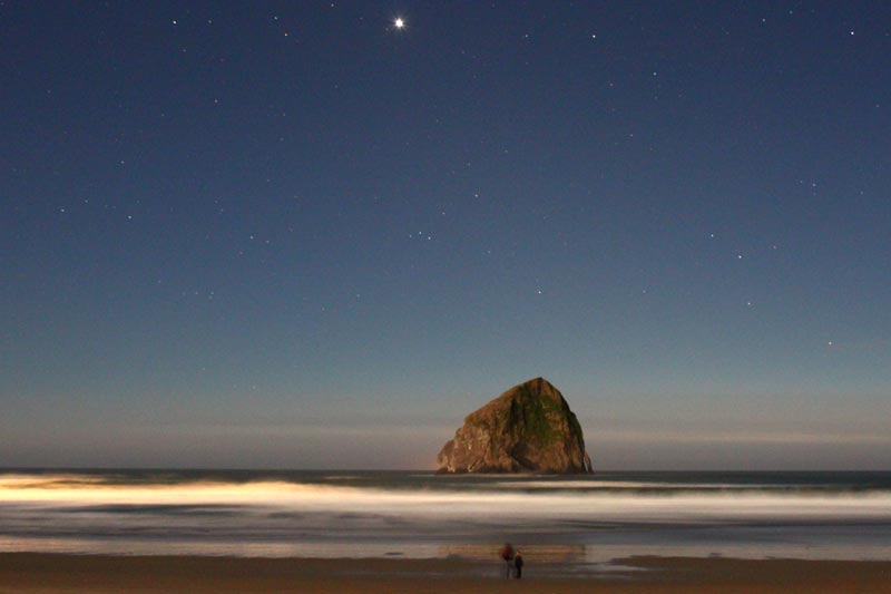
(Cannon Beach, Oregon) - After a few days of rain last week, the Oregon and Washington coast are again sunny for awhile – at least a week. According to the National Weather Service (NWS) offices in Portland, Medford and Seattle, expect to see fairly warm temps and mostly sunny skies along the coastlines of Washington and Oregon. (Above: Pacific City at night. While not actually the glowing waves effect, the look is not too dissimilar. See below for actualy glowing waves)
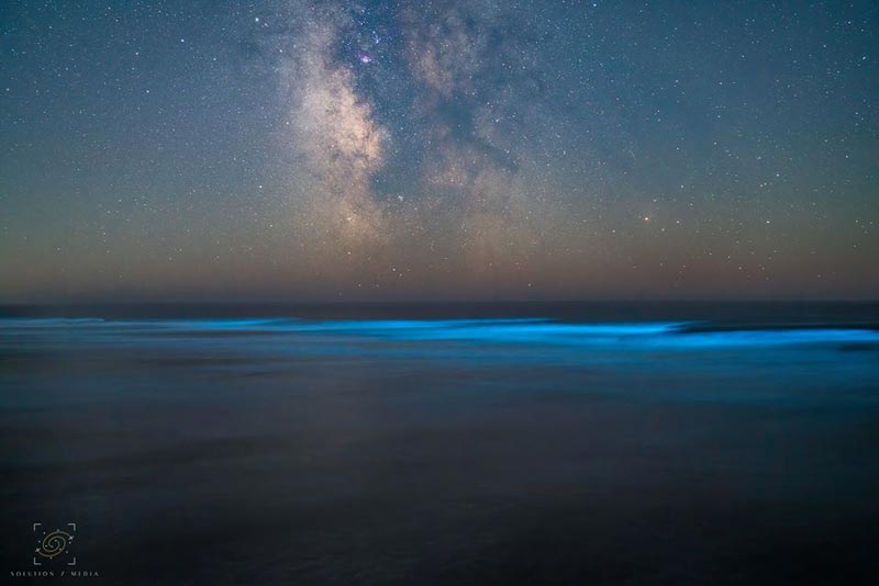
This may again greatly increase your chances of seeing the glowing waves at night as well as the glowing sand phenomena. Last week’s rain killed off all the nearshore bioluminescent phytoplankton, but sunny, clear conditions allow that to return. On top of that, Seaside Aquarium is reporting a heavy diatom bloom in the area, the result of some rain and then a resurgence of sun. If one kind of phytoplankton is blooming in great numbers, it’s quite possible the glowing kind is as well. See Astounding Glowing Waves (and Sand) on Oregon Coast Right Now
Your chances of seeing this stunning oddity are much better now – a rarity that’s been happening often this summer. It is not guaranteed, however.
How to find this? See Bioluminescent Phytoplankton: What Makes Glowing Sand On Oregon Coast, Washington.
Photo above courtesy Steven Smith / Solution 7 Media
On the central Washington coast, conditions appear to be a little sunnier than Oregon beaches for the week. Predictions for Monday through Saturday are for highs in the 60s and low 70s, with patchy fog in the mornings on many days that burn away later.
On the upper half of the Oregon coast (including Cannon Beach, Pacific City, Yachats, etc.), afternoon highs are mostly 65 to 70 for much of the week, with partly cloudy skies. Wednesday looks to have the sunniest conditions at this time.
There’s more sun the farther south you go, as you get closer to Coos Bay. The southern end of the Oregon coast will get higher temps, however, especially nearing next weekend when the forecast calls for about 80s degrees in areas like Brookings.
Throughout the week, most of the Oregon and Washington coastlines remain in a fairly similar pattern.
“A weak upper trough lingers over the area through Wednesday night continuing the possibility of coastal marine clouds moving inland Thursday morning,” the NWS said. “Any clouds will quickly clear late Thursday morning as a weak upper ridge moves over the area. The winds will be light, but lose the onshore component such that the temperatures will be slightly warmer on Thursday afternoon with interior areas peaking in the mid to upper 80s and coastal areas in the lower 70s.”
There is the possibility of thunderstorms farther south which may make it into the southern coast later in the week. An unusual pattern that’s interacting with all this are the wildfires from California, which is causing haze and hazardous smoke in some areas of southern Oregon. The NWS said this haze may inhibit the formation of thunderstorms, however.
TRAVEL ADVISORY: Avoid the north Oregon coast for now as it is overwhelmed and you may not find a parking spot or proper facilities. -------- See Oregon Coast Weather - Washington Coast Weather
Oregon Coast Hotels for this event - Where to eat - Map - Virtual Tour
Cannon Beach Lodging
Nehalem Bay Lodgings
Manzanita Hotels, Lodging
Three Capes Lodging
Pacific City Hotels, Lodging
Lincoln City Lodging
Depoe Bay Lodging
Newport Lodging
Waldport Lodging
Yachats Lodging
Oregon Coast Vacation Rentals
Oregon Coast Lodging Specials
More About Oregon Coast hotels, lodging.....
More About Oregon Coast Restaurants, Dining.....
LATEST Related Oregon Coast Articles
From Portland and Vancouver to eastern Oregon, Cascades and as far south as Madras and Albany. Weather
Washington / Oregon Travel: Gas Prices Jump More Than Usual As War Heightens
Sharper rise because of crude oil and other factors. Traffic, travel tips
Virtual Oregon Coast Field Trip: How to Chomp on Yum-Yums from Netarts Bay
Producers of the Bay series on Wednesday, March 18, from 6:30 to 7:30 p.m. Oceanside events, Pacific City events, Lincoln City events, Garibaldi events, Tillamook events
A Staple for Oregon Coast Spring Break, Festival of Illusions Hits Lincoln Ci...
2026 Festival of Illusions, March 22-27. Pacific City events, Lincoln City events, Depoe Bay events, Newport events
Dusting of Snow for Much of NW Oregon Tonight a March Curiosity
Snow levels down to 500 ft tonight, with the Coast Range and Cascades seeing heavier impacts. Weather
Controversial Lodging Tax Passed by Oregon Lawmakers
While the measure helps wildlife and ranchers, it will increase hotel rates statewide. Hotel news, Astoria hotel news, Seaside hotel news, Cannon Beach hotel news, Manzanita hotel news, Rockaway Beach hotel news, Garibaldi hotel news, Pacific City hotel news, Lincoln City hotel news, Depoe Bay hotel news, Newport hotel news, Yachats hotel news, Bandon hotel news, Coos Bay hotel news, Brookings hotel news, Florence hotel news
Velella Velella Hit the Oregon Coast and Washington - But Something is Different
Many of the creatures are smaller than usual, indicating unusual conditions offshore. Marine sciences
Oregon State Police Fish and Wildlife Seek Help Finding Bull Elk Poachers
Cash awards are offered for information leading to arrests in this Prineville-area case. Sciences, eastern Oregon
Back to Oregon Coast
Contact Advertise on BeachConnection.net
All Content, unless otherwise attributed, copyright BeachConnection.net Unauthorized use or publication is not permitted


