The Gleefully Neglected Oregon Coast: Area Between Yachats and Florence
Update Periodically
By Oregon Coast Beach Connection staff
Includes exclusive listings; some specials in winter
In Cannon Beach:
Includes rentals not listed anywhere else
In Manzanita, Wheeler, Rockaway Beach:
Some specials for winter
In Pacific City, Oceanside:
Some specials for winter
In Lincoln City:
Some specials for winter
In Depoe Bay, Gleneden Beach:
Some specials for winter
In Newport:
Look for some specials
In Waldport
Some specials for winter
In Yachats, Florence
Some specials for winter
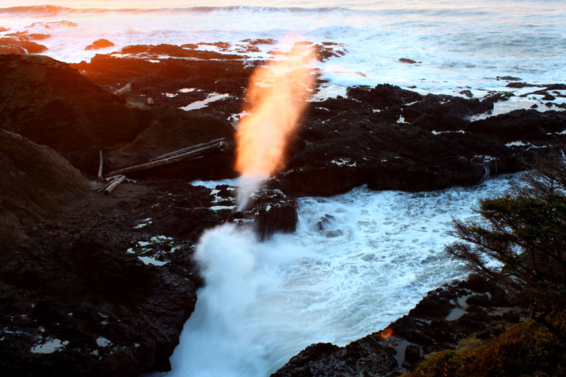
(Yachats, Oregon) – Sometimes, neglect is a good thing. While this area is by no means a secret spot on this coastline – it just feels like it because there’s no one there. That stretch of meandering shoreline between Yachats and Florence is simply overlooked. (Above: Cook's Chasm - Upper Lane County Map).
Stunning Oregon coast vistas pop up left and right along this unforgettable auto tour – but it’s the kind of drive that could be your last. It's so tempting to keep looking out the window that it requires of you a a great deal of discipline to keep your eyes on the road.
It’s a mere 20 miles or so between Florence and Yachats, and it is filled with numerous tight curves atop high cliffs that create a constant cavalcade of amazing ocean views. If the weather is rough, there's plenty to see along this route from your ride. And if it's just shy of rough – and you’re able to explore on foot – this section is among the most pristine and uncrowded of all the Oregon coast.
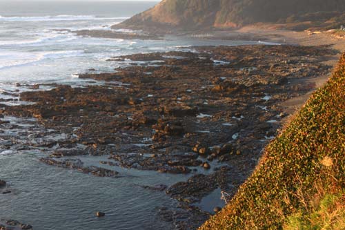
First up, just south of Yachats, you begin the climb towards Cape Perpetua and the Devil's Churn, as blackened basalt shelves meander between you and the sea in varied, puzzling shapes. Jagged and alien-looking much of the time, they harbor a bevy of tidepool life if you’re able to pop out and visit them. Sometimes they’re just too far below you and only a gravel pullout or two are all that allows you a decent glance. These pullouts are jaw-dropping, too. The highest one is not a bad place to keep an eye out for the coveted green flash at sunset. Loftier vantage points can give you a better chance.
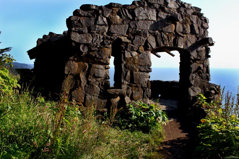
The trained eye of the TV addict may recognize some of these vistas: this area was often used as stock footage in the Bates Motel TV series a few years back.
For the next 20 miles or so, the road rises and falls, interspersed with rocky landscapes and sandy beaches dotted with boulders and basalt structures. This part of the central Oregon coast is extremely varied in layout and geological features: some beaches have soaring bluffs and other rocky blobs while others are fairly flat. Some are an intriguing mix of both. Yet all are rather bereft of human presence.
There’s Cape Perpetua and its raucous Devil’s Churn itself, a much-lauded and discussed pair of attractions. Immediately south of there is Cape Cove Beach, a place not talked about much – partially because it doesn’t always exist. During winter it often fills up with ocean water, rendering it more of a miniature bay rather than a beach. (See more at the Upper Lane County Map, Virtual Tour).
Just south of that, you encounter Cook’s Chasm and its famed spouting horn, and these day the even more famous Thor’s Well.
The true hidden treasures lie just south of all this.
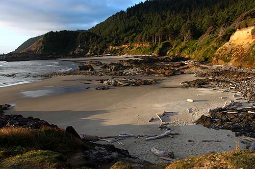
At Strawberry Hill, climb out over a large headland with steps embedded in the rocks and sand, and wander down to a sandy stretch of various colors and textures, where boulders and formations create a kind of labyrinth. Tidepools reign supreme here, and the shapes and structures get more and more complex the farther inside this mini-cove you go.
Then there’s the cobblestone adventures of Bob Creek Wayside, where lower tides let freaky mushroom-like rock formations emerge, often covered with crusty marine life and sea stars. Directly above this sits Bray’s Point, an engaging lookout next to the highway all its own.
Stonefield Beach State Recreation Site straddles Ten Mile Creek and features three distinctly wondrous sides. A flat, sandy beach occasionally known for agates is on the south, while the north side is a trippy place covered in wildly-colored rock structures. The pathway to the northern half is also an eye-popper, with a remarkable walk past the creek.
At Rock Creek Campground and Roosevelt Beach, there's lots of sand and a handful of small sea stacks, with a patch of basalt that cradles an idyllic, babbling brook. A bit south of there, spots like Muriel O. Ponsler Wayside are all sand, and it's about where the landscape flattens out to seemingly endless beaches.
Other names to look out for on this special stretch of central Oregon coast are Neptune Beach, Tokatee Klootchman and Ocean Beach Picnic Area, among others.
Then comes a kind of climax to it all: Heceta Head Lighthouse and Carl Washburne State Park, along with a myriad of pullouts that allow you to gaze in awe at the wildlife-covered cliffs and dramatic waves slamming into bulging structures at the bottom. Hotels in Yachats - Where to eat - Yachats Maps and Virtual Tours - Upper Lane County Map and Virtual Tours
Cannon Beach Lodging
Nehalem Bay Lodgings
Manzanita Hotels, Lodging
Three Capes Lodging
Pacific City Hotels, Lodging
Lincoln City Lodging
Depoe Bay Lodging
Newport Lodging
Waldport Lodging
Yachats Lodging
Oregon Coast Vacation Rentals
Oregon Coast Lodging Specials
More About Oregon Coast hotels, lodging.....
More About Oregon Coast Restaurants, Dining.....
LATEST Related Oregon Coast Articles
State park at Port Orford was closed for more than a week
2026 Beachcombers 'n Glass Float Expo Brings Real Glass Floats to Washington ...
Feb 14 through March 8 they're dropped; Expo at Ocean Shores March 7?8. Washington events
Wildlife Officials Offer Rewards for Info in Multiple Oregon Gray Wolf Poachings
The latest in southern Oregon, preceded by others in the east
Some Minor Traffic Issues / Construction for Lincoln City, OR 18B to Oregon C...
Work begins next week in Lincoln City and Willamina / Sheridan
Train Derailment Shuts Down Some Central Oregon Coast Roads Briefly
It appears as if part of a train trestle gave way. Newport, Toledo, Depoe Bay. Traffic
Seaside Event Brings Sea Rescue History of Oregon / Washington Coast To Life
January 29 at 6 p.m. at Seaside Brewing: the precursor to the US Coast Guard. Seaside events
Last Night's Aurora Shots from Oregon Coast
A strong storm seen from Newport, Bandon, Port Angeles, Florence, Pacific City, Cannon Beach and more. Astronomy. Sciences
South Oregon Coast Gets Yummy: Charleston Crab Feed, Robert Burns Celebration
22nd Annual Burns event Feb 7; 41st Charleston Crab Feed Feb 14. Coos Bay events
Back to Oregon Coast
Contact Advertise on BeachConnection.net
All Content, unless otherwise attributed, copyright BeachConnection.net Unauthorized use or publication is not permitted


