First Round of Sneaker Waves, Stormwatching for Oregon / Washington Coast: Warnings
Published 10/30/22 at 4:53 PM
By Oregon Coast Beach Connection staff
Includes exclusive listings; some specials in winter
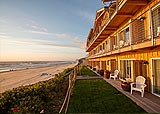
In Cannon Beach:
Includes rentals not listed anywhere else
In Manzanita, Wheeler, Rockaway Beach:
Some specials for winter
In Pacific City, Oceanside:
Some specials for winter
In Lincoln City:
Some specials for winter
In Depoe Bay, Gleneden Beach:
Some specials for winter
In Newport:
Look for some specials
In Waldport
Some specials for winter
In Yachats, Florence
Some specials for winter
Southern Oregon Coast Hotels / Lodgings
Reedsport to Brookings, places to stay; winter deals
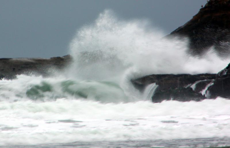
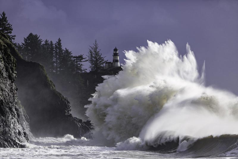
(Cannon Beach, Oregon) – The first serious bout of wave action and beach hazards for the Oregon coast and south Washington coast hits the beaches later tonight, bringing waves as high as 20 – 25 feet in some areas along with a variety of advisories. The southern Curry Coast is under a beach hazards statement, the upper section of the south Oregon coast is under a high surf advisory, and the upper half of the Oregon coast and southern edges of Washington's coast have more informal statements about increased sneaker wave dangers. (Photo Oregon Coast Beach Connection: giant waves at Cape Kiwanda)
All of this starts about 11 p.m. Sunday and is active until late afternoon on Monday to late evening.
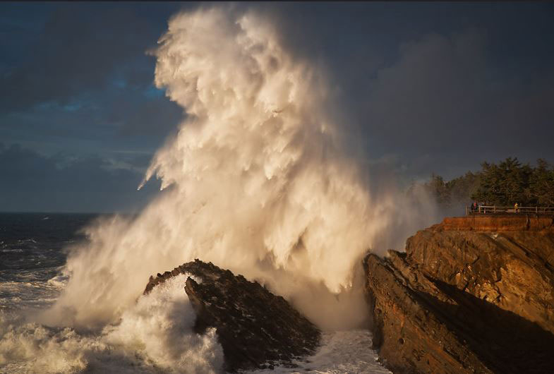
There is increased danger but also plenty of storm watching, especially on the south coast's Shore Acres area and possibly Washington coast's Cape Disappointment.
From Ocean Park in Washington southwards through Cannon Beach, Pacific City and down to Florence, the Portland office of the National Weather Service (NWS) said offshore seas will be building to 18 feet overnight with conditions more conducive to sneaker waves.
“Not that it will be a calm day on the beach on Monday with rain and some wind, but if you do decide to venture onto the beach or want to fish from a jetty, be aware there is an increased risk of sneaker waves on Monday,” the Portland NWS said.
For the time being they're simply issuing cautionary statements, but there could be greater dangers coming.
“A relatively large longer period swell will bring a threat of sneaker waves to the coast Monday,” the NWS said. “There is a chance conditions could meet High Surf Advisory criteria, but this largely assumes current model guidance is in fact too low late Sunday night into early Monday. Given the uncertainty, timing and marginal nature of this event will hold off on any highlights for now.”
See Oregon Coast Weather - Washington Coast Weather
On the south central Oregon coast – including Reedsport, Coos Bay, Bandon and Port Orford – the NWS in Medford issued a high surf advisory from 11 p.m. this evening until 5 p.m. Monday. Large, breaking waves of 20 to 25 feet are expected on beaches, which will make many areas in this area unacceptably dangerous, including smaller beaches. Numerous spots around Bandon will be especially problematic as there are only cliffs behind the beach and no quick escape from waves.
The NWS said hazardous conditions are likely, and these big waves “could inundate beaches and low lying shorelines. Beach erosion is possible, and exposed infrastructure may be damaged.”
'Wave Height' Explained Along Oregon, Washington Coast: What It Means
For the southern Curry Coast – including Gold Beach and Brookings – conditions are less severe but the risk of sneaker waves is sizable.
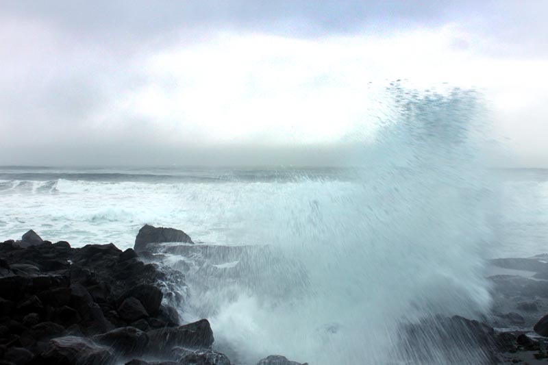
“Even during calm conditions, sneaker waves can sweep up the beach without warning and knock unsuspecting people over and pull them out to sea,” the NWS said. “Shock and hypothermia can occur quickly in the cold Pacific waters. In addition, logs and other debris can be lifted and carried by the waves, crushing or entrapping unsuspecting victims underneath.”
Weather along the coastlines will be rainy and windy in the first place, so it won't be ideal for being on the sands. However, storm watching from your car should be excellent, such as at Depoe Bay, Oceanside, Pacific City, Bandon, Coos Bay's Cape Arago areas, Port Orford, the pullouts near Humbug, or Neahkahnie Mountain near Manzanita.
Oregon Coast Hotels in this area - South Coast Hotels - Where to eat - Maps - Virtual Tours


Cannon Beach Lodging
Nehalem Bay Lodgings
Manzanita Hotels, Lodging
Three Capes Lodging
Pacific City Hotels, Lodging
Lincoln City Lodging
Depoe Bay Lodging
Newport Lodging
Waldport Lodging
Yachats Lodging
Oregon Coast Vacation Rentals
Oregon Coast Lodging Specials


Shore Acres, courtesy Manuela Durson - see Manuela Durson Fine Arts for more
More About Oregon Coast hotels, lodging.....
More About Oregon Coast Restaurants, Dining.....


LATEST Related Oregon Coast Articles
22 May 2026 at 9:34pm
New landmark rising in Newport: the fully assembled skeleton of a 70-foot blue whale. Newport events
Heat Warnings, Advisories Around Oregon, Washington Now Include Coast - Some ...
13 Jun 2026 at 9:54pm
90 to 100 degrees in many areas. Coast sees unusual 80s. Weather, sciences
Manzanita in July: History of Oregon Coast's 101 and Pirate-Themed Scavenger ...
26 Jun 2026 at 6:51am
July 9: Scavenger Hunt. July 11: History of Highway. Manzanita events, Nehalem events, Cannon Beach events, Tillamook events
Oregon Coast News Roundup: Dead Whale, Fatal Vehicle Wreck, Arrests
26 Jun 2026 at 6:51am
19th deceased whale this year; fatal collision Yamhill County. Seaside, marine sciences, Gearhart, Newberg, traffic, true crime
Nighttime Traffic Delays Coming to North Oregon Coast's Youngs Bay Bridge
30 May 2026 at 7:01am
Also part of the Oregon 42: U.S. 101 to Cedar Point Road project. Astoria, Coos Bay
Celebrating 50 Years of Cascade Biosphere on Central Oregon Coast, July 18
12 Jun 2026 at 10:11pm
50th anniversary of its UNESCO designation with a full day and evening. Lincoln City events. History
Oregon Man Visits the Sun - Well, At Least Photographically. Video Results Ar...
23 Jun 2026 at 9:05pm
Closeups of the sun taken from Portland, what they show. Astronomy, weather, sciences, Portland, Salem, Seaside, Warrenton
Orcas Literally Leaping in Celebration on Oregon Coast (Video), and Yes, They...
2 Jun 2026 at 11:05am
When breaching becomes a killer whale party in the Depoe Bay area. Marine sciences
Back to Oregon Coast
Contact Advertise on Oregon Coast Beach Connection
All Content, unless otherwise attributed, copyright Oregon Coast Beach Connection. Unauthorized use or publication is not permitted

Oregon
Coast Hotels
S. Coast Hotels
Astoria/Warrenton Hotels
Seaside Hotels
Cannon
Beach Hotels
Nehalem Bay Lodgings
Manzanita Hotels, Lodging
Rockaway Beach Hotels
Three Capes Lodging
Pacific City Hotels, Lodging
Lincoln
City Lodging
Depoe
Bay Hotels
Newport Hotels
Waldport Lodging
Yachats
Lodging
Oregon
Coast Vacation Rentals
Oregon
Coast Lodging Specials
South Coast Hotels
Dining
Guide
Seaside
Cannon
Beach Dining
Manzanita,
Rockaway, Wheeler Dining
Pacific
City, Oceanside, Netarts, Tierra Del Mar Restaurants
Tillamook
Bay Restaurants, Dining
Lincoln
City Dining, Restaurants
Depoe
Bay Restaurants, Dining
Newport Restaurants, Dining
Waldport,
Yachats Restaurants, Dining
Florence Restaurants, Dining
Restaurant
Reviews
Coast
Events Calendar
Astoria
Seaside,
Cannon Beach Calendar
Manzanita,
Rockaway Events
Tillamook,
Pacific City Calendar
Lincoln
City Events Calendar
Newport,
Depoe Bay Events Calendar
Yachats Events Calendar
Oregon Coast Complete Guides every beach access, attraction
Search for Oregon Coast Subjects, Articles
Explore Every Beach Spot


News Headlines from All Over Oregon Need to scan Oregon headlines? Constantly updated news from all over Oregon: a comprehensive, up-to-the-minute display of news headlines from a variety of media
Oregon Coast Oceanfront Lodging, Hotels, Rentals
Book Coastal Lodging Now
Booking.com