



S. Oregon Coast Will Get Heavy Waves, Winds Through Friday | Warnings
Published 03/03/21 at 5:30 PM PDT
By Oregon Coast Beach Connection staff
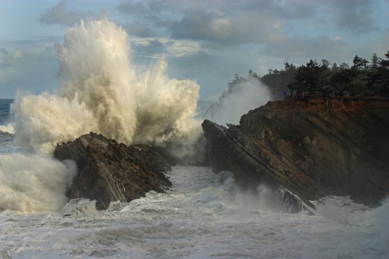
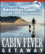
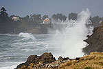
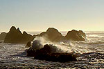
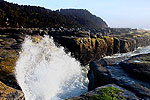
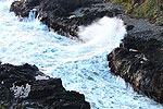
(Brookings, Oregon) – Much of the southern Oregon coast is in for some surprise stormy weather over the next few days, as the National Weather Service (NWS) issues a high surf advisory for southern-facing beaches closer farther south and a high wind warning for everything south of Florence. (Photo courtesy Oregon's Adventure Coast / Steven Michael Photography)
Nothing major is expected for the northern Oregon coast or Washington coast, but some wave action could still prove good for agate hunting and other unusual finds.
Includes exclusive listings; some specials in winter
In Cannon Beach:
Includes rentals not listed anywhere else
In Manzanita, Wheeler, Rockaway Beach:
Some specials for winter
In Pacific City, Oceanside:
Some specials for winter
In Lincoln City:
Some specials for winter
In Depoe Bay, Gleneden Beach:
Some specials for winter
In Newport:
Look for some specials
In Waldport
Some specials for winter
In Yachats, Florence
Some specials for winter
Southern Oregon Coast Hotels / Lodgings
Reedsport to Brookings, places to stay; winter deals
The high surf advisory is in effect from noon Thursday to noon on Friday, covering mostly the areas south of Bandon.
“Southerly storm force winds are possible with gale force winds likely,” the NWS said. “This could create high surf with breaking waves of 20 to 25 feet.”
The NWS said it is mostly concerned about beaches facing south, especially parts of Port Orford and Brookings, where swells could inundate ports and sections beyond the vegetation line.
“These conditions typically could bring waves into the parking lot of Port Orford and the RV Park in Brookings Harbor,” the NWS said.
The high wind warning is in effect for the areas of Reedsport and southward, including Winchester Bay, Coos Bay, Port Orford, Bandon and Brookings. South winds of 35 mph to 45 mph are expected with gusts up around 60 mph.
“Damaging winds will blow down trees and power lines,” the NWS said. “Widespread power outages are expected. Travel will be difficult, especially for high profile vehicles.”
The NWS also added you should stay out of forest areas along the southern Oregon coast because of the danger of falling branches.
Things calm down after the weekend, however.
“Wave models continue to decrease the threat of long-period large swells early next week, but steep seas appear likely, with seas in excess of 10 feet expected for much of the week as additional systems pass through the region,” the NWS said.
High winds will not make it pleasant for storm watching, so you’ll want to stick to your vehicle and find a good high vantage point, such as the pullout just north of Myers Beach. Shore Acres State Park near Coos Bay should be a show-stopper and you can hide behind the viewing area.
For the northern Oregon coast and Washington coast, it will be somewhat large waves offshore at times over the weekend, which could translate into sizable wave activity on rocky areas like Yachats, Depoe Bay and Cape Disappointment, but nothing overly spectacular.
See Oregon Coast Weather - Washington Coast Weather
See Oregon Coast Sky Cams - Web Cams, Weather Cams
This kind of wave action could continue scouring out sand from places north of Florence, while it will most certainly do so south of there. After the weekend will be a good time to look for beach treasures throughout the Washington and Oregon coastlines. MORE PHOTOS BELOW
Oregon Coast Hotels in this area - South Coast Hotels - Where to eat - Maps - Virtual Tours - Southern Coast













Cannon Beach Lodging
Nehalem Bay Lodgings
Manzanita Hotels, Lodging
Three Capes Lodging
Pacific City Hotels, Lodging
Lincoln City Lodging
Depoe Bay Lodging
Newport Lodging
Waldport Lodging
Yachats Lodging
Oregon Coast Vacation Rentals
Oregon Coast Lodging Specials


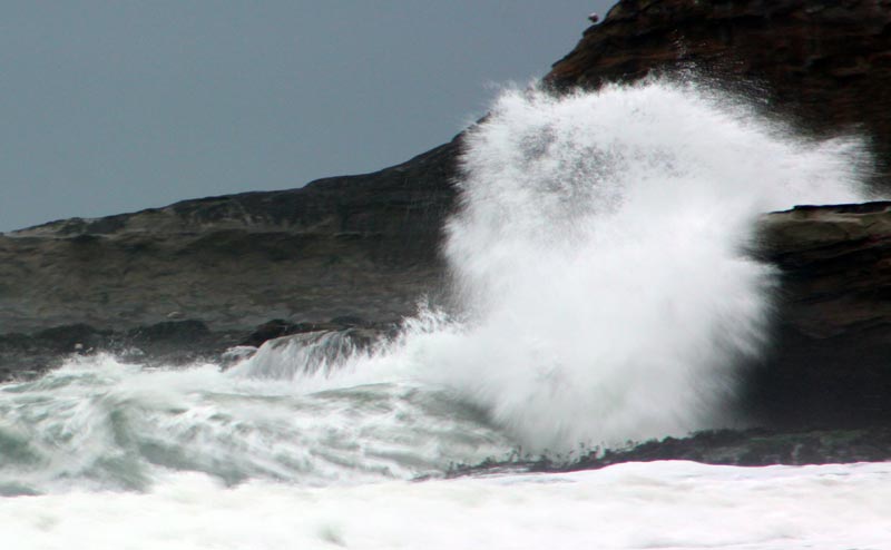
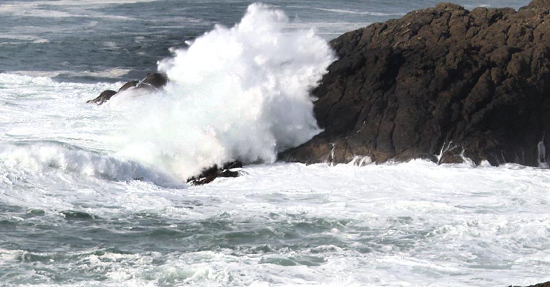

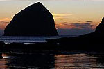
Coquille Point, courtesy Rick Poecker
More About Oregon Coast hotels, lodging.....
More About Oregon Coast Restaurants, Dining.....


LATEST Related Oregon Coast Articles
10 Nov 2026 at 3:51pm
Weekend will get dangerous again, then another system early week. Weather, sciences
Avian Influenza Hitting Oregon's Migrating Fowl, Especially Willamette Valley
10 Nov 2026 at 3:51pm
A growing number of sick and dead birds across the state. Salem, Eugene, Silverton, Albany, Corvallis
Two Fatal Wrecks: South Oregon Coast and Coast Range
9 Nov 2026 at 6:41pm
Two single-vehicle wrecks: one near Coquille and the other in the central Oregon Coast Range near Florence. Traffic, rescue
A Weekend of Near-Deadly Misses Along the Oregon Coast in Video
9 Nov 2026 at 6:41pm
More weather warnings on the way this week. Rescue, safety. Cannon Beach, Manzanita Neahkahnie Mt., Barview jetty, Lincoln City SW 35th, Depoe Bay Spouting Horn, Oceanside Tunnel Beach
South Oregon Coast's Holidays Go Bonkers at Brookings, Gold Beach, Cape Blanco
9 Nov 2026 at 6:41pm
Brookings' Festival of Lights, Hughes House, Gold Beach kids party and a musical. Gold Beach events, Brookings events, Port Orford events
Shore Acres Likely a Show Sunday: Where Else to Watch on Oregon / Washington ...
7 Nov 2026 at 8:54am
Big waves expected at Coos Bay, Cape Disappointment, Yachats, Depoe Bay, etc: but stay off beaches
Waves Up To 28 Feet Sunday: Various Surf, Wind Alerts Oregon and Washington C...
6 Nov 2026 at 10:57pm
This bodes well for places like Shore Acres or Cape Disappointment. Weather. La Push, Raymond, Ocean Shores, Westport, Long Beach, Astoria, Seaside, Cannon Beach, Manzanita, Nehalem, Wheeler, Rockaway, Garibaldi, Tillamook, Oceanside, Pacific City, Lincoln City, Depoe Bay, Newport, Waldport, Yachats, Florence, Reedsport, Winchester Bay, Coos Bay, Bandon, Gold Beach, Brookings
Waves as High as 28 Feet Coming to Oregon Coast - Washington Coast
6 Nov 2026 at 9:19pm
Keep up on all regional weather warnings, alerts. Seaside, Astoria, Cannon Beach, Lincoln City
Back to Oregon Coast
Contact Advertise on BeachConnection.net
All Content, unless otherwise attributed, copyright BeachConnection.net Unauthorized use or publication is not permitted


Oregon
Coast Hotels
S. Coast Hotels
Seaside Hotels
Cannon
Beach Hotels
Nehalem Bay Lodgings
Manzanita Hotels, Lodging
Rockaway Beach Hotels
Three Capes Lodging
Pacific City Hotels, Lodging
Lincoln
City Lodging
Depoe
Bay Hotels
Newport Hotels
Waldport Lodging
Yachats
Lodging
Oregon
Coast Vacation Rentals
Oregon
Coast Lodging Specials
South Coast Hotels
Dining
Guide
Seaside
Cannon
Beach Dining
Manzanita,
Rockaway, Wheeler Dining
Pacific
City, Oceanside, Netarts, Tierra Del Mar Restaurants
Tillamook
Bay Restaurants, Dining
Lincoln
City Dining, Restaurants
Depoe
Bay Restaurants, Dining
Newport Restaurants, Dining
Waldport,
Yachats Restaurants, Dining
Florence Restaurants, Dining
Restaurant
Reviews
Coast
Events Calendar
Astoria
Seaside,
Cannon Beach Calendar
Manzanita,
Rockaway Events
Tillamook,
Pacific City Calendar
Lincoln
City Events Calendar
Newport,
Depoe Bay Events Calendar
Yachats Events Calendar
Oregon Coast Complete Guides every beach access, attraction
Search for Oregon Coast Subjects, Articles
Explore Every Beach Spot


News Headlines from All Over Oregon Need to scan Oregon headlines? Constantly updated news from all over Oregon: a comprehensive, up-to-the-minute display of news headlines from a variety of media
Oregon Coast Oceanfront Lodging, Hotels, Rentals
Book Coastal Lodging Now
Booking.com