Flooding Closures, Delays Along Oregon Coast Highway 101 at Seaside, Neskowin, Coos Bay / UPDATES
Published 12/05/23 a 6:15 p.m. - Updated 12/05/23 a 7:07 p.m.
By Oregon Coast Beach Connection staff
(Seaside, Oregon) – Flood issues abound on the Oregon coast as of early Tuesday evening, as various delays dot Highway 101 from Seaside down to Coos Bay. (Photo of flooding at Seaside, courtesy Angi D. Wildt Gallery)
Includes exclusive listings; some specials in winter
In Cannon Beach:
Includes rentals not listed anywhere else
In Manzanita, Wheeler, Rockaway Beach:
Some specials for winter
In Pacific City, Oceanside:
Some specials for winter
In Lincoln City:
Some specials for winter
In Depoe Bay, Gleneden Beach:
Some specials for winter
In Newport:
Look for some specials
In Waldport
Some specials for winter
In Yachats, Florence
Some specials for winter
Southern Oregon Coast Hotels / Lodgings
Reedsport to Brookings, places to stay; winter deals
UPDATE: The major closure happened early this morning at Seaside, and as of 6 p.m. is officially back open.
UPDATES: Flooding at coastal state parks.
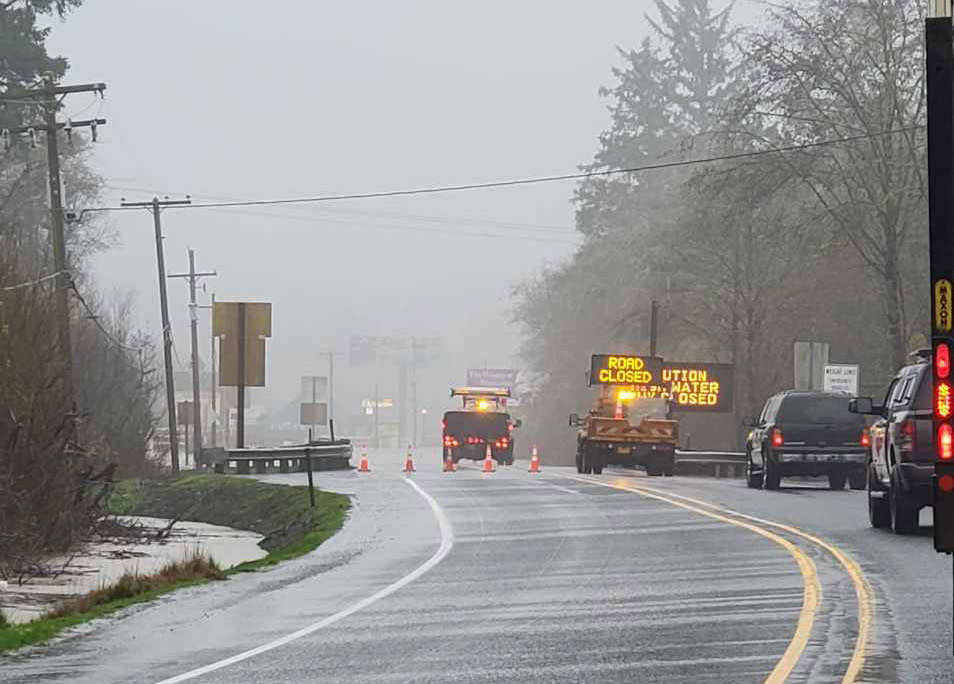
At MP 22.5 – 25, about two miles south of Seaside, major flooding has taken over this part of the main highway of the north Oregon coast. High water issues started in the overnight hours, as flooding hit by 4 a.m., according to Seaside's Angi Wildt.
Until early evening there was no way between Cannon Beach and Seaside.
“U.S. 101 between Seaside and the junction with U.S. 26 closed due to high water Tuesday morning, Dec. 5,” ODOT said. “There is no local detour is available. Heavy rain is expected all this week. We will monitor the water level in this area 24/7 and open the highway here when possible -- first to high-clearance vehicles such as commercial trucks, then, once the water has receded enough, to other vehicles.”
There were for a time some conflicting reports, however, that the highway had been opened as of 4:50 p.m., but ODOT's updates just confirmed it as of 6:15 p.m.
Continue to check Tripcheck.com for updates as high tides may force more closures.
Flooding in Seaside, photo courtesy ODOT
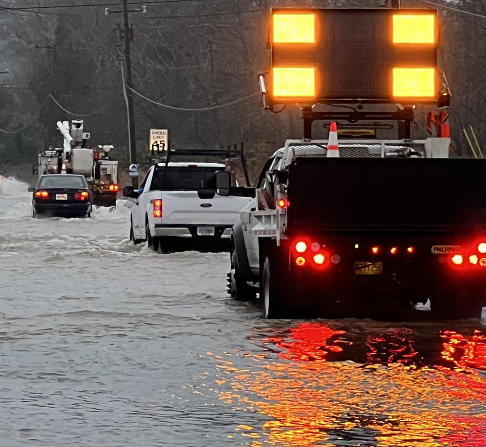
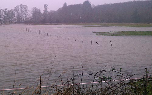
One mile south of Neskowin there is another delay as of early afternoon Tuesday, happening right about MP 97.8.
ODOT said “High water has the highway closed to north bound traffic. North bound traffic will be detoured. The highway is open to south bound traffic only. Highway is open to one lane of traffic and is being controlled by pilot car, use caution.”
There is an estimated time of delay of 20 minutes up to two hours.
Flooding at Neskowin - ODOT
Three miles north of Seal Rock there is more high water – happening about MP 148. You may get delayed up to 20 minutes.
At Highway 6 right outside of Tillamook, flooding has closed an area there. ODOT says there is a detour with signage that directs you.
Farther down on the south Oregon coast at Coos Bay, MP 239.5 has a major delay due to high water. That spot is two miles south of town.
UPDATES: Oregon State Parks and Recreation Department (OPRD) said there is substantial flooding at some Oregon coast state parks, including Coos Bay's Sunset Bay (pictured here).
"There is flooding in several parks; including Cape Lookout, Sunset Bay & Willamette Mission. Your safety is our priority. We've implemented partial and full closures. Please check the state park webpage for up-to-date alert."
Oregon Coast Hotels in this area - South Coast Hotels - Where to eat - Maps - Virtual Tours


Cannon Beach Lodging
Nehalem Bay Lodgings
Manzanita Hotels, Lodging
Three Capes Lodging
Pacific City Hotels, Lodging
Lincoln City Lodging
Depoe Bay Lodging
Newport Lodging
Waldport Lodging
Yachats Lodging
Oregon Coast Vacation Rentals
Oregon Coast Lodging Specials


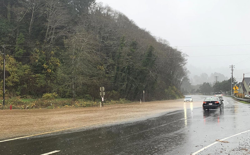
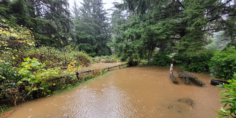
Flooding at Salmon River, central coast
More About Oregon Coast hotels, lodging.....
More About Oregon Coast Restaurants, Dining.....


 Andre' GW Hagestedt is editor, owner and primary photographer / videographer of Oregon Coast Beach Connection, an online publication that sees over 1 million pageviews per month. He is also author of several books about the coast.
LATEST Related Oregon Coast Articles
30 May 2026 at 7:01am
Surprises in the skies include an unpredictable meteor shower, vibrant Mars, and possible bioluminescence. Astronomy, sciences
NOAA Feds Looking Into Crimes After Initials Carved Into Washington Coast Whale
18 May 2026 at 10:02am
Someone had also tried to remove baleen - all federal crimes. Marine sciences
Manzanita in July: History of Oregon Coast's 101 and Pirate-Themed Scavenger ...
26 Jun 2026 at 6:51am
July 9: Scavenger Hunt. July 11: History of Highway. Manzanita events, Nehalem events, Cannon Beach events, Tillamook events
June Highlights on Oregon's Tillamook Coast: Nehalem Bay Crab Derby, Rockaway...
27 May 2026 at 9:15pm
Rockaway Beach events: June 19 -21; Kelly's Crab Derby, Nehalem Bay events June 6
Tragic Crash Near Oregon Coast Range; Washington County K-9 Nabs Thief
16 May 2026 at 8:00am
A Lincoln City man died in a wreck in Yamhill County. Crime, traffic, safety
Coast Guard Calls Off Search Along Inner Washington Coast After Body Found
23 May 2026 at 11:27pm
65-year-old man missing near Point Wilson, Washington. Safety
Oregon Coast This Weekend: Wildfire, Oil Spill, DUII on the Dunes, Fatal Crash
1 Jun 2026 at 10:05pm
Incidents in Astoria, Winchester Bay, Dune City, Cloverdale, Tillamook. Traffic, crime, US Coast Guard
Gnarly, Somewhat Gruesome Video of Killer Whale Attack on Oregon Coast
23 Jun 2026 at 9:05pm
Unusual top-down footage of them hunting a harbor seal. Marine sciences, Seal Rock, Depoe Bay, Newport, Yachats
Back to Oregon Coast
Contact Advertise on Oregon Coast Beach Connection
All Content, unless otherwise attributed, copyright Oregon Coast Beach Connection. Unauthorized use or publication is not permitted
Keywords: Oregon coast flooding, weather, Washington coast, Coos Bay, Florence, Yachats, Waldport, Newport, Cannon Beach, Seaside, Astoria

Oregon
Coast Hotels
S. Coast Hotels
Astoria/Warrenton Hotels
Seaside Hotels
Cannon
Beach Hotels
Nehalem Bay Lodgings
Manzanita Hotels, Lodging
Rockaway Beach Hotels
Three Capes Lodging
Pacific City Hotels, Lodging
Lincoln
City Lodging
Depoe
Bay Hotels
Newport Hotels
Waldport Lodging
Yachats
Lodging
Oregon
Coast Vacation Rentals
Oregon
Coast Lodging Specials
South Coast Hotels
Dining
Guide
Seaside
Cannon
Beach Dining
Manzanita,
Rockaway, Wheeler Dining
Pacific
City, Oceanside, Netarts, Tierra Del Mar Restaurants
Tillamook
Bay Restaurants, Dining
Lincoln
City Dining, Restaurants
Depoe
Bay Restaurants, Dining
Newport Restaurants, Dining
Waldport,
Yachats Restaurants, Dining
Florence Restaurants, Dining
Restaurant
Reviews
Coast
Events Calendar
Astoria
Seaside,
Cannon Beach Calendar
Manzanita,
Rockaway Events
Tillamook,
Pacific City Calendar
Lincoln
City Events Calendar
Newport,
Depoe Bay Events Calendar
Yachats Events Calendar
Oregon Coast Complete Guides every beach access, attraction
Search for Oregon Coast Subjects, Articles
Explore Every Beach Spot


News Headlines from All Over Oregon Need to scan Oregon headlines? Constantly updated news from all over Oregon: a comprehensive, up-to-the-minute display of news headlines from a variety of media
Oregon Coast Oceanfront Lodging, Hotels, Rentals
Book Coastal Lodging Now
Booking.com