Wind Warnings for Oregon / Washington Coast; Snow, Big Waves Early Week
Published 12/10/21 at 5:22 AM PST
By Oregon Coast Beach Connection staff
Includes exclusive listings; some specials in winter
In Cannon Beach:
Includes rentals not listed anywhere else
In Manzanita, Wheeler, Rockaway Beach:
Some specials for winter
In Pacific City, Oceanside:
Some specials for winter
In Lincoln City:
Some specials for winter
In Depoe Bay, Gleneden Beach:
Some specials for winter
In Newport:
Look for some specials
In Waldport
Some specials for winter
In Yachats, Florence
Some specials for winter
Southern Oregon Coast Hotels / Lodgings
Reedsport to Brookings, places to stay; winter deals
(Astoria, Oregon) – Snow in the Coast Range passes, high wind warnings and maybe some dangerous seas: it’s all coming to a Washington or Oregon coast beach or coast range pass near you this week.
The National Weather Service (NWS) has issued a high warning for the entirety of the Oregon and Washington coast for Saturday, in place at different times depending on the region. On Sunday and Monday, there is a good possibility for extremely large waves, maybe even sneaker wave dangers. Then, expect some snow in the Coast Range passes on Tuesday.
Expect wind gusts up around 65 mph in most areas.
“Some damage can be expected from the high winds, especially to signs, tree limbs and power lines,” the NWS said. “Power outages are possible. Drive with extreme caution in the warning area and be prepared for flying debris.”
On the north and central Washington coast, the high wind warning is in effect from Friday evening through Saturday morning, with south winds of 35 to 45 mph with gusts up to 60 mph possible.
On the south Washington coast beaches and headlands, they’re looking at similar winds, with the warning in effect from 7 p.m. Friday through 7 a.m. Saturday.
For the north and central Oregon coast (from Astoria down through Florence), the warning is in effect from 1 a.m. Saturday through 1 p.m. that day. Similarly, gusts up to 65 mph are expected along the exposed beaches and headlands.
Along the southern Oregon coast – from Reedsport down through Gold Beach and Brookings – the high wind warning is in effect from 4 a.m. on Saturday through 4 p.m. that day. Slightly lesser winds are predicted, with gusts between 55 and 65 mph.
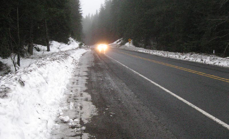
The NWS said the western slopes of the Coast Range should see about two to four inches of rain on Saturday.
Snow levels will again be falling to the upper parts of the Oregon Coast Range, especially on the northern half of the coastline. They stay well above 1800 feet through Monday night, when they’ll fall to that level – which will largely only affect Highway 26 and Highway 18. However, Tuesday you can expect snow above the 1400-foot mark in the coast range highways, which could make things dangerous for much of that day.
Snow levels rise considerably on Wednesday afternoon, but you may get a glimpse of white by the sides of the roads for a day or so on the way to the beaches.
“A deep upper level trough will drop out of the Gulf of Alaska behind the front Sat night and amplify offshore on Sunday,” the NWS said. “Expect snow levels to fall again behind the front with mainly southwest flow, which should maintain a cool and showery pattern.”
See Oregon Coast Weather - Washington Coast Weather
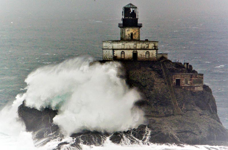
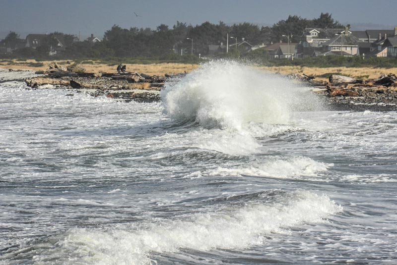
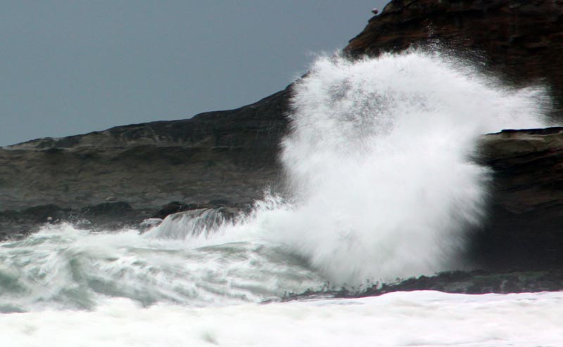
On the beaches, it could well be a wild one for waves over the weekend and into the early week, with the NWS predicting some extremely large swells out at sea and a long period between them. That long period could spell trouble for beachgoing after the big waves, but so far the NWS has not issued any warnings. The largest action may well be farther out to sea as well.
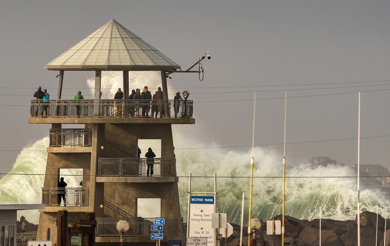
Mammoth waves in Westport, courtesy Westport Visitors
However, the NWS said that south winds will be picking up and seas will eventually get to 16 to 18 feet at 15 seconds by late Saturday and early Sunday. There’s a good chance seas will build even higher on Monday.
Saturday won’t be a day for hanging around the beaches in any case with those heavy winds. But Sunday and Monday should at least provide some entertaining wave action, if not some dangerous conditions out there. Keep an eye on Oregon Coast Beach Connection for further warnings should they arise.
Oregon Coast Hotels in this area - South Coast Hotels - Where to eat - Maps - Virtual Tours


Cannon Beach Lodging
Nehalem Bay Lodgings
Manzanita Hotels, Lodging
Three Capes Lodging
Pacific City Hotels, Lodging
Lincoln City Lodging
Depoe Bay Lodging
Newport Lodging
Waldport Lodging
Yachats Lodging
Oregon Coast Vacation Rentals
Oregon Coast Lodging Specials


Photos above courtesy Seaside Aquarium
More About Oregon Coast hotels, lodging.....
More About Oregon Coast Restaurants, Dining.....


LATEST Related Oregon Coast Articles
4 Jun 2026 at 8:29am
June 16, 17 and 18 in Oceanside. Netarts / Oceanside events, Tillamook events
Oregon Coast Authorities Offer Tips on Safe Vehicle Travel with Your Pet
8 Jun 2026 at 12:09am
Lincoln County Sheriffs urge take these extra precautions. Traffic
2026 Elections: Oregon's Measure 120 Goes Down Fast - At Least So Far
20 May 2026 at 12:34am
Controversial gas tax is out, says Associated Press. Traffic
Coho Oceanfront Lodge Hints at Its 'Oregon Coast of Old' Beginnings: History
19 Jun 2026 at 9:06am
Now a generational Lincoln City tradition, it got its start in 1970. Lincoln City hotel reviews, history
Pirate Invasion, Curry County Fair and Wild Mushrooms Dot S. Oregon Coast Lan...
26 Jun 2026 at 6:51am
Fair in Gold Beach July 23 - 26; Pirates of Pacific Fest Aug 7 - 9; Wild Rivers Mushroom Fest Nov 7 - 8. Brookings events, Gold Beach events
Little Oregon Coast Food Fest Gets Bigger: Toledo's Art, Oysters 'n Brews
23 Jun 2026 at 9:05pm
Returning August 1 and 2 to the little town outside of Newport. Newport events, Yachats event
Oodles of Orcas: Latest Run of Oregon Coast Killer Whales ID'd
16 May 2026 at 8:00am
Two different sets seen from Pacific City down through Coos Bay. Sciences
100 Degrees Coming for Portland, Valley, Gorge, SW Washington
20 Jun 2026 at 11:06pm
Expanded advisories: Oregon coast may reach 80s; alerts for valley, Portland, Gorge, Washington, Seattle, Salem, Medford. Weather
Back to Oregon Coast
Contact Advertise on BeachConnection.net
All Content, unless otherwise attributed, copyright BeachConnection.net Unauthorized use or publication is not permitted

Oregon
Coast Hotels
S. Coast Hotels
Seaside Hotels
Cannon
Beach Hotels
Nehalem Bay Lodgings
Manzanita Hotels, Lodging
Rockaway Beach Hotels
Three Capes Lodging
Pacific City Hotels, Lodging
Lincoln
City Lodging
Depoe
Bay Hotels
Newport Hotels
Waldport Lodging
Yachats
Lodging
Oregon
Coast Vacation Rentals
Oregon
Coast Lodging Specials
South Coast Hotels
Dining
Guide
Seaside
Cannon
Beach Dining
Manzanita,
Rockaway, Wheeler Dining
Pacific
City, Oceanside, Netarts, Tierra Del Mar Restaurants
Tillamook
Bay Restaurants, Dining
Lincoln
City Dining, Restaurants
Depoe
Bay Restaurants, Dining
Newport Restaurants, Dining
Waldport,
Yachats Restaurants, Dining
Florence Restaurants, Dining
Restaurant
Reviews
Coast
Events Calendar
Astoria
Seaside,
Cannon Beach Calendar
Manzanita,
Rockaway Events
Tillamook,
Pacific City Calendar
Lincoln
City Events Calendar
Newport,
Depoe Bay Events Calendar
Yachats Events Calendar
Oregon Coast Complete Guides every beach access, attraction
Search for Oregon Coast Subjects, Articles
Explore Every Beach Spot


News Headlines from All Over Oregon Need to scan Oregon headlines? Constantly updated news from all over Oregon: a comprehensive, up-to-the-minute display of news headlines from a variety of media
Oregon Coast Oceanfront Lodging, Hotels, Rentals
Book Coastal Lodging Now
Booking.com