Oregon Coast Travel News
100 Degrees Coming for Portland, Valley, Gorge, SW Washington
20 Jun 2026 at 11:06pm
Expanded advisories: Oregon coast may reach 80s; alerts for valley, Portland, Gorge, Washington, Seattle, Salem, Medford. Weather
Gnarly, Somewhat Gruesome Video of Killer Whale Attack on Oregon Coast
19 Jun 2026 at 9:06am
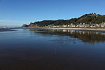
Unusual top-down footage of them hunting a harbor seal. Marine sciences, Seal Rock, Depoe Bay, Newport, Yachats
Absolute Complete Guide to Oregon Coast Fourth of July, 2026: All Towns
19 Jun 2026 at 9:06am
Astoria events, Seaside events, Cannon Beach events, Manzanita events, Rockaway Beach events, Tillamook events, Oceanside events, Pacific City events, Lincoln City events, Depoe Bay events, Newport events, Waldport events, Yachats events, Florence events, Reedsport events, North Bend events, Coos Bay events, Charleston events, Bandon events, Port Orford events, Gold Beach events, Brookings events. Weather
Man Sought for Bias Crimes on Oregon Coast Is Shot After Pulling Gun on Officers
19 Jun 2026 at 9:06am
The man had damaged a fruit stand and threatened a woman. True crime
Science of Summer Solstice: How It Changes Around Oregon, Washington, the Coast
19 Jun 2026 at 9:06am
The 45th parallel can dictate a few things in this region. Sciences, weather, astronomy
Video: Orcas Bouncing, Jumping Out of the Surf in Spectacular Oregon Coast Di...
19 Jun 2026 at 9:06am
Seal Rock was the site of wild jumps, tail slaps. Marine sciences. Whale
Coho Oceanfront Lodge Hints at Its 'Oregon Coast of Old' Beginnings: History
19 Jun 2026 at 9:06am
Now a generational Lincoln City tradition, it got its start in 1970. Lincoln City hotel reviews, history
Florence Fills Skies with Kites in June: Four Days of Oregon Coast Flying Colors
19 Jun 2026 at 9:06am
June 22 - 25 at Heceta Beach. Florence events
Pacific Northwest Weather | Oregon, Washington, Coastlines - Live View from S...
19 Jun 2026 at 9:06am
See the region live from space. Gateway to Oregon coast, Washington coast, inland Oregon weather, warnings, alerts
South Oregon Coast's Beloved Charleston Seafood Festival Back, June 27
19 Jun 2026 at 9:06am
More food, more activities - and it's back to the Coos Bay area. Coos Bay events
Oregon State Police Seek Tips in Otter Poaching at Coastal Pond
19 Jun 2026 at 9:06am
Someone unlawfully killed a river otter near Fall Creek Road. True crime
Current Conditions in Oregon, Washington, Coastlines - Current Temps
19 Jun 2026 at 9:06am
Updated by Minute: Washington coast and all of Oregon current temperatures, conditions. Weather, sciences
Ontario Eastern Oregon Weather - Forecasts, Sky Cams, Alerts, Current Conditions
15 Jun 2026 at 8:54am
Weather forecasts, sky cams, alerts and current conditions for Ontario in eastern Oregon
Heat Warnings, Advisories Around Oregon, Washington Now Include Coast - Some ...
13 Jun 2026 at 9:54pm
90 to 100 degrees in many areas. Coast sees unusual 80s. Weather, sciences
Celebrating a Century-old Oregon Coast Landmark? There's a Beer and a Coffee ...
13 Jun 2026 at 9:54pm
Buoy Beer Company and Astoria Coffee Company. Astoria events, restaurant rewviews
SPC Severe Thunderstorm Watch 364
21 Jun 2026 at 12:45pm
WW 364 SEVERE TSTM CO KS NE 211845Z - 220200Z
URGENT - IMMEDIATE BROADCAST REQUESTED
Severe Thunderstorm Watch Number 364
NWS Storm Prediction Center Norman OK
1245 PM MDT Sun Jun 21 2026
The NWS Storm Prediction Center has issued a
* Severe Thunderstorm Watch for portions of
Northeast Colorado
Northwest Kansas
Western Nebraska
* Effective this Sunday afternoon and evening from 1245 PM until
800 PM MDT.
* Primary threats include...
Scattered large hail likely with isolated very large hail events
to 3 inches in diameter possible
Scattered damaging wind gusts to 70 mph possible
SUMMARY...Thunderstorms will develop and intensify over the watch
area this afternoon, spreading southeastward with time. Large to
very large hail is the main concern, but there will be an increasing
risk of damaging winds this evening.
The severe thunderstorm watch area is approximately along and 60
statute miles east and west of a line from 35 miles northwest of
Mullen NE to 50 miles south of Goodland KS. For a complete depiction
of the watch see the associated watch outline update (WOUS64 KWNS
WOU4).
PRECAUTIONARY/PREPAREDNESS ACTIONS...
REMEMBER...A Severe Thunderstorm Watch means conditions are
favorable for severe thunderstorms in and close to the watch area.
Persons in these areas should be on the lookout for threatening
weather conditions and listen for later statements and possible
warnings. Severe thunderstorms can and occasionally do produce
tornadoes.
&&
OTHER WATCH INFORMATION...CONTINUE...WW 363...
AVIATION...A few severe thunderstorms with hail surface and aloft to
3 inches. Extreme turbulence and surface wind gusts to 60 knots. A
few cumulonimbi with maximum tops to 500. Mean storm motion vector
30030.
...Hart
Read more
SPC Tornado Watch 363
21 Jun 2026 at 1:45pm
WW 363 TORNADO IL IN MO 211830Z - 220200Z
URGENT - IMMEDIATE BROADCAST REQUESTED
Tornado Watch Number 363
NWS Storm Prediction Center Norman OK
130 PM CDT Sun Jun 21 2026
The NWS Storm Prediction Center has issued a
* Tornado Watch for portions of
Central and Southern Illinois
Southwest Indiana
Southeast Missouri
* Effective this Sunday afternoon and evening from 130 PM until
900 PM CDT.
* Primary threats include...
A few tornadoes likely with a couple intense tornadoes possible
Scattered damaging wind gusts to 70 mph likely
Isolated large hail events to 1.5 inches in diameter possible
SUMMARY...Thunderstorms will intensify this afternoon across the
watch area, with a few supercells expected. Damaging winds and
tornadoes are possible in the strongest cells.
The tornado watch area is approximately along and 50 statute miles
north and south of a line from 35 miles southwest of Scott Afb IL to
30 miles south of Terre Haute IN. For a complete depiction of the
watch see the associated watch outline update (WOUS64 KWNS WOU3).
PRECAUTIONARY/PREPAREDNESS ACTIONS...
REMEMBER...A Tornado Watch means conditions are favorable for
tornadoes and severe thunderstorms in and close to the watch
area. Persons in these areas should be on the lookout for
threatening weather conditions and listen for later statements
and possible warnings.
&&
AVIATION...Tornadoes and a few severe thunderstorms with hail
surface and aloft to 1.5 inches. Extreme turbulence and surface wind
gusts to 60 knots. A few cumulonimbi with maximum tops to 500. Mean
storm motion vector 26030.
...Hart
Read more
SPC Severe Thunderstorm Watch 364 Status Reports
21 Jun 2026 at 12:45pm
WW 0364 Status Updates
STATUS FOR WATCH 0364 HAS NOT BEEN ISSUED YET
Read more
|