Weather Pendulum: Portland, Valley, Oregon Coast Back to Colder and Wetter This Week
Published 05/13/2019 at 5:53 AM PDT
By Oregon Coast Beach Connection staff
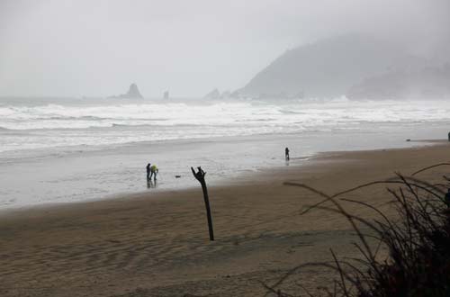
(Portland, Oregon) – It looks like summer is over – for now. That early summer, that is. With the Portland, Salem and Eugene areas getting up around 90, and the Oregon coast basking in glorious skies, this week becomes a meteorological pendulum and wanders into conditions below normal. While some big minus tides are coming up over the weekend on the Oregon coast, slightly stormy seas may not let that come to be.
Includes exclusive listings; some specials in winter
In Cannon Beach:
Includes rentals not listed anywhere else
In Manzanita, Wheeler, Rockaway Beach:
Some specials for winter
In Pacific City, Oceanside:
Some specials for winter
In Lincoln City:
Some specials for winter
In Depoe Bay, Gleneden Beach:
Some specials for winter
In Newport:
Look for some specials
In Waldport
Some specials for winter
In Yachats, Florence
Some specials for winter
For the Portland and inland valley area, after Monday’s 70 degrees everything cools drastically to a much more spring-like high of 60 on Tuesday, with cloudy and rainy conditions. Up to a quarter of an inch of rain is possible, according to the National Weather Service (NWS) in Portland. Wednesday around the metro area warms slightly to the mid 60s and a lesser amount of rain, while Thursday remains largely a similar forecast. Friday, the sun starts to peek out a little bit and the next few days involve rain and maybe a few bouts of sunshine.
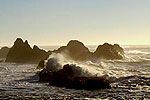
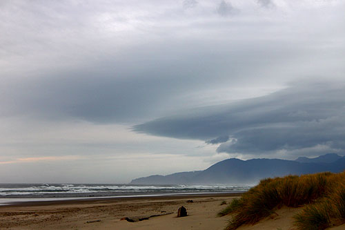
Highs along the Oregon coast won’t reach much more than the mid 50s for the week, with somewhat heavy rain on Monday and Tuesday. Things continue to be showery for the week, and there may be some sun breaks after Thursday.
Spectacular low tides are coming from May 18 through May 22. Minus tides of about minus one foot may be opening things up in the morning hours along the Oregon coast.
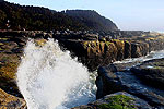
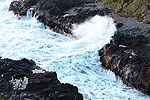
Wave height might be canceling out those low tides, however, by the time the weekend comes along.
“Seas will remain 4 to 6 feet through Thursday, but will build closer to 8 to 10 feet Thursday night through Saturday in conjunction with this stronger storm system,” the NWS said.
Early on Monday morning the NWS revealed a gray week for the inland valley and the Oregon coast, and talked of storm conditions for the first time in awhile.
“Satellite imagery this morning reveals marine clouds firmly entrenched along the coast,” the NWS said. “Marine clouds are also just beginning to spread into the Willamette Valley and should further expand to cover much of the lowlands of northwest Oregon and southwest Washington over the next 6 hours. Given the marine layer is anticipated to be a bit thicker than yesterday, expect clouds to dissipate a bit slower and high temperatures to be a touch cooler.”
The NWS said the first storm in several weeks is poised to hit the northwest portion of the state. Some models are showing the rain arriving earlier and earlier. The NWS is predicting the highest rainfall in southern Washington and lesser amounts farther south into the valley. Tuesday’s heavy rainfall is not expected to last long, and what comes on Wednesday will be in reverse geographically: higher levels of rain will be hitting Lane County and lower amounts farther north.
For the long term, the NWS said to expect periodic showers, and some mountain areas in Oregon could get snow. Thunder storms could pop up over the weekend. Oregon Coast Travel News
Oregon Coast Lodgings in this area - Where to eat - Maps - Virtual Tours
Cannon Beach Lodging
Nehalem Bay Lodgings
Manzanita Hotels, Lodging
Three Capes Lodging
Pacific City Hotels, Lodging
Lincoln City Lodging
Depoe Bay Lodging
Newport Lodging
Waldport Lodging
Yachats Lodging
Oregon Coast Vacation Rentals
Oregon Coast Lodging Specials
More About Oregon Coast hotels, lodging.....
More About Oregon Coast Restaurants, Dining.....
LATEST Related Oregon Coast Articles
It's a bit mysterious how they're still there in sand. Sciences
Newport Truly Fire: Central Oregon Coast's Legendary Inn at Nye Beach
Newport Hotel Review: eco-friendly, upscale and downright glowing. Newport hotel reviews, Newport hotel news
Oregon State Police Fish and Wildlife Seek Help Finding Bull Elk Poachers
Cash awards are offered for information leading to arrests in this Prineville-area case. Sciences, eastern Oregon
Animal Cruelty Petition Could End Up Banning Most Hunting and Fishing in Oregon
PEACE Act / IP28 could affect the meat industry, farms; but group says need to strengthen laws. Marine Sciences
Oregon State Police Make Arrest in Gearhart Bomb Case; Two Crashes Near Coast...
A bomb case has been solved; OSP respond to two major crashes in region. True crime
Yachats' Little Log Church the Center of Renewal Ceremonies on Oregon Coast
30th annual Valentine's Day Celebration of Renewal and Commitment on Saturday, Feb. 14. Yachats events, Florence events, Waldport events, Newport
South Oregon Coast Gets Yummy: Charleston Crab Feed, Robert Burns Celebration
22nd Annual Burns event Feb 7; 41st Charleston Crab Feed Feb 14. Coos Bay events
South Oregon Coast's Wreck of the Sujameco: Where (and When) to Find It
Coos Bay: the other big wreck of the coastline at Horsfall Beach. History
Back to Oregon Coast
Contact Advertise on BeachConnection.net
All Content, unless otherwise attributed, copyright BeachConnection.net Unauthorized use or publication is not permitted


