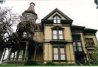
Astoria, Oregon's Americana: from Rusty to Royal
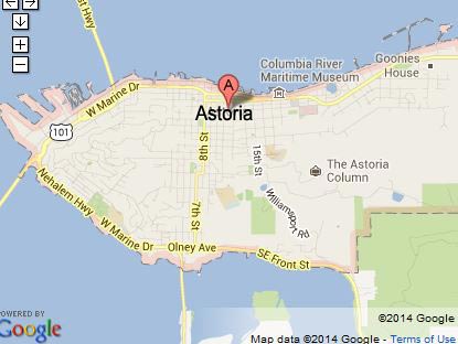
At the very northern tip of the Oregon coast, the ancient town of Astoria seems to occupy the unique status of legendary icon and yet guarded secret destination.
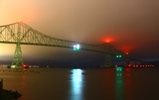
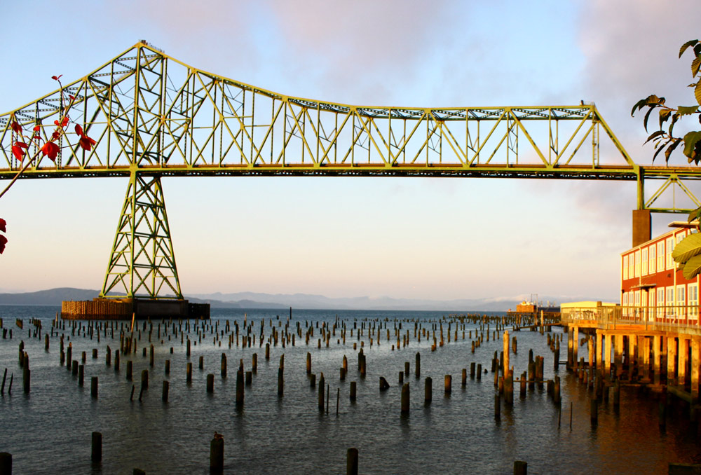
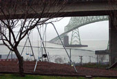
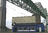
Oregon Coast Virtual Tour: Astoria-Megler Bridge
The Astoria-Megler Bridge stretches 4.1 miles across the river.
Twists, Turns of Construction History of Astoria-Megler Bridge, Longest Oregon Coast Landmark - On July 29, 1966 the bridge to the Washington coast opened
Cathedral Tree Astoria, Oregon
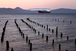
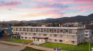
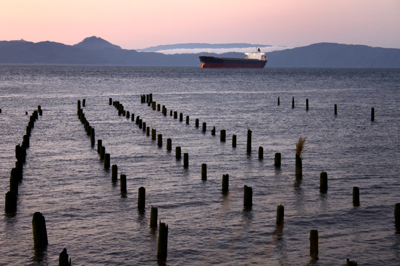
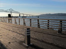
Wandering the Waterfront of Astoria, N. Oregon Coast
Few places ooze history like the north Oregon coast town of Astoria. In fact, it probably screams history in a multitude of ways.

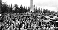
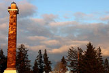
Beginnings, Inspirations of the Astoria Column - N. Oregon Coast History City bigwigs over a century ago hoped to create something that would rival the Eiffel Tower
 Astoria's Pigeon Steps a Quirky but Scenic Walk of Oregon Coast History - Paved walkways with curious strips, charming but awkward
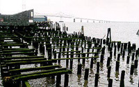
Astoria Trolley Rails Riverwalk - Dockside Trestles
A variety of views are found along the riverfront and the Astoria Riverfront Trolley tracks in town
Seeing the Oregon Coast from Space and Vice Versa
seeing Astoria from the International Space Station - and seeing space from the north and central coast
seeing Astoria from the International Space Station - and seeing space from the north and central coast
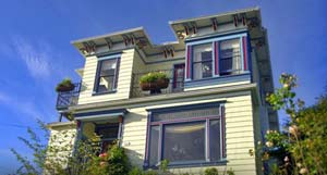
 Seriously Quaint Oregon Coast Frontier Town That U.S. and International Travelers Must Know - Astoria: historical to the untamed and the truly curious
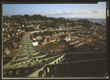
From Astoria's Skyline Come Tales, Images of an Oregon Coast and American First The oldest town west of the Rockies, nation's longest bridge, more
Catching Another Side of Astoria: Ethereal Oregon Coast Scenery at Night - A photo essay: surreal city and maybe some Star Trek
3 Wild Curiosities of Astoria, Oregon Coast No One Else Has. Hint: 1st Exploding Whale, Bridge, Star Trek - The only town in the universe Star Trek called 'heaven'; Florence didn't have the first exploding whale
Hidden Viewpoint Hall and Alameda
Astoria Heritage Museum – Columbia River Maritime Museum – Uppertown Firefighters Museum – New Youngs Bay Bridge
What's Up with Astoria? And What's Down Below the Oregon Coast Town - An array of startling stats about Astoria: length of the bridge, height of Coxcomb Hill: more facts
Filming The Goonies on N. Oregon Coast: at Astoria, Cannon Beach Goonies' early days here are a bit of an adventure as well
Sci-Fi Connections to Oregon Coast Includes Star Trek, LOST, Stargate, 65 - A varied and surprising list from Brookings to Astoria
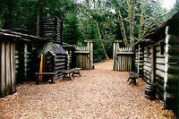
Official Oregon Coast Lewis and Clark Guide
Corps of Discovery, Sacegawea – Sauvie Island, southern Washington, Astoria, Oregon, Oregon coast, Columbia River, Fort Clatsop, Cannon Beach, Seaside, Warrenton, Dismal Nitch and more
Corps of Discovery, Sacegawea – Sauvie Island, southern Washington, Astoria, Oregon, Oregon coast, Columbia River, Fort Clatsop, Cannon Beach, Seaside, Warrenton, Dismal Nitch and more
Fort Stevens State Park Geology: What's Really Underneath This Oregon Coast Historical Site - Parts of the area did not exist until 1920s
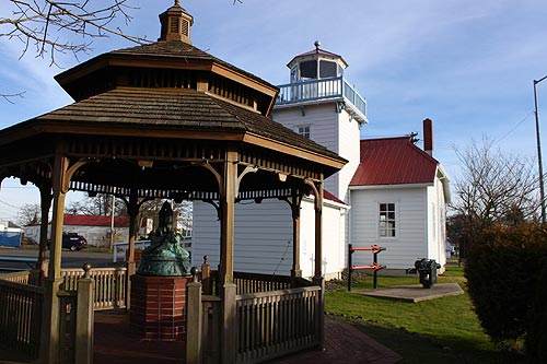
Warrenton / Skipanon Lighthouse Park Interpretive Center
At the big marina at the Skipanon River, is a (sort of) lighthouse that no one knows
At Top of the Oregon Coast, Astoria Area's Fort Stevens Lets You Walk History - From Lewis and Clark to a shipwreck and World War II
Where a Japanese Sub Fired on Oregon: Battery Russell and Fort Stevens
It turned out to be a Japanese submarine that had fired at Fort Stevens in the dead of night. A landmark bit of Oregon coast history: one of a few times the US was fired upon
It turned out to be a Japanese submarine that had fired at Fort Stevens in the dead of night. A landmark bit of Oregon coast history: one of a few times the US was fired upon

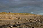
– Beach Access #1A (DeLaura Dune)
MORE FORT STEVENS SOON
Astoria History Timeline: 200 of Years At the Top of Oregon Coast
You often don't know what you're really looking at around here: now you might
Astoria History Timeline: 200 of Years At the Top of Oregon Coast
You often don't know what you're really looking at around here: now you might
What Ghosts Gather Around Fort Stevens, N. Coast
The spirit of an army man supposedly wanders the north Oregon coast, showing up in some fairly disparate places.
The spirit of an army man supposedly wanders the north Oregon coast, showing up in some fairly disparate places.
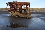
More to History of Oregon Coast's Peter Iredale Than Just a Shipwreck
Its rusted bones are a huge attraction to those visiting Astoria, Seaside, Cannon Beach and Washington coast
Its rusted bones are a huge attraction to those visiting Astoria, Seaside, Cannon Beach and Washington coast
Warrenton Had an 'Exploding Whale' 30 Years Before Central Oregon Coast Was it as bad as the Florence Exploding Whale we all know and love? Quite likely
VARIED ASTORIA, WARRENTON, GEARHART ARTICLES - hit refresh to see different stories
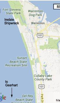
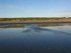
Sunset Beach, between Warrenton and Gearhart, N. Oregon Coast
Rules for Driving on Clatsop Beach - Beach Access #4
– Sunset Beach Fort to Trail Access
– Cullaby Lake Near Sunset Beach
– Cullaby Lake Near Sunset Beach
– Beach Access #5 (Del Rey Beach and Del Rey Beach State Recreation Site)
Gearhart Oregon Coast Virtual Tour: Gearhart's North Beaches, Driving the Beaches - 10th Street
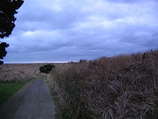
There are really only two main ways to connect with the beach accesses at Gearhart, which run along a couple of roads that run parallel to the sandy dunes of the cloistered north Oregon coast town
There are really only two main ways to connect with the beach accesses at Gearhart, which run along a couple of roads that run parallel to the sandy dunes of the cloistered north Oregon coast town
Exploring Gearhart History As You Explore N. Oregon Coast Beaches
Gearhart was founded in 1918 and is still pristine, nature-oriented. As you walk or drive these well-manicured neighborhoods, one thing you'll notice is Gearhart's emphasis on retaining its past and traditions
Gearhart Oregon Coast Virtual Tour: Gearhart's North Beaches, Driving the Beaches - 10th Street
There are really only two main ways to connect with the beach accesses at Gearhart, which run along a couple of roads that run parallel to the sandy dunes of the cloistered north Oregon coast town

From the Archives
More of N. Oregon Coast's Wreck of Peter Iredale Showing Than Ever Before: Astoria / Warrenton Surprise - From 2024: an amazing but brief sight
More of N. Oregon Coast's Wreck of Peter Iredale Showing Than Ever Before: Astoria / Warrenton Surprise - From 2024: an amazing but brief sight
Oregon Coast Shipwrecks: List of Those You Can See - and Cannot - From Astoria down to Brookings, deep history and details of shipwrecks
From the Archives
Historic Astoria Ferry Abruptly Sinks - Rare Interior Photos of N. Oregon Coast Landmark 100-year-old Tourist No. 2 capsized, officials don't know why