BEACH
NEWS YOU CAN USE
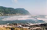
Covering 160 miles of Oregon coast
travel: Seaside, Cannon Beach, Manzanita, Nehalem, Wheeler, Rockaway,
Garibaldi, Tillamook, Oceanside, Pacific City, Lincoln City, Depoe
Bay, Newport, Wadport, Yachats & Florence.
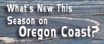
Spring
is here. Are you ready? |
|
|
Oregon
Beach Spots The Locals Don’t Want You To Know About
More about Sand Dollars on the Oregon coast |
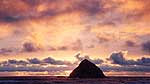
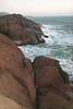
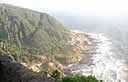
BREATHTAKING
CLIFFTOP IN NEWPORT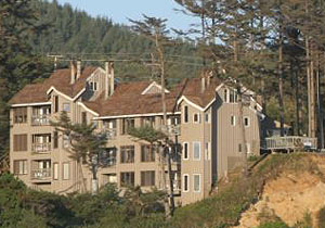
STARFISH
POINT
is located on the Central Oregon Coast - in Newport - and offers
only the finest in luxury condominium lodging. At Starfish Point,
every unit is focused on the beauty of the sea and the beach.
All of the units boast two bedrooms, two bathrooms, designer kitchens,
wireless broadband Internet, fireplaces, Jacuzzi’s and private
decks - surrounding you in soothing relaxation. We have a friendly
staff dedicated to high quality and superb customer service. 140
NW 48th Street, Newport. (541) 265-3751. (800) 870-7795.
www.starfishpoint.com
|
|
|
SPECIAL
SECTIONS |
| calendar
of events |
lewis
& clark guide |
| beach
news | weather |
| editor's
adventure blog |
| columnists:
guy ditorrice (general)
| peg miller (shopping) |
| coastal
pubcrawl | Important
Links |
| coastal
science | kooky
coast |
OR
TAKE THE VIRTUAL TOUR |
 ASTORIA ASTORIA
Where the Columbia meets the Pacific, Land of Lewis & Clark
and loads of atmosphere & history |
 SEASIDE SEASIDE
The Promenade, Tillamook Head, family fun & broad, sandy
beaches |
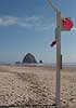 CANNON
BEACH CANNON
BEACH
A mysterious lighthouse, upscale yet earthy, a huge monolith,
fine eateries & an art mecca |
 NEHALEM
BAY NEHALEM
BAY
Manzanita's beaches, Nehalem and Wheeler's quirky beauty; laid
back Rockaway |
 TILLAMOOK
BAY TILLAMOOK
BAY
Garibaldi, Barview, Bay City, Tillamook & an oceanfront
ghost town |
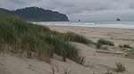
 THREE
CAPES LOOP THREE
CAPES LOOP
The hidden secret of the coast: Cape Meares, a lighthouse, Oceanside,
Netarts and Pacific City |
 LINCOLN
CITY & THE CORRIDOR OF MYSTERY LINCOLN
CITY & THE CORRIDOR OF MYSTERY
Miles & miles of unbroken beaches, Cascade Head, Neskowin
and many manmade attractions |
 DEPOE
BAY DEPOE
BAY
A spouting horn downtown, freaky hidden cliffs and whales, whales,
whales |
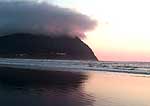
 NEWPORT NEWPORT
Time-tripping Nye Beach, a bustling bayfront, marine science-central
and two lighthouses |
 WALDPORT
/ SEAL ROCK WALDPORT
/ SEAL ROCK
Pristine, even secretive sands and wild geologic landmarks |
 YACHATS YACHATS
Constantly dramatic wave action, a mix of the rugged & upscale |
 UPPER
LANE COUNTY UPPER
LANE COUNTY
25 miles of deserted beaches & oodles of wonders |
 FLORENCE FLORENCE
A lighthouse, ancient bayfront and miles and miles of fluffy
dunes |
|
Cannon
Beach Ecola Creek Lodge
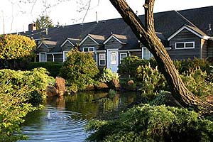 Ecola
Creek Lodge, Cannon Beach. In a quiet neighborhood,
this longtime coastal landmark boasts a koi/lily pond, spacious
lawns, gardens, stained glass windows and wireless internet –
all in a slightly Victorian vibe. With some rooms pet friendly,
you are a couple minutes walk from town and close to the beach.
Guests also get access to a full recreational and exercise facility.
Wild bunnies provide an adorable addition to your stay, making for
an especially serene coastal experience. 208 5th St. www.cannonbeachlodge.com.
800-873-2749. Ecola
Creek Lodge, Cannon Beach. In a quiet neighborhood,
this longtime coastal landmark boasts a koi/lily pond, spacious
lawns, gardens, stained glass windows and wireless internet –
all in a slightly Victorian vibe. With some rooms pet friendly,
you are a couple minutes walk from town and close to the beach.
Guests also get access to a full recreational and exercise facility.
Wild bunnies provide an adorable addition to your stay, making for
an especially serene coastal experience. 208 5th St. www.cannonbeachlodge.com.
800-873-2749. |

RELATED
STORIES
Memorable
Neighborhood Tours of the Oregon Coast Sometimes,
there's more to the beach than the shoreline
Hiking
It and Roughing It on Oregon’s Coast A look
at trails and rugged campgrounds
Last
Time Drexler Will Mate, Says Aquarium The seal, not
the Trailblazer, is on his last legs (or fins)
Some
Oregon Spots Are Hidden; Some Have Secrets A tour
of unusual details from Manzanita to Florence
Geologic
Wonders of Oregon Beaches Make Freaky History Lesson Beneath
the sands and deep inside the cliffs, there's more to the coast
Oregon
Coast Town Celebrates Wine in May Seaside Downtown
Wine Walk will boast some 20 wineries on May 13
BACK
TO NEWS INDEX PAGE
BACK
TO BEACH CONNECTION
|

 Family
Fun
Family
Fun